What is Land Use Mapping?
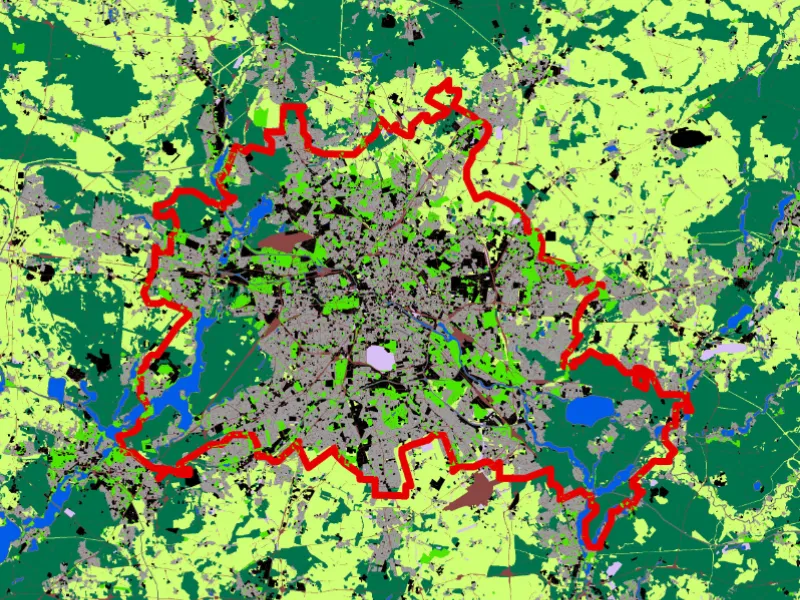
Land use mapping is a comprehensive tool in the field of geography to understand all that’s happening on the Earth’s surface. It helps visualize both
Land use mapping is a comprehensive tool in the field of geography to understand all that’s happening on the Earth’s surface. It helps visualize both

When an entity is studied through analysing, evaluating, and modelling geographical data features—such as locations, qualities, and relationships—the geometric or geographic properties of the data
What is geospatial data analysis, and why are many organizations incorporating it into their analytics and other operations? We’ll answer these questions and more as
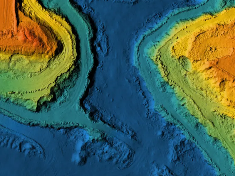
Importance of Elevation Models in Mapping Elevation data plays a vital role in several tasks related to mapping and geospatial analysis. The data provides the

Urban planning is the process of designing and regulating the use of land, resources, facilities, and services in a city or metropolitan area to manage

It is now essential to stay ahead of the competition in this dynamic age of rapid technological innovation. Enterprises and institutions are manoeuvring across the

What is GIS and its Application? Geographical data is one of the most abundant types of data available, forming the foundation for almost every application
What is Digitization in GIS? What is digitizing in GIS? Simply put, it is the process of converting geographic data into a digital format, which
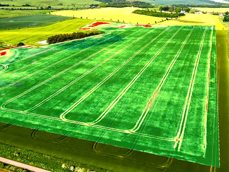
The use of technology has revolutionized the agricultural landscape around the world. One of the most transformative tools reshaping farming today is GIS technology in

Geographic Information Systems (GIS) have become indispensable tools in modern transportation infrastructure and urban planning. These systems allow for the capture, storage, analysis, and presentation