GIS Navigator Logo
CASE STUDIES

Empowering RAF Lakenheath's Infrastructure with Spatial Intelligence: Your Company's Expertise in the KIER Project

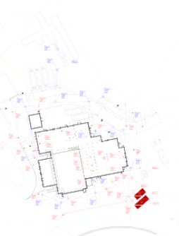
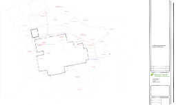
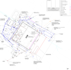
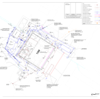
Our company is proud to be part of the KIER project, a transformative infrastructure upgrade initiative at the Royal Air Force Lakenheath (RAF Lakenheath) in Suffolk, UK. This project signifies a major leap forward for the base, preparing it for the arrival of the US Air Force’s. Our expertise in facilitating a crucial aspect of the KIER project is transitioning from traditional Building Information Modelling (BIM) tools like Revit and Computer-Aided Design (CAD) to a state-of-the-art Geographic Information System (GIS) with a solid Geodatabase. This shift marks a paradigm change in data management for RAF Lakenheath, paving the way for a more spatially intelligent approach to infrastructure development.

Unlocking the Power of Spatial Intelligence

While BIM and CAD have served the construction industry well, the KIER project demands a more sophisticated approach. Here’s how GIS with a Geodatabase empowers RAF Lakenheath. Transitioning to a GIS-based approach offers significant advantages for the KIER project:

  • Enhanced Decision-Making in Spatial Analysis: Move beyond traditional 2D drawings. GIS empowers a deeper understanding of the physical base layout. Imagine analyzing facility footprints, utility networks, and environmental factors – all within a single, intuitive platform. This fosters informed decision-making for optimal infrastructure placement and development.
  • Streamlined Collaboration of Data Integration, Management and Visualization: A centralized Geodatabase facilitates seamless data sharing and collaboration across various project stakeholders, including engineers, architects, and facility managers. GIS offers a powerful suite of tools for managing and visualizing spatial data. Our team will help establish a user-friendly system for stakeholders to access, analyze, and share critical infrastructure information. This fosters improved communication, collaboration, and project transparency.
  • Improved Efficiency: GIS streamlines data management processes, allowing for quicker retrieval, analysis, and visualization of spatial information, ultimately saving time and resources.
  • Future-Proof Infrastructure Management: The Geodatabase serves as a central repository for infrastructure data, ensuring its accessibility and usability for future maintenance, upgrades, and expansion projects.

Company's Expertise

Our company brings unparalleled expertise in data migration, GIS implementation, and spatial analysis. We offer a comprehensive suite of services to ensure a smooth and successful transition for the KIER project:

  • Data Conversion: Our team possesses the technical know-how to convert BIM and CAD models into a GIS-compatible format, ensure accurate and complete data transfer to maintain project integrity.
  • Customizable Geodatabase Design: We tailor the Geodatabase schema to seamlessly integrate facility data, utility networks, and environmental factors, catering to the project’s specific needs.
  • GIS Workflow Integration: We understand the importance of seamless integration with existing workflows.  We provide comprehensive training and support to integrate GIS workflows into existing project management practices, minimizing disruption and maximizing user adoption.
  • Standardized Data Schema Design: Our data architects will establish a well-defined schema for the Geodatabase. This ensures data consistency, simplifies integration across disciplines, and facilitates efficient information retrieval and analysis
  • Ongoing Support: Our team offers ongoing support throughout the project lifecycle to ensure the effective utilization of the GIS platform and address any emerging challenges.

our company brings unparalleled expertise in data migration, GIS implementation, and spatial analysis. We offer a comprehensive suite of services to ensure a smooth and successful transition for the KIER project:

  • Data Conversion: Our team possesses the technical know-how to convert BIM and CAD models into a GIS-compatible format, ensure accurate and complete data transfer to maintain project integrity.
  • Customizable Geodatabase Design: We tailor the Geodatabase schema to seamlessly integrate facility data, utility networks, and environmental factors, catering to the project’s specific needs.
  • GIS Workflow Integration: We understand the importance of seamless integration with existing workflows.  We provide comprehensive training and support to integrate GIS workflows into existing project management practices, minimizing disruption and maximizing user adoption.
  • Standardized Data Schema Design: Our data architects will establish a well-defined schema for the Geodatabase. This ensures data consistency, simplifies integration across disciplines, and facilitates efficient information retrieval and analysis
  • Ongoing Support: Our team offers ongoing support throughout the project lifecycle to ensure the effective utilization of the GIS platform and address any emerging challenges.
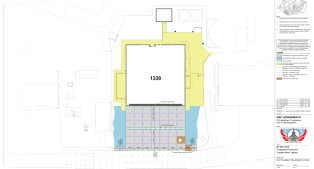
GIS Case Study Image

Company's Expertise

our company brings unparalleled expertise in data migration, GIS implementation, and spatial analysis. We offer a comprehensive suite of services to ensure a smooth and successful transition for the KIER project:

  • Data Conversion: Our team possesses the technical know-how to convert BIM and CAD models into a GIS-compatible format, ensure accurate and complete data transfer to maintain project integrity.
  • Customizable Geodatabase Design: We tailor the Geodatabase schema to seamlessly integrate facility data, utility networks, and environmental factors, catering to the project’s specific needs.
  • GIS Workflow Integration: We understand the importance of seamless integration with existing workflows.  We provide comprehensive training and support to integrate GIS workflows into existing project management practices, minimizing disruption and maximizing user adoption.
  • Standardized Data Schema Design: Our data architects will establish a well-defined schema for the Geodatabase. This ensures data consistency, simplifies integration across disciplines, and facilitates efficient information retrieval and analysis
  • Ongoing Support: Our team offers ongoing support throughout the project lifecycle to ensure the effective utilization of the GIS platform and address any emerging challenges.
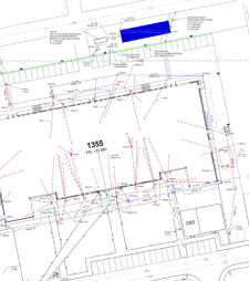
GIS Case Study Image

CONCLUSION

By partnering with GIS Navigator, the KIER project signifies a transformative step towards a future-proofed RAF Lakenheath leveraging the power of spatial intelligence. By implementing a robust GIS platform with a Geodatabase, we are empowering the base with a powerful tool for managing its infrastructure for the years to come. Our expertise ensures a smooth transition, unlocks the true value of spatial data, and empowers informed decision-making for a successful project outcome.