Precise GIS solutions for smarter decisions and better resource management
Who We Are
GIS Navigator specialise in delivering bespoke spatial data solutions to our valued clients. Our services are designed to empower businesses around the globe to make smarter and more sustainable decisions.
At GIS Navigator, we are committed to offering precision and accuracy right from the start. We specialize in digitizing and analysing spatial data to deliver solutions in transportation networks, environmental monitoring, urban planning, disaster management, and natural resource mapping.
We help extract high-resolution data from satellite imagery while boosting your ability to analyse, plan and execute your projects with precision and clarity.
Seamlessly transform complex spatial data into actionable insights with us. We ensure reliable mapping integration while guaranteeing thorough geographical understanding.
Effortlessly assess and mitigate flood risks through accurate geospatial modeling and protect communities and infrastructures by making informed decisions.
Need precise data to guide your next project? GIS Navigator delivers dependable GIS services to support better planning, faster decisions, and stronger outcomes on time, every time.
GIS Navigator transformed complex BIM and CAD utility data into a GIS driven solution. Their precise spatial analysis and database management have enhanced infrastructure planning with precision. Truly exceptional work!
Kier
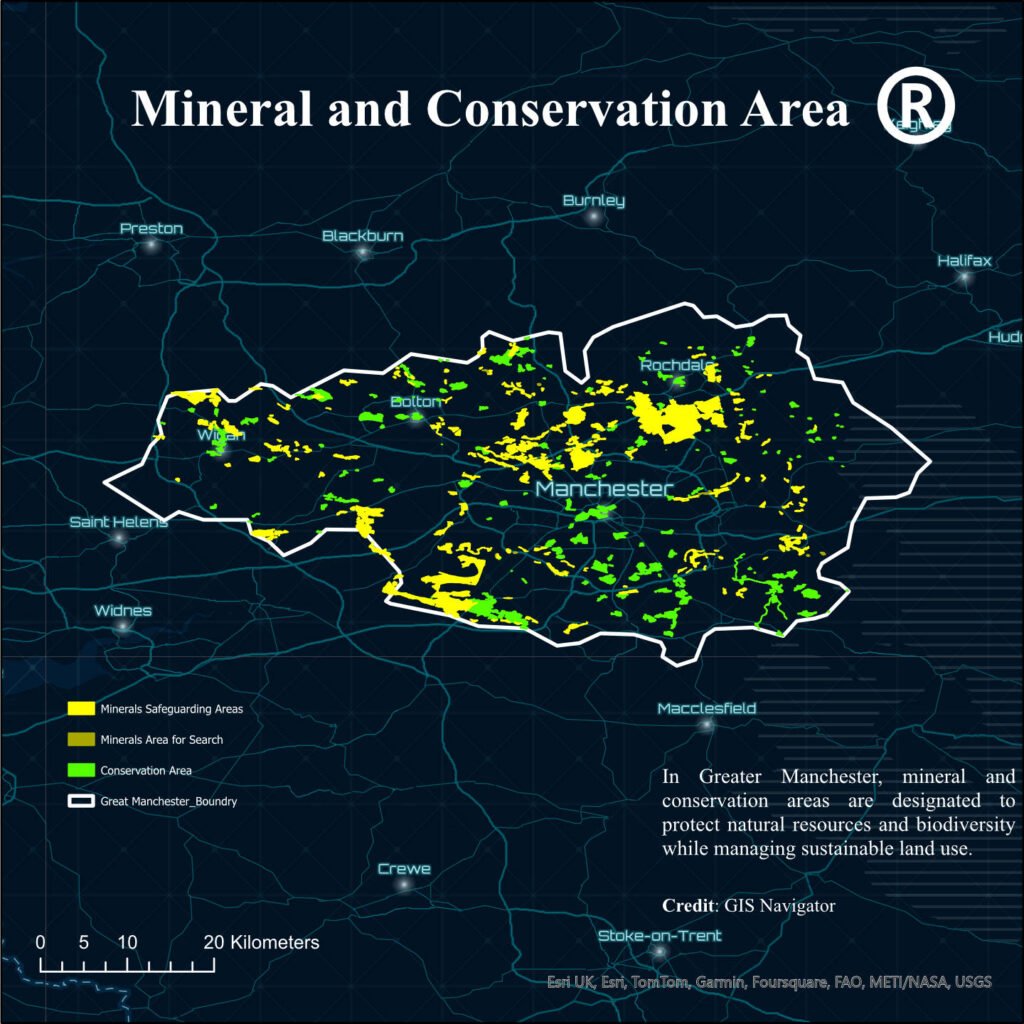
GIS Navigator’s precise analysis helped AMS Planning identify 50 optimal housing sites in Manchester County, balancing 30+ critical factors while ensuring regulatory compliance and community alignment. Great work done!
AMS Planning
The team delivered a high resolution digitised map making a digital twin with remarkable accuracy, transforming our scanned maps into an interactive, terrain model. Highly recommended!
SnowFox Discovery
Contact Us
Your Trusted Partner for Advanced GIS Solutions.
Our experts are ready to guide you in finding the perfect GIS solutions for your needs. Let’s discuss your project today!