Enhance decision-making in mining and natural resources with accurate, location-based data.
The mining and natural resources industry faces complex challenges, including locating viable sites, monitoring environmental changes, and managing resources sustainably. Companies must balance efficient resource extraction with minimal environmental disruption. Accurate mapping and data analysis are essential to meet these demands, ensuring informed decision-making, compliance with regulations, and sustainable development. GIS technology offers powerful tools to tackle these challenges, enhancing site selection, environmental monitoring, and resource management, ultimately leading to more effective and responsible operations.
How GIS Navigator Helps
Precision Site Selection keeping multi factors in mind
Advanced Satellite Image Analysis
Environmental Change Monitoring and free Consultancy
Accurate Resource Mapping
How GIS Navigator Helps
Precision Site Selection keeping multi factors in mind
Advanced Satellite Image Analysis
Environmental Change Monitoring and free Consultancy
Accurate Resource Mapping
Looking for Professional Approach and Quality Services?
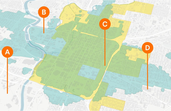
It is a comprehensive service identifying optimal locations for various projects, including new housing developments, hospitals, schools, and commercial centres. By analysing geographical and environmental data, we help organisations make data-driven decisions, reducing risks and enhancing planning efficiency.
Our approach considers terrain, resource availability, and environmental impact, ensuring that projects are both economically viable and sustainable. This targeted analysis provides a robust foundation for successful project execution across industries.
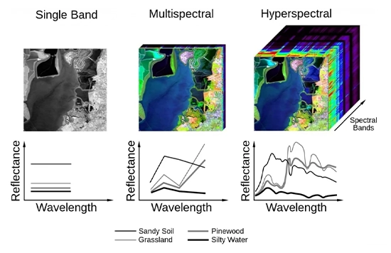
Multispectral & Hyperspectral Image Processing
Our Multispectral & Hyperspectral Image Processing service offers in-depth analysis of land and mineral compositions. By capturing a wide range of light spectra, this technology detects subtle differences in the landscape, identifying valuable mineral deposits and monitoring vegetation health.
This advanced imaging supports precise exploration and environmental assessments, enabling mining companies to efficiently target extraction areas while minimising environmental disturbance, leading to more sustainable and profitable operations.
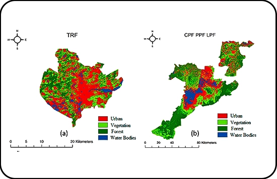
Change Detection
Change detection technology provides crucial understanding across sectors by continuously monitoring environmental and terrain changes. By tracking changes in land use, urban growth, vegetation cover, and the distribution of natural resources, this tool enables organisations to monitor changes in the landscape, including urbanisation, deforestation, and reforestation.
Tracking urban sprawl supports sustainable development, while detecting deforestation patterns aids conservation. Early change detection allows stakeholders to take proactive steps, manage resources wisely, and minimise environmental impact, ensuring projects meet financial and environmental goals.
River Erosion & Sediment Deposition Tracking
River Erosion and Deposition of Sediments Monitoring riverbank stability and sediment movement is crucial for overseeing infrastructure and environmental projects close to bodies of water.
This service aids water resource management and sustainable community development by reducing erosion risks. By analysing river dynamics and sediment patterns, we support infrastructure planning, habitat preservation, and minimise environmental impact, ensuring projects near rivers remain safe, balanced, and legally compliant.
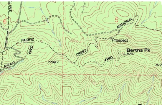
Contour Mapping
Contour Mapping provides detailed visual representations of terrain, which is crucial for planning mining activities. This service helps identify elevation changes and terrain features, enabling precise excavation and infrastructure planning. By understanding topographical variations, mining companies can optimise site design, reduce excavation costs, and enhance safety. Contour maps also assist in efficient resource allocation and environmental impact assessments, making operations more effective and sustainable.
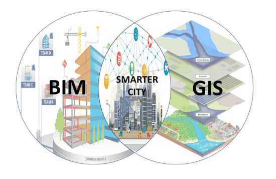
Georeferencing & Digitisation
Georeferencing and digitisation transform physical maps into accurate digital formats, streamlining resource management and operational planning. This service enhances data accessibility and accuracy, allowing for better decision-making. By integrating historical data with modern GIS systems, companies can quickly analyse past and present information, improving exploration strategies and operational efficiency. This digital transition supports more effective and sustainable mining practices.
Contact Us
Your Trusted Partner for Advanced GIS Solutions.
Our experts are ready to guide you in finding the perfect GIS solutions for your needs. Let’s discuss your project today!