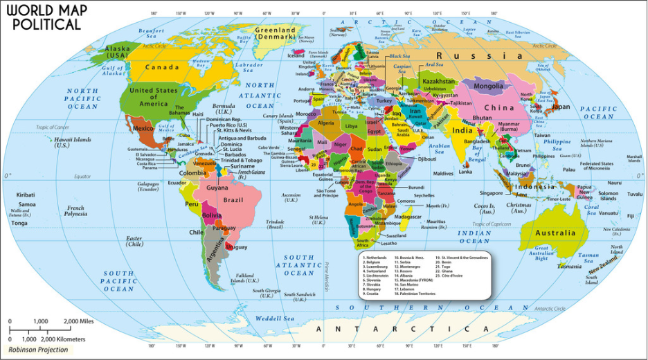
Types of Maps – The Foundations of Geographic Understanding
Maps have always helped people understand the world. Long before satellites or screens, travellers drew their own routes by hand, marking coastlines and paths as
Maps have always helped people understand the world. Long before satellites or screens, travellers drew their own routes by hand, marking coastlines and paths as
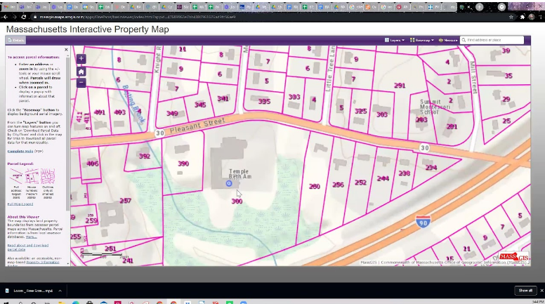
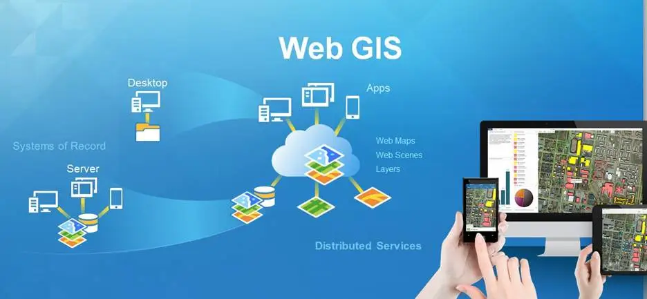
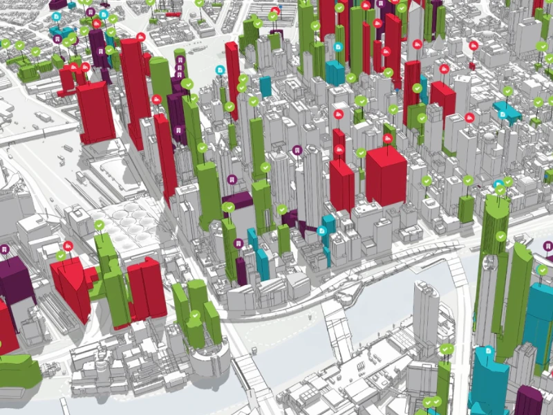
Most people use Geographic Information Systems (GIS) every day without realising it. Whether you check traffic on your phone, track a parcel, or look up
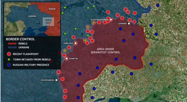
Politics is not only about laws or leadership, it’s about location. Where people live, how borders are drawn, and which areas gain access to resources
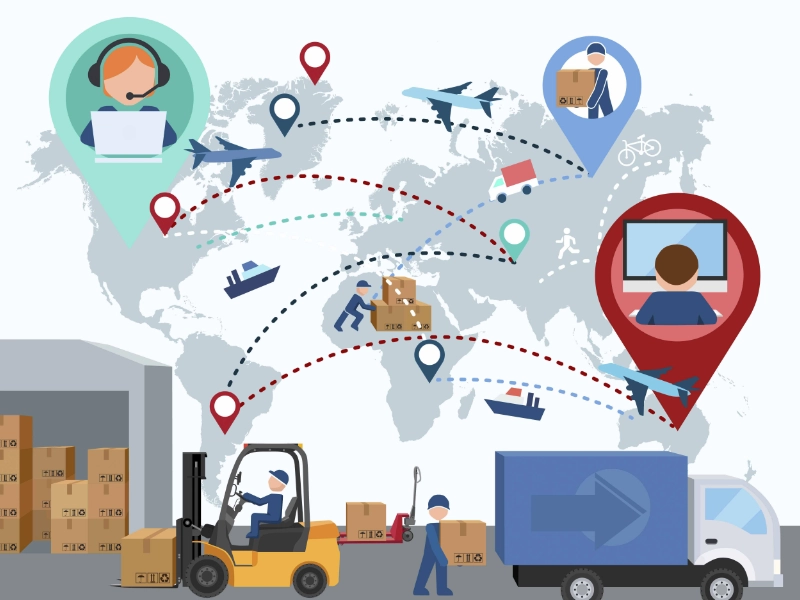
Every supply chain manager knows that logistics problems rarely show up neatly in a spreadsheet. Delays happen on the road, at the port, or in
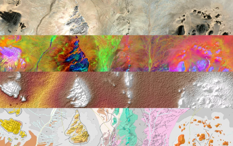
Once exploration confirms a viable deposit, the focus shifts from discovery to design. Every decision now depends on understanding the land, its terrain, structure, water
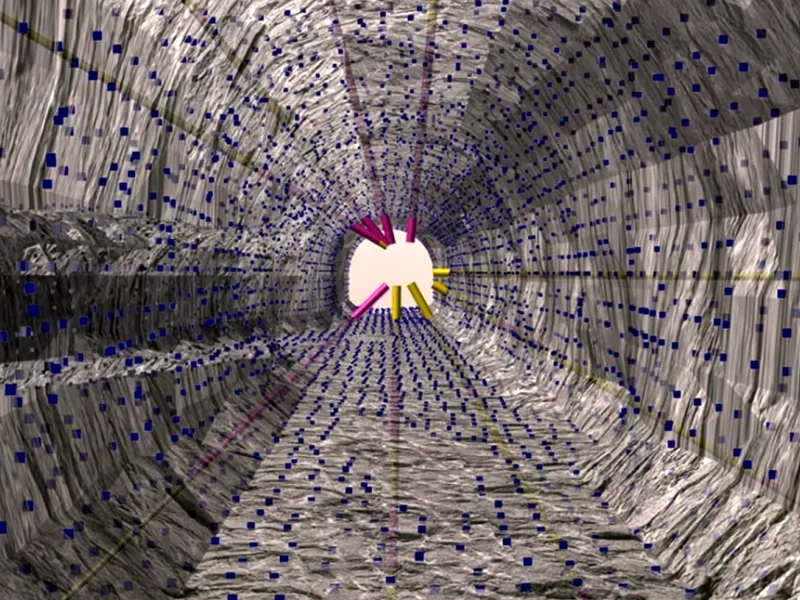
Mining has always relied on location, precision, and timing. As global demand for critical minerals increases, the margin for error in exploration and planning continues
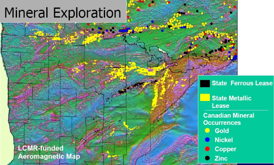
Mining has always been a game of location, precision, and timing. As global demand for critical minerals grows, the margin for error in exploration and
People once printed maps, folded them, and scribbled notes like “new road” or “closed shop.” Now the map updates itself. Flood alerts appear before water
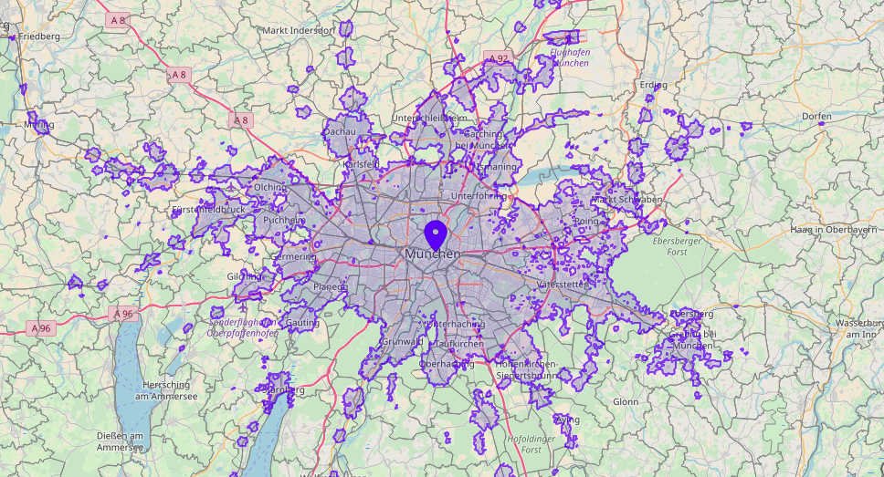
When you’re choosing a site for a store, a clinic, or even a housing project, distance can be misleading. What truly matters is time. A
Retail has always been about location, but in today’s competitive market, simply being in the right place isn’t enough. Success now depends on knowing the