Land use mapping is a comprehensive tool in the field of geography to understand all that’s happening on the Earth’s surface. It helps visualize both natural and human activities while categorising land into different uses and zones such as residential, agricultural, commercial, or industrial. This process, often referred to as land use mapping geography, plays a central role in guiding sustainable development, resource allocation, and environmental protection. But what is a land use map exactly? It’s a visual representation that shows how specific areas of land are used whether for housing, agriculture, industry, or conservation. This zoning shows how different areas are used differently and supports informed decision-making for sustainable development. It also guides precautionary measures to protect the environment and manage resources more responsibly.
Do you wish to learn more about land use map and how it facilitates various actions such as monitoring forests, planning modern cities, and more? Or do you want GIS Navigator to help you visualise land use patterns, categorise land zones, and support better planning decisions? In this article, we aim to explore land use mapping in detail while also understanding the role of GIS in making land use maps more accurate, actionable, and efficient.
In this blog, we explore the concept of land use mapping in detail, the role of GIS in land use map creation, and how land use analysis can help planners, policymakers, and environmentalists make informed decisions. Read on to discover how modern tools like GIS are transforming the way we understand and manage land resources.
Want to See Land Use Clearly? GIS Navigator Can Help!
Use precise mapping to track changes, support conservation, and make informed decisions.
📞 Schedule a Call | 📩 Email Us | 💼 Get a Quote Now
What is Land Use Mapping?
So, what is a land use map used for in practical terms? Land mapping refers to the process of identifying and categorizing how a certain land is used for different types of activities. These activities can include the development of residential and commercial areas, transportation and agriculture.
Professionals working in land use mapping geography often use these visual datasets to analyse urban growth, rural development, and conservation needs.
The process of land use mapping is crucial for urban planning and environmental monitoring. In addition, the method is also applied to perform effective resource management through data which is critical to understand how land is being used.
Moreover, planners, etc. can familiarize themselves with land development and conservation efforts.
Land use mapping facilitates many different professionals to perform several actions. For example; urban planners use this method for land allocation and resource managers utilize it to make sustainable strategies in the context of land exploitation.
Land use and land cover are two different phenomena. Both of them are totally interconnected however, it is important to understand the difference between the two. Land use is the process of knowing what type of human activities are being done on a certain piece of land. On the other hand, land cover refers to the process of describing the physical material which is present on a certain land’s surface. This data can include both natural and man-made materials such as forests, water bodies, etc. as well as built infrastructures.
The Role of GIS in Land Use Mapping
A land use map in GIS is more than a static image it’s a dynamic, interactive tool that allows users to explore spatial data in depth. Whether you’re working on land development or environmental projects, a GIS-based land use analysis provides the insight needed to plan effectively. Geographic Information System (GIS) is a tool that is used for detailed land use mapping. It allows for collecting, visualizing and analysing spatial data in detail. GIS enables professionals to understand how a certain piece of land is being used.
It does so by providing them with various types of data. For example; satellite imagery, demographic data, topographical data and more. The obtained data is crucial for effective urban planning. In addition, users can also work on environmental management and disaster response.
By utilizing GIS Navigator, users can improve their analysis and visualization in the context of land use mapping. Moreover, they can also make informed and more sustainable decisions. GIS Navigator provides users with in-depth spatial data to help them understand and identify patterns and relationships among several elements. This information is crucial for effective planning.
Another advantage of utilizing GIS technology is that it transforms complex data into visual maps. These maps also have interactive 2D and 3D representations which makes it more easier to navigate complex data for informed decision-making.
1. Understanding the Basics of Land Use Mapping in GIS
How GIS Works in Land Use Mapping
GIS is a great tool to manage spatial data. It facilitates the process of storing such detailed data in digital formats which allows users to visualize it in the form of maps or even 3D models for that matter. In addition to that, GIS also enables users to manipulate and analyse data in several different ways. One of the biggest advantages of using GIS is that it enables interactive land use analysis, making it easier to identify patterns, relationships, and future risks.
GIS allows for storing large datasets easily and that’s not all as it also allows users to easily organize or retrieve the data as per their needs. In addition to that, professionals can also update and modify the obtained spatial data as and when they come across updated information.
All of this can be done in real time while also enabling users to also run simulations. We must also include that users can also utilize GIS for a detailed spatial analysis. By doing so, they cannot only analyze patterns and relationships but can also predict changes with the passage of time.
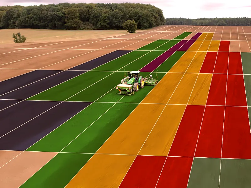
We are sure that you would know how GIS shares data that is in the form of layers. There are a couple of layers that are commonly used in land use mapping by GIS. For example; vegetation, water bodies, residential, commercial, etc. The vegetation layer displays the types of vegetation which is essential to analyze forests and farmlands.
In addition, the data helps assess natural resources as well. As it’s evident from the name, the layer of the water bodies shows rivers, lakes and other prominent water resources. This information is crucial to making various decisions such as resource management and the identification of areas that are prone to floods.
Similarly, the residential layer shows two types of residential areas; the ones that have been zoned for residential development and the ones that have been developed already. Moreover, the commercial layer displays data covering commercial areas such as factories, warehouses, etc.
Data Sources for Land Use Mapping
Land use mapping relies on different data sources to obtain information. In this part of the blog, we will briefly discuss the primary data sources that are used in land use mapping.
One of the primary data sources is satellite imagery. It’s not only the most commonly used data source but it also happens to get high-resolution images. These images allow an in-depth study of the data while also offering insights into changes in land cover and monitoring environmental conditions and natural resources.
Another data source that is utilized for land use mapping is aerial photography. By utilizing this source, the data is collected through aircraft and drones. And if the resources allow, then other airborne equipment can also be utilized to obtain data.
Remote sensing is another data source which allows users to collect data on the Earth’s surface. This can be done without having to form any physical contact. The remote sensors are responsible for capturing data across electromagnetic wavelengths.
Open-source data is gaining popularity for land use mapping and rightly so – mainly because of the fact that it is free to use and publicly accessible. This makes open-source data one of the most preferred resources for professionals. Two of the sources namely Landsat and Sentinel are widely used for land use mapping. Here is why:
Landsat, launched in 1972 happens to provide the longest continuous record of Earth’s satellite imagery. It captures data that is visible, in the form of infrared and thermal wavelengths. Professionals in the fields of agriculture, urban development, etc. can make the most of Landsat to access high-resolution imagery for free.
Similarly, Sentinel is another crucial tool to gather different types of data. We must also mention that it is a group of satellites which help gather high-quality data in real-time. Professionals can use Sentinel frequently without any limitations on the number of visits to gather the required data.
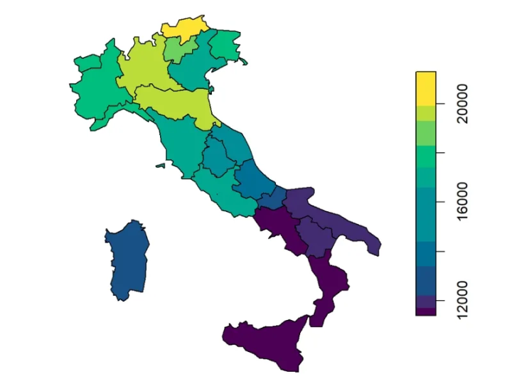
Different Land Use Zone
As the heading suggests, there are different types of land that have been classified according to their purpose. For example; there is urban land, rural land as well as agricultural land. In addition to that, there are lands that have been classified as commercial and industrial as well.
To briefly touch upon all the land use classifications, we will start with urban land which is used for houses, schools, hospitals, etc. Then comes rural land which is the area used for smaller groups of people usually along the countryside. Rural areas do not have well-developed infrastructures.
The agricultural land is used by the farmers, etc. to perform activities related to food production. This land is highly valuable in almost every part of the world mainly because of how rich it is in resources. Commercial and industrial lands are used to build and operate shops, stores, factories and warehouses respectively.
Looking to Monitor Forests and Plan Modern Cities?
Learn how land use mapping facilitates actions like forest monitoring and urban planning, contributing to sustainable development.
📞 Schedule a Call | 📩 Email Us | 💼 Get a Quote Now
2. Applications of GIS in Land Use Mapping
There are various applications of GIS in land use mapping, the details of which are mentioned below!
Urban Planning
GIS helps in effective and efficient urban planning & development. It offers insights into determining residential zones and allows for building sustainable infrastructures. City planners can make the most of GIS by determining residential areas effectively and then working on their development.
Moreover, other infrastructures can also be planned and developed by utilizing GIS at the very beginning of all projects. During the process, the city planners can also carefully distribute amenities by studying the areas in detail. This ensures the efficient use of resources throughout the project’s lifecycle.
Cities with a dense population utilize GIS technology for zoning and development planning.
With GIS Navigator, urban planners can confidently zone residential and commercial areas, distribute amenities, and design sustainable infrastructure from the ground up. Our tools support population-dense cities in planning smarter, faster, and with better visibility. → Plan your next urban project with GIS precision.
Agriculture
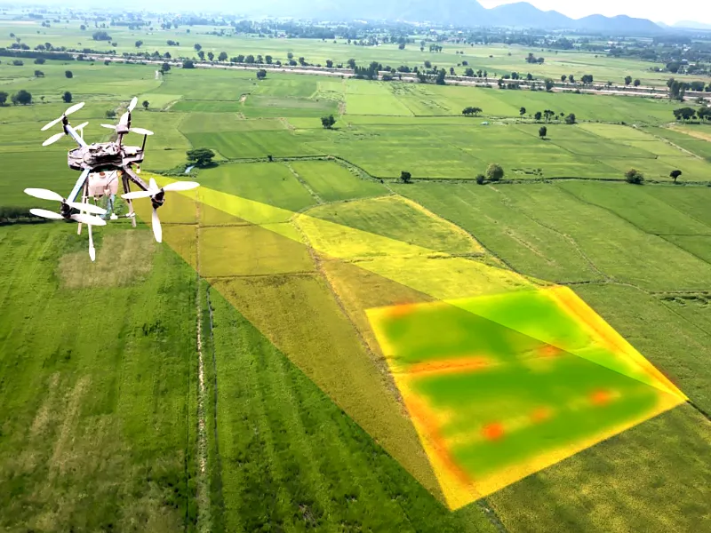
In the field of agriculture, GIS facilitates several operations. For example; farmers, agriculturists and other researchers can gain the data they require to perform several actions. This can include monitoring crop health, precision farming and more.
One of the examples of utilizing GIS in agriculture is that farmers can manage water distribution in a more effective manner. Areas that can face droughts get more water as compared to the areas that are otherwise healthy. This careful irrigation planning counts as a sustainable agriculture practice.
Environmental Conservation
Environmental conservation has become the need of the hour. We cannot just keep developing buildings and infrastructures that are harmful to the environment. By using GIS, environmentalists and other stakeholders can map protected areas while also tracking deforestation.
One of the examples of environmental conservation through GIS is the wildlife conservation efforts that are taken to protect endangered species.
GIS Navigator helps you boost crop productivity and protect natural resources. Monitor land use, optimise irrigation, and track environmental changes all in one platform. → Learn how GIS Navigator supports environmental monitoring and agriculture through smart, spatial data solutions.
Disaster Management and Mitigation
When it comes to effective disaster management, GIS technology plays a crucial role. When users utilize GIS to monitor areas that are prone to floods, earthquakes landslides, etc., they can immediately take measures to mitigate the losses of lives and infrastructures.
GIS facilitates the process of post-disaster recovery efforts once the concerned teams have gotten their hands on the data related to damage in case of floods, fires, etc.
From mapping high-risk zones to tracking real-time events, GIS Navigator helps you reduce risks, respond faster, and streamline recovery efforts. → Discover how GIS Navigator supports disaster management and mitigation.
Infrastructure Development
Planning large-scale infrastructures becomes easier to manage by utilizing GIS technology. Planners can make the most of the tool by planning roads, railways and utility lines effectively. The best part about utilizing this technology in infrastructure development is that the stakeholders can plan out everything without impacting the environment.
GIS has been widely used to optimize transportation networks across the world. By doing so, the stakeholders can ensure less fuel consumption and reduced travel costs.
Plan roads, utilities, and transport networks more efficiently with GIS Navigator. Visualise, optimise, and deliver infrastructure projects with confidence. → See how GIS Navigator enhances infrastructure planning and development.
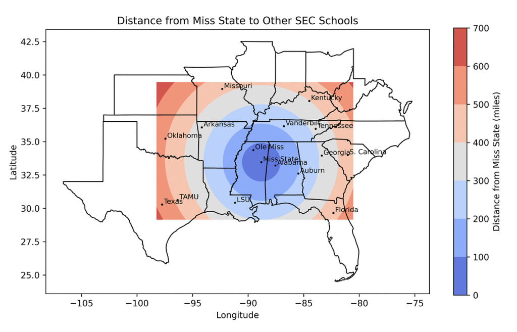
Land Use Change Detection
Monitoring urban sprawl accurately can be a challenge for many. However, with the help of GIS, professionals can get their hands on data that helps monitor and analyze changes in land use over time. Apart from urban sprawl, concerned teams can also study the patterns of deforestation and take measures to protect ecosystems that are vulnerable.
Many different methods and techniques such as satellite-based change detection are utilized to do monitor changes on Earth’s surface. Moreover, multi-temporal GIS analysis shares data in the format of time-lapse so that it can be studied in detail and then informed decisions are made for conservation as well as disaster management.
Ready to Map Smarter?
Discover how GIS Navigator helps you monitor land use, analyse zoning, and plan with precision.
📞 Schedule a Call | 📩 Email Us | 💼 Get a Quote Now
3. Tools and Techniques for Land Use Mapping in GIS
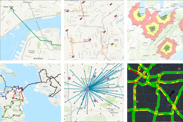
Remote Sensing and GIS Integration
Remote sensing helps generate up-to-date and highly accurate land use maps. The entire process is facilitated by having access to satellite data. When satellite data and remote sensing are integrated into GIS, users capture detailed information on Earth’s surface. This information not only allows for visualization but also enables the processes of tracking changes and monitoring several environmental impacts.
Normalized Difference Vegetation Index (NDVI) is a remote sensing tool that is widely used for vegetation monitoring. This tool helps professionals monitor the health and density of vegetation.
In addition to that, the data obtained through NDVI can also help monitor crop health as well as urban green spaces. One can also study the patterns that can warn regarding deforestation. Such insights are invaluable for making informed decisions that won’t harm the environment.
Top Tools and Software for Land Use Mapping
Several GIS tools and software are used for land use mapping. Some of them are ArcGIS, QGIS as well as Google Earth Engine. These tools offer unique features as per the needs & requirements of certain projects. Allow us to briefly share how the above-mentioned tools facilitate GIS users for land use mapping!
ArcGIS: It is one of the commonly used software which provides a variety of comprehensive tools. These tools allow the creation, analysis and visualization of land use data in detail. ArcGIS is a customizable tool which is used by large companies to perform advanced spatial analysis.
QGIS: QGIS can be used as an alternative to ArcGIS, it’s also free and widely accessible. This not only makes the tool popular among professionals but it also supports several plugins as well. These plugins are essential for carrying out detailed and accurate land use mapping, spatial analysis, etc.
Google Earth Engine: This is a cloud-based tool which allows its users to access and analyze large data easily. By having access to huge datasets obtained from satellites, etc., users can efficiently create land use maps.
Machine Learning and AI in Land Use Mapping
The use of machine learning and Artificial Intelligence (AI) has revolutionized land use mapping. By using such tools, users can enjoy automated classification of land types. These tools can be trained to learn and recognize patterns and features present on the land’s surface.
We must also add here that the obtained data from these models is not only detailed but also error-free. Convolutional Neural Networks (CNNs), also known as ConvNets are deep learning algorithms which are utilized for image classification, segmentation and high res. land use mapping.
Similarly, Generative Adversarial Networks (GANs) are used to generate detailed land use maps ensuring that the gathered data does not have discrepancies in it.
4. Challenges in GIS Land Use Mapping
Data Accuracy and Resolution
One of the biggest challenges in GIS land use mapping is data accuracy and its resolution. Users would prefer to work on accurate and high-resolution data which comes with a price. In addition to that, no one can say for sure if that data is also up-to-date.
Moreover, in remote areas, users can experience different types of challenges such as not having enough or comprehensive data to fully study land use. Several other challenges can also arise while obtaining data in remote and underdeveloped areas such as the atmospheric conditions. These conditions can directly impact data accuracy as users won’t be able to get clear images.
Importance of accurate georeferencing and resolving discrepancies in spatial data.
To make sure that obtained spatial data correctly aligns with real-world data (locations), it’s important that the georeferencing is highly accurate. In some cases, minor inaccuracies in data can lead to errors while analysing land use – ultimately impacting the process of decision-making.
Users can avoid facing such challenges by correcting misaligned layers in maps, updating outdated data and removing conflicting data from the system. This won’t only help them maintain accuracy throughout the process but they will also be able to make informed decisions later on.
Legal and Policy Constraints
Government regulations and policies can guide users in land use planning as they mention how a certain land can be utilized and developed in various ways. In addition, such policies also dictate how the conservation must take place on a specific land.
Usually, these regulations include environmental protection standards, zoning laws, guidelines on urban development and more. By utilizing GIS, users can also streamline their processes as they are in a better position to integrate regulatory policies into the obtained spatial data. This allows for efficient planning and development as the stakeholders will make decisions that align with government regulations and other legal requirements.
Land tenure describes the legal rights groups of people or individuals have over a certain land. This information can majorly impact land use decisions. GIS allows for establishing accurate ownership boundaries which also helps in resolving land-related disputes.
Moreover, by mapping the groups or individual rights, users can efficiently manage land allocation. By doing so, the stakeholders can ensure that they are not carrying out the development projects on land that does not belong to other owners. GIS also facilitates the process of transparent mapping which is essential for land distribution.
Ready to Build Green Infrastructures with Modern Technologies?
Explore how GIS Navigator can help you design and implement environmental friendly infrastructures.
📞 Schedule a Call | 📩 Email Us | 💼 Get a Quote Now
Conclusion
Land use mapping is no longer just a technical exercise it’s a powerful decision-making tool for those who want to plan smarter and act sustainably. With GIS Navigator, you gain more than just access to GIS technology you unlock a platform purpose-built to help you visualise land use patterns, analyse spatial data, and make confident, future-ready decisions.
Whether you’re a city planner or environmental consultant, understanding land use mapping geography and applying GIS for land use analysis is crucial for addressing climate change, resource distribution, and urban growth challenges.
Our platform supports sectors ranging from urban planning and agriculture to infrastructure and environmental management. By offering data in clear, layered formats topography, land cover, human activity, water resources, and more GIS Navigator helps you see the full picture, uncover hidden patterns, and optimise how land is used and managed.
The future of land use mapping is bright, and it’s being shaped by those who embrace intelligent tools like GIS Navigator. As the world faces increasing pressures from urbanisation and climate change, stakeholders need reliable data and advanced tools to respond with agility. GIS Navigator empowers you to design greener buildings, build resilient cities, and protect natural ecosystems while keeping your projects aligned with sustainability goals.
Sustainability is no longer optional. It’s a necessity. And the right tools make all the difference.
If you’re ready to make informed, responsible, and efficient land use decisions, let GIS Navigator show you how.
Visit GIS Navigator to explore how our team can help you fulfil your land use mapping requirements for your upcoming projects.