First things first; let’s try to understand what a terrain is. A terrain represents the physical features of an area of land. It includes elevation, slope and the arrangement of the natural features such as mountains, plains and rivers. A terrain influences the natural features such as how the inhabitants of a particular area carry out activities such as agriculture. Or how vegetation grows and more. The terrain is a crucial element in the fields of geography, geology and environmental science.
These features particularly slope aspect combinations significantly influence land usability, agricultural productivity, and natural hazard vulnerability.
Need Accurate Terrain Insights?
GIS Navigator helps with slope analysis and aspect for better land management and risk assessment.
📞 Schedule a Call | 📩 Email Us | 💼 Get a Quote Now
Overview of Terrain Analysis in GIS
Terrain analysis in GIS is fundamental to shaping the world around us. For example; it helps in site selection that facilitates the operations for urban planning and development. It also aids in risk management by helping professionals understand topography. In addition to that, it plays a vital role in irrigation planning as well as soil and water management, ultimately facilitating agriculturists and farmers.
Moreover, terrain analysis plays a role in effective environmental conservation and disaster management. Professionals can analyse the terrain and then predict and prevent soil erosion promptly. As far as disaster management is concerned, terrain analysis helps in assessing the risks of natural disasters and taking appropriate actions while mitigating the potential damage.
When evaluating aspect vs slope, it becomes clear that both elements serve unique but complementary roles in landscape analysis. While slope dictates how steep the land is, aspect determines its orientation both of which are critical in terrain modelling and planning.
Overview of the Slope and Aspect
Slope influences water flow and erosion. In addition to that, understanding slopes helps farmers and other stakeholders to make data-driven decisions when it comes to land use, effective water management, etc. Allow us to add that slope analysis also facilitates in better development of the infrastructure.
Aspect refers to the direction a slope faces. Understanding aspects can help understand sunlight exposure in a given, ultimately tracking the temperature, soil moisture as well as vegetation. In addition, it can also help create microclimates in a region which can influence the local weather patterns. Moreover, aspect-related knowledge is very helpful in managing biodiversity leading to effective conservation planning.
Importance of Slope and Aspect in GIS
In GIS, the slope and aspect are crucial for a terrain analysis. These elements influence several fields such as planning and development, agriculture, etc. For example; concerned stakeholders can determine various factors such as sunlight exposure, water runoff and land suitability. When individuals in the field have a proper understanding of the aforementioned factors, they become equipped with the necessary knowledge to make informed decisions.
2. Understanding Slope in GIS
Definition of Slope
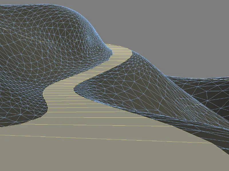
In the context of GIS, terrain slope refers to the measurement of steepness or incline at any given point on the land surface. It is an essential part of terrain analysis. A slope is represented as an angle in degrees or as a percentage.
Methods to Calculate Slope
There are two key features of a slope: degrees and percentage.
Slope Calculation in Degrees (0-90): Slope is expressed as the angle between a horizontal plane and a terrain surface. A 0° slope denotes a flat terrain whereas, a 90° slope represents a vertical incline.
Slope Calculation as a Percentage (Rise/Run): Slope can also be represented as a percentage; calculated from the vertical change (rise) to the horizontal change (run) and then multiplied by 100.
Slope calculation is done by utilizing a Digital Elevation Model (DEM). This type of model is a 3D representation of the terrain’s surface. The DEM has the data for each cell in a grid and the slope is then calculated through the comparison of the elevation difference between one cell and its neighbouring cells.
Representation of Slope in GIS
Slope in GIS can be represented in two ways; raster model and vector model. Let’s have a look at both models to understand what they mean in the context of slope representation in GIS.
Raster representation: In this format, the terrain is divided into a grid of cells or pixels. Each cell denotes a specific value that represents the slope at the location. Raster format data is excellent for representing continuous surfaces like slopes as uniform data across the landscape is represented through this format.
Vector representation: In this format, the data is represented in the form of polygons. These features represent areas of equal slope and other terrain characteristics. The advantage of representing data in vector format is that it allows for the accurate representation of boundaries and other distinct features.
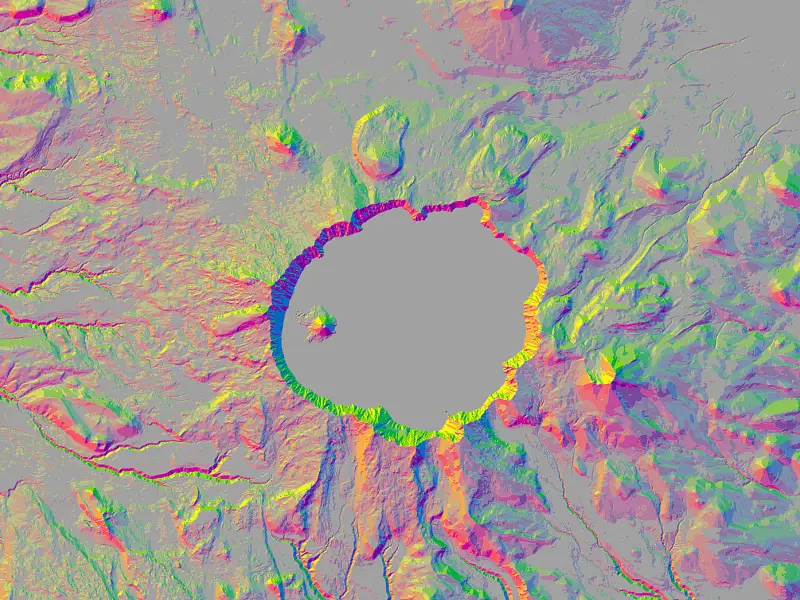
Interpretation of Slope Maps
Slope maps are created to represent the steepness or terrain incline across a given area of land. It uses colours or contour lines to denote the various degrees of slope. For example; a slope map can be visually represented using color-coded ranges. Typically, three colours (green, yellow and red) are used in a slope map. We must add that the darker the colour, the steeper the slope is going to be.
3. Applications of Slope in GIS
There are various applications of slope in GIS. Continue reading to learn about them!
Hydrological Applications
Slope in Watershed Delineation: Slope influences how water moves across a landscape. Its role in watershed delineation is also critical. Allow us to explain what that means: slope helps in defining the boundaries of a watershed in a way that indicates in which direction the water will flow. We must add that steeper slopes lead to faster water flow. Professionals, after understanding slope patterns in detail can accurately identify drainage basins, flow paths of surface water, etc. This information is highly beneficial for effective water resource management and planning.
Erosion and Runoff Analysis: In these kinds of analyses, slope plays a vital role as it impacts water speed and volume which can affect soil erosion. Allow us to add that a steeper slope would produce more rapid water runoff. This can result in soil erosion in areas that have unprotected soil. Understanding slope patterns also facilitates professionals in predicting areas that are at a higher risk for erosion and mitigating the risks through vegetation cover, terracing, etc.
Want to manage flood risks, minimise erosion, and control runoff more effectively?
👉 Discover Our Flood Risk Analysis Services
Urban and Regional Planning
Suitable site for Society (Emaar Communities): Understanding slope analysis also allows for the development of large-scale, integrated communities. Such communities shape the world we live in ultimately beautifying the urban landscape. We must add here that in addition to developing well-planned communities, professionals can also build sustainable designs. Emaar Properties happens to develop such communities. By introducing innovation in urban living, such master-planned communities positively impact the economy.
Slope Stability and Hazard Assessment: Slope stability refers to the resistance shown by inclined soil to collapse. The study involves the analysis of forces which are acting on a given slope for example; gravity, water pressure, etc. to see whether or not the slope will remain intact. Hazard assessment allows for the evaluation of (potential) risks associated with slope instability. This can include landslides, mudslides and rockfalls. In hazard assessment, professionals map out the areas that are at risk of slope failures by assessing the likelihood of similar events occurring in the past. Professionals can also predict the potential impact of slope failures on the environment, infrastructures and people. This type of slope analysis in geography is essential for identifying hazard-prone zones and developing informed mitigation strategies.
Looking for accurate risk assessments for slope stability, flood risks, and site safety?
See how we assist in Urban Planning & Development & Flood Risk Analysis Services
Agricultural Applications
Influence of Slope on Soil Erosion and Water Drainage: As the slope plays an essential role in agriculture, it becomes crucial to understand how it can impact the movement of water across the land, ultimately benefiting or harming the soil. The rate of soil erosion can increase with the steepness of the slope. Moreover, the slope can hugely impact the water drainage patterns. Slope analysis helps ensure that water is well-distributed in the soil. For example; water runoff is rapid on steeper slopes, making the soil super moist for the plants while also contributing to drought in other areas. This can be analysed and corrected through in-depth slope analysis. 👉 Explore Our Environmental Monitoring & Agriculture Services
Slope Considerations in Terrace Farming: Terrace farming refers to the practice of utilizing sloped land in such a way that it is transformed into a series of flat, step-like terraces. This practice allows for effective cultivation. And why wouldn’t it? Because it helps mitigate the risks of soil erosion while also helping in optimized water use.
Struggling with Terrain Challenges?
Get precise geospatial analysis to make informed decisions. Let’s discuss how GIS Navigator can assist!
📞 Schedule a Call | 📩 Email Us | 💼 Get a Quote Now
4. Understanding Aspect in GIS
Definition of Aspect (Exposure / Direction of Slope)
Aspect, in the context of geographical and environmental concepts, refers to the direction that a slope faces in relation to the cardinal points (north, south, east, west). Aspect helps in determining the microclimate of an area as it influences the amount of sunlight that particular area happens to receive throughout the day. South-facing slopes receive more sunlight as compared to the north-facing slopes. Aspect analysis is essential for several fields including agriculture, environmental management and forestry.
Methods to Calculate Aspect [Angle between Highest and Lowest point in terrain (0-360)]
The method of calculating aspects involves the analysis of DEMs and other topographic data. The aspect is shown in the data as an angle ranging from 0 to 360 degrees. Allow us to share what the values correspond to:
0° corresponds to the north, 90° corresponds to the east, 180° corresponds to the south and 270° corresponds to the west.
Representation of Aspect in GIS
Compass Direction Interpretation: This process works by understanding the numerical aspect angle and then converting it into a compass direction. The data is expressed in ways; cardinal points (N, E, S, W) and intercardinal points (NE, SW).
Visual Representation of Aspect Maps: The aspect maps are visually represented in multiple ways such as color-coded maps, the use of legends, contours and map scale and orientation.
5. Applications of Aspect in GIS
Solar Energy and Light Exposure
Aspect’s Influence on Solar Panel Placement: Since the aspect directly influences the amount of sunlight a solar panel receives, understanding the optimal placement of the panels is highly crucial. There are two ways the directions can be finalized; optimal directions and suboptimal directions. The former refers to considering the northern and southern hemispheres while the latter refers to angle aspects such as east-facing and west-facing directions.
Understanding Aspects for Building Design and Energy Efficiency: Understanding aspects can majorly help architects as they start building designs. Here’s how; when professionals understand how aspects work, they can develop designs in such a way that are energy efficient and will also receive maximum natural light.
Agricultural Applications
Aspect’s Impact on Crop Growth and Yield: Understanding the aspect’s impact on crop growth and yield is extremely crucial for farmers, etc. For example; aspect impacts various factors in the field of agriculture such as sunlight exposure, microclimate analysis, soil quality, water management and more.
Microclimate Analysis
Impact of Aspect on Temperature and Weather Patterns: Aspect also impacts local temperatures and weather patterns. The aspect can impact solar radiation ultimately impacting the temperature. In addition, it can also influence weather patterns, precipitation and runoff. Having an in-depth knowledge of such factors in the context of aspects helps make timely decisions.
Plan Smarter with Aspect Analysis for Solar Energy, Agriculture, and Climate.
👉 Explore Our Environmental Monitoring & Agriculture Services
6. Case Studies of Slope and Aspect Applications
Real-World Examples of Slope and Aspect Analysis in GIS
There are several real-world examples of slope and aspect analysis in GIS such as precision farming (agriculture & crop management), site selection (urban planning & development), wildlife habitat mapping (environmental conservation), etc.
Best Sites for Wind Farming: Slope analysis will help in comprehending the terrain and wind flow and by understanding wind direction through aspect analysis, professionals can select sites for wind farming. In addition to that, site suitability can also be monitored to finalize the setup of wind farming at a large scale.
Assessing landslide risks in mountainous regions: Slope and aspect analysis are quite helpful in assessing landslide risks in mountainous regions. Though the process is lengthy and might require a lot of time to obtain the data, professionals can timely alert the authorities to take appropriate actions. By doing so, they can mitigate the loss of human life and damage to the infrastructure.
Success Stories
Slope and aspect analysis have been instrumental in shaping well-planned urban spaces like Dubai. In this fast-growing city, slope analysis helps develop sustainable infrastructures that not only manage water runoff but also reduce erosion. Planners use this knowledge to design effective drainage systems, optimise building placement, and ensure the stability of foundations in challenging terrain.
Similarly, aspect analysis plays a key role in designing energy-efficient buildings. By understanding how sunlight and wind patterns interact with the landscape, developers in Dubai can identify optimal locations for residential areas, amenities, and recreational spaces ensuring both comfort and sustainability for residents.
7. Tools and Techniques for Slope and Aspect Analysis
Software Tools for Slope and Aspect Calculation (ArcGIS, QGIS, etc.): There are several software tools that can calculate slope and aspect analysis efficiently. For example; ArcGIS and QGIS. ArcGIS is a powerful GIS tool. It offers tools to calculate the slope and aspect for DEMs. In addition, it also provides the users with advanced feature analysis – allowing them to perform in-depth terrain studies. Similarly, QGIS is an open-source GIS platform. It has tools such as Slope Tool to accurately perform slope analysis. QGIS happens to be a cost-effective versatile tool for both slope and aspect analysis.
Get accurate and data-driven results with advanced GIS mapping.
Explore our Spatial Analysis Services.
8. Challenges and Limitations of Slope and Aspect Analysis
Like their benefits, slope and aspects analysis also have a couple of challenges and limitations. Let’s briefly explore them!
Data Quality and Resolution Concerns (30 Meter DEM): Data quality and resolution concerns arise when 30 Meter DEMs are used. The obtained data not only lacks detail and precision but can also require rework. This can happen in areas of land that have complex terrain features. Such data is not useful and badly impacts slope and aspect analysis.
Interpretation Challenges in Complex Terrain: The interpretation of slope and aspect data in areas that have irregular terrain features is not an easy job. Since complex topography often offers variations that can’t be generalized, professionals find it difficult to perform several actions such as predicting water flow or studying erosion patterns.
Improve Planning with GIS Terrain Analysis!
Optimize site selection, erosion control, and development with GIS-powered insights. Talk to our experts now!
📞 Schedule a Call | 📩 Email Us | 💼 Get a Quote Now
9. Future Directions in Slope and Aspect Analysis
These are instrumental for terrain analysis as the focus is on leveraging modern technologies to get things things. In addition to that, the integration of advanced computational methods helps enhance both the accuracy and utility of terrain analysis.
Advances in DEM Technology for Improved Slope and Aspect Analysis (LiDAR, UAVs): DEMs play a vital role in conducting accurate slope analysis. LiDAR technology utilizes laser pulses that help create highly detailed topographical maps. This also allows for generating high-resolution DEMs. LiDAR is an excellent choice when it comes to areas having dense vegetation because, in such areas, conventional methods don’t work. Similarly, UAVs play an essential role in revolutionizing data collection methods for DEMs. UAVs help professionals capture data from large areas quickly in a cost-efficient manner.
Integration of Slope and Aspect Analysis with Machine Learning and AI: By integrating slope and aspect analysis with Machine Learning and AI, professionals can explore new avenues and better opportunities. This allows for informed decision-making such as the accurate identification of patterns, predicting risks, optimizing land and water use and more. The integration of machine learning and AI in these fields will truly revolutionize agricultural practices, ultimately achieving higher levels of sustainability.
The combined study of slope aspect through terrain analysis in GIS offers detailed insights into landform behavior, supporting real-world applications in agriculture, disaster management, and environmental sustainability.
Get in touch with GIS Navigator today and our team of experts will help you out in your next project!


