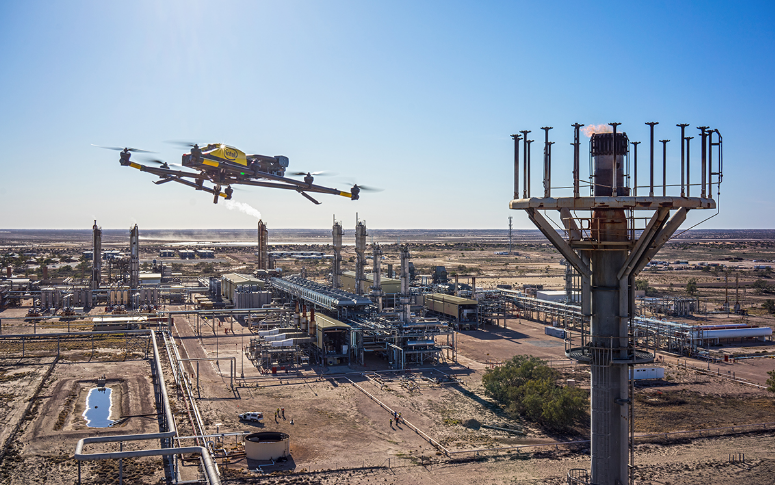
The cutting edge technology of remote sensing is quickly evolving. Soon, we’ll be using remote sensing predictive analysis powered by satellites, photogrammetry, and LiDAR technology to make complex-data predictions and create business results based on natural cycles and patterns of behaviour.
With the rise of geospatial predictive analytics, industries are now exploring how GIS predictive modelling can uncover insights about land, infrastructure, risk, and the environment long before problems surface.
Machine learning is already used to process remote sensor data for object detection. But could the recent explosion of robots-as-a-service UAV providers with remote sensing capability fuel a revolution in predictive analytics, too?
Want to Make Data-Driven Decisions with Confidence?
Use GIS Navigator’s predictive modelling solutions to analyse trends, assess risks, and plan smarter.
📞 Schedule a Call | 📩 Email Us | 💼 Get a Quote Now
What is Predictive Analytics?

Predictive analytics is a subset of data science that uses statistical modelling and machine learning techniques to play out predictions of future outcomes using historical data.
With the help of sophisticated algorithms, researchers can develop and test future scenarios usually hundreds or thousands of times over to achieve a startling degree of precision.
It sounds like science fiction, but predictive analytics are already being used to build out scenarios for energy firms, financial advisors, law enforcement, and pandemic researchers.
As cloud computing makes big data more budget friendly, more organizations are getting access to tools that can help them reliably and accurately predict trends and behaviours for seconds, weeks, or even years into the future.
Need Accurate Predictions for Smarter Planning?
Leverage advanced GIS and remote sensing techniques to forecast changes and optimize outcomes.
📞 Schedule a Call | 📩 Email Us | 💼 Get a Quote Now
How does remote sensing AI come into play?

Artificial intelligence is commonly used in remote sensing to streamline object identification, producing faster, more accurate results. In fact, studies show that AI is between 43% to 96% more accurate than humans at object identification.
AI allows us to create interactive 3D maps of photogrammetry data sets without spending hundreds of human-powered hours. In the emerging future, machine learning could take on more predictive analysis functions using the incredible wealth of information collected using aerial sensor technologies.
As more researchers incorporate geospatial predictive modeling into their workflows, remote sensing data becomes a powerful input for forecasting patterns like urban growth, deforestation, and flood risks.
For example, readily available satellite data (most of which is currently untapped by researchers) can be fed into predictive modelling software alongside socio-economic data to build dynamic models of future environmental and social threats. This has already been done with research models using Google Earth images of a Senegalese flood plain to provide decision-makers on the ground with a powerful new tool to protect their people.
As this technology continues to evolve, these models can pull back the veil of the unknown to help organizations prepare for and respond to humanitarian crises.
Also Check: Spatial Analysis in Environmental Studies
Opportunity value for machine learning in remote sensing
Machine learning combined with predictive geospatial analytics and remote sensing is expected to transform multiple industries, from disaster response to smart infrastructure planning.
Disaster risk reduction:
Through GIS for predictive analysis, photogrammetric data on vegetation and terrain can be used to model vulnerability and anticipate natural disasters such as floods, landslides, or wildfires before they strike.
Asset selection and protection:
Modelling erosion and environmental degradation in landslide-prone regions allows stakeholders to make decisions with regard to real estate investment, the location of manufacturing centres and infrastructure, and much more.
Event prediction for timely response and recovery
Remote sensing data can be used to predict which areas would be hardest hit in a disaster, so municipalities and organizations can properly equip first responders and other support teams as part of a collaborative, interdisciplinary approach to disaster preparation.
Economic decision making
Photogrammetry is already being used to collect data for natural resource management and financial services.
Improve Accuracy with Predictive GIS Modelling
Transform raw data into actionable insights with GIS Navigator’s cutting-edge solutions.
📞 Schedule a Call | 📩 Email Us | 💼 Get a Quote Now
Conclusion
The connection between these technologies is very promising, but still in early development for many use cases. While the vast pool of data collected from weather satellites is currently in use by researchers, many don’t have access to predictive analytics algorithms — so their data largely sits unexamined.
Luckily, that is starting to change. As more companies realize the value of data analytics and remote sensing for industrial and agricultural purposes, the needle will start to move, and these game-changing technologies will become more widely available.
Are you ready to harness the power of predictive modelling in remote sensing and GIS for your next project? Look no further than GIS Navigator.
Our cutting-edge GIS services are designed to provide you with accurate data, efficient resource management, and robust disaster preparedness solutions. Whether you’re in environmental monitoring, geohazard assessment, or agricultural management, our expertise can help you achieve sustainable and effective outcomes.
The future of GIS predictive modelling lies in empowering real-time, data-driven responses to spatial challenges. By combining AI, remote sensing, and geospatial datasets, organizations gain access to powerful geospatial predictive analytics for smarter decision-making.
Contact us today to discover how GIS Navigator can transform your operations and lead you to success.


