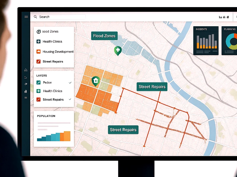
Spatial analysis in environmental studies is an essential technique that enables researchers and authorities to understand and address various environmental issues. Specialists leverage geographic information system (GIS), remote sensing, and spatial statistics to facilitate the examination of spatial patterns, relationships, and processes within the environment.
In this blog, our experts will walk you though the methodologies, applications, and prospects of spatial analysis in environmental studies. So, stay with us!
Looking for Data-Driven Environmental Solutions?
Use GIS Navigator’s spatial analysis to monitor ecosystems, track changes, and support sustainable planning.
📞 Schedule a Call | 📩 Email Us | 💼 Get a Quote Now
Significance of Spatial Analysis in Environmental Studies
Before exploring significance of spatial analysis in environmental studies, let’s first understand what is environmental studies. This field aim to understand the complex interactions between natural and human activities and systems. And spatial analysis support this by offering a wide array of tools to visualize, analyze, and interpret spatial data.
By leveraging state of the art equipment, it identifies trends, patterns, and anomalies that are not evident through traditional methods. Furthermore, the integration of spatial analysis allows for a detailed understanding of environmental phenomena which is extremely important for effective decision-making and policy development.
Need Better Insights for Environmental Planning?
Leverage GIS-powered spatial analysis to assess risks, protect resources, and drive smarter decisions.
📞 Schedule a Call | 📩 Email Us | 💼 Get a Quote Now
System for Spatial Analysis
Multiple systems are used to conduct spatial analysis. Each of these methods serve a specific purpose in environmental study. So, let’s explore them one by one:
Geographic Information Systems (GIS)
The foundational tool in spatial analysis is none other than GIS. It enables the storage, manipulation, and visualization of spatial data. Researchers –using GIS services—create detailed maps, perform spatial queries, and analyze data to examine geographic relationships. Additionally, the power of GIS is harnessed to support a wide array of applications; some of notables of them are mapping land use and changes to modeling habitat suitability for wildlife.
Remote Sensing

Remote sensing is the process of acquiring data from satellite or aerial sensors and deploying the same to provide large-scale and detailed observations of the Earth’s surface. State of the art technology such as LiDAR, radar, and multispectral and hyperspectral imaging are used to monitor environmental changes, assess vegetation health, and map water bodies. Likewise, the same are used to track urban expansion.
Spatial Statistics
Set of techniques that experts deploy to analyze spatial data and identify patterns and relationships are collectively called spatial statistics. Experts deploy a range of methods such as spatial autocorrelation, point pattern analysis, and spatial regression to decipher the distribution and clustering of environmental variables.
The aforesaid environmental variables entail pollution levels, species distribution, and disease outbreak (Covid is an example from not so distant past).
Modeling and Simulation
If you are interested in future environmental conditions and assess the impact of different scenarios, you need to learn spatial modeling and simulation as both are used for the said purpose. These models are deployed to simulate the spread of pollutants and the effects of climate change on ecosystems (poignantly, we are still expediting the process and making less efforts to make planet earth safe for future generations). Likewise, the same is also used to simulate the potential consequences of land use changes. These models have proved to be extremely efficient when it comes to scenario planning and risk assessment.
Also Check: What is Spatial Analysis?
Applications of Spatial Analysis
Following are the applications of spatial analysis:
Climate Change Studies
Spatial analysis is used in climate change studies. This field is extensively used to conduct research in climate change that enables the examination of the temperature and precipitation patterns, sea level rise, and the impacts of ecosystem and human settlements. Furthermore, spatial analysis is greatly useful when it comes to identifying vulnerable areas, assessing risks(like flood risk mapping), and crafting mitigation strategies.
Biodiversity and Conservation

In biodiversity and conservation efforts, spatial analysis helps in mapping species distribution, identifying critical habitats, and monitoring changes in biodiversity. By doing this, spatial analysis supports the design of protected areas, and conversation plans. This way, endangered species and ecosystems are safeguarded (see, how important is spatial analysis for conservation of mother earth).
Land Use and Land Cover Change
Unchecked, unplanned, and unabated human activities are taking a heavy toll on climate and the planet. Therefore, analyzing land use and land cover are extremely important in understanding the impact of human activities. By leveraging spatial analysis, experts can track deforestation, urbanization, agricultural expansion, and habitat fragmentation.
Water Resource Management
Water scarcity is a bigger issue, so much so that experts are warning that future wars might be fought over water resources. Therefore, it becomes extremely important to efficiently manage water resources; spatial analysis is an important tool for that. It enables monitoring of water quality and empower experts to predict flood risks. Additionally, spatial helps in sustainable management of rivers, lakes, and underground water.
Make Smarter Environmental Decisions with GIS
Transform complex data into clear, actionable insights with GIS Navigator’s solutions.
📞 Schedule a Call | 📩 Email Us | 💼 Get a Quote Now
Conclusion
In conclusion, we can say that GIS services are extremely important when it comes to study environment. The combination of essential tools and methodologies under the umbrella of spatial analysis helps us understand and resolve complex environmental challenges.
From climate change and biodiversity conservation to pollution control and disaster risk management, spatial analysis enables informed decision-making and effective policy development.


