Mining has always been a game of location, precision, and timing. As global demand for critical minerals grows, the margin for error in exploration and planning narrows. Today, the smartest mining decisions are no longer made in the field first, they’re made on the map.
Instead of relying on scattered data and guesswork, today’s mining teams can see the full picture before work even starts. GIS tools bring maps, surveys, and environmental details together in a way that makes decisions clearer. The result is simple: fewer surprises, smarter planning, and better use of every investment tied to the land.
At GIS Navigator, we help mining stakeholders use spatial intelligence to reduce uncertainty, improve efficiency, and achieve sustainable growth across global mining projects.
The Challenge: Billions Spent on Uncertain Ground
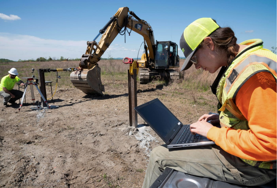
Exploration demands heavy investment long before a drill reaches bedrock. Teams travel to remote locations, machinery is transported, surveys begin, permits are secured, and yet many targets still fail to produce results. According to the Financial Times, global exploration budgets dropped by around 6% in 2024 to roughly US $12.5 billion, even as the world races to secure lithium, copper, nickel, and other minerals essential for the clean-energy transition.
For investors, the challenge isn’t just finding minerals, it’s avoiding expensive dead ends. When early signals are missed, budgets evaporate and timelines slip. That’s why the key question in modern exploration is straightforward:
How can we increase confidence before drilling starts, and protect capital from uncertainty?
Struggling to reduce risk before exploration begins?
Talk to our GIS team to analyse data layers, spot high-value zones, and protect your capital from uncertainty.
📞 Schedule a Call | 📩 Email Us | 💼 Get a Quote Now
GIS in Action: Turning Clues into Confidence
Putting the Right Data Layers Together: A Clearer Picture from Day One
Exploration always begins with scattered clues. GIS brings those clues together in a way that geologists and investors can finally trust. Geological maps show rock types and structures. Geophysical surveys reveal magnetic shifts that often occur near mineralisation. Geochemical sampling traces metals carried by streams and soil. Alone, each dataset has blind spots, combined in GIS, they build a real picture of the subsurface. Teams can test assumptions digitally first instead of gambling on expensive drill holes. For investors, this means fewer surprises and more confidence before they commit capital to a site.
Predictive Mineral Potential Mapping: Betting on the Most Promising Ground
Predictive mapping starts with a simple idea: deposits rarely appear at random. They form under certain conditions, the right rocks, the right chemistry, the right movement of the earth. GIS looks for places where those clues come together again. Instead of checking vast areas on foot, the work shifts to scoring which spots look most promising. That way, field teams head out with a clear plan, not a long wishlist. It’s a smarter use of time and funding, especially when every drill hole carries a cost.
Want to know which sites hold the strongest potential?
Get a GIS-driven prospect ranking that highlights promising targets before your next field campaign.
📞 Schedule a Call | 📩 Email Us | 💼 Get a Quote Now
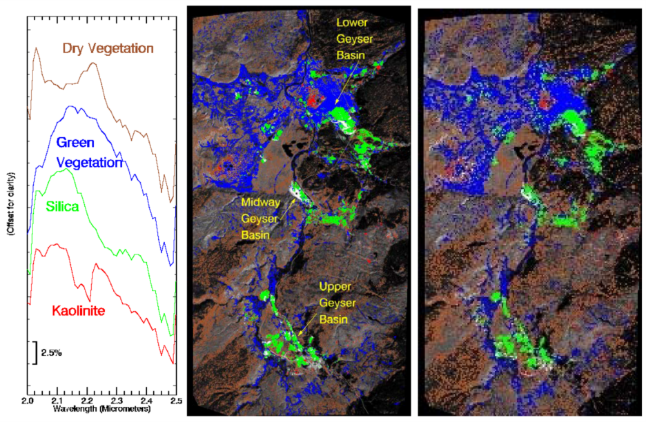
Remote Sensing & Spectral Analysis: Spotting What’s Hidden from the Ground
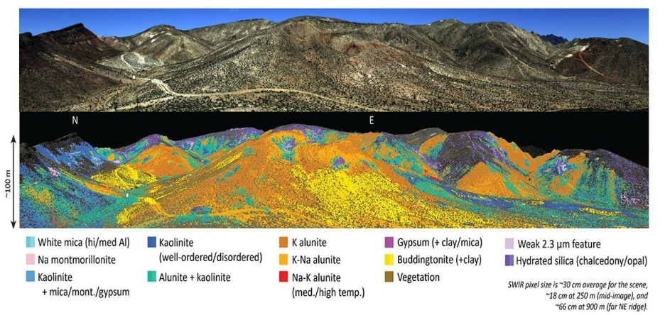
Sometimes the ground gives away little secrets if you look closely. Maybe you’re crossing a wide, open field and notice a stubborn strip where grass just refuses to grow, even though the rest is full and green. Details like that often point to something unusual happening below the surface. In another spot, puddles disappear faster than they should after rain. These odd little differences often have a deeper cause, hotter rock beneath, minerals shifting the soil, or water finding new paths underground.
Geologists pay attention to these hints rather than jumping to quick conclusions. They compare what they see in the field with records, older maps, and satellite snapshots taken in different seasons. When the same location stands out again and again, it becomes a smart place to investigate properly. Small surface quirks often point to bigger stories underground.
Investor Lens: Better Odds for Every Pound Spent
Exploration is expensive because most drill holes do not hit the target. When GIS narrows down where to test first, even a small improvement in accuracy can protect a huge amount of capital.

Investors also get clearer visibility. Maps show where the geology looks promising, how close access roads are, and whether water or protected land could affect operations later. That means early forecasts rely on real evidence, not assumptions.
Real-world use cases include:
- Cornwall, UK – lithium prospects are mapped using local geology and brine chemistry to guide first drilling locations.
- Ghana – gold firms combine satellite images with known fault lines to trace likely mineral belts.
- Saudi Arabia – data from remote sensing highlights areas that could host rare earth elements.
When decisions are grounded in data from day one, budgets stretch further and confidence grows across the investment team.
Check our main blog: GIS services in the mining sector
Future Outlook: Smarter Predictions with New Technology
GIS is moving beyond simple mapping. New tools use machine learning to spot mineral trends that humans may overlook. When the computer compares thousands of known deposits with new territory, it can find patterns that suggest similar opportunities nearby.

Sensors in the field now stream live data back into GIS, so exploration models adjust as new evidence arrives. Instead of waiting months for results, teams can refine their plans almost instantly.
For investors, this shift means earlier clarity. Money is directed to areas where the data keeps pointing in the right direction, not where guesses once led the way.
Ready to bring clarity to your next mining investment?
Start your project with GIS Navigator to turn exploration data into confident, measurable decisions.
📞 Schedule a Call | 📩 Email Us | 💼 Get a Quote Now
Conclusion: Smarter, Safer, More Sustainable Mining
Mining will always be about extracting value from the ground. GIS ensures that every extraction starts with intelligence, not guesswork. Across exploration, design, operation, and even rehabilitation, spatial data is the framework that links geology, economics and environment into one visual narrative.
At GIS Navigator, we help mining investors and operators use spatial data to reduce risk, enhance efficiency, and achieve sustainability, from exploration to rehabilitation.
Contact us to explore how GIS can power your next mining project.