Imagine knowing exactly where your customers are, how they behave, and what areas of your business are underperforming, all displayed on a single, interactive map. That’s not just a dream. It’s a reality powered by Geographic Information Systems (GIS).
GIS may sound like a technical tool reserved for high professionals or planners, but it has become a critical asset for businesses across industries. From retail to logistics, GIS is quietly solving real-world challenges with data-driven precision.
In this blog, we’ll break down 10 practical ways GIS can benefit your business, backed by everyday examples. By the end, you’ll see why GIS is one of the smartest investments a forward-thinking company can make.
What is GIS?
At its core, GIS is a system that links data to maps. It helps users capture, manage, analyse, and visualise data geographically. Instead of looking at rows of spreadsheets, imagine seeing those numbers come alive on an interactive map.
How it works is simple: GIS layers data such as customer addresses, sales trends, delivery times, or competitor locations on top of geographic maps. This makes spotting patterns, identifying inefficiencies, and making better decisions easier.
Everyday example? Think about ride-sharing apps like Uber. When you book a ride, GIS helps locate the nearest driver, estimate your route, and monitor traffic all in real-time. The same logic applies to business decisions.
10 Practical Ways GIS Can Solve Real Business Problems
1. Turn Raw Data into Visual Gold
Problem: “I have data, but I don’t know what to do with it.”
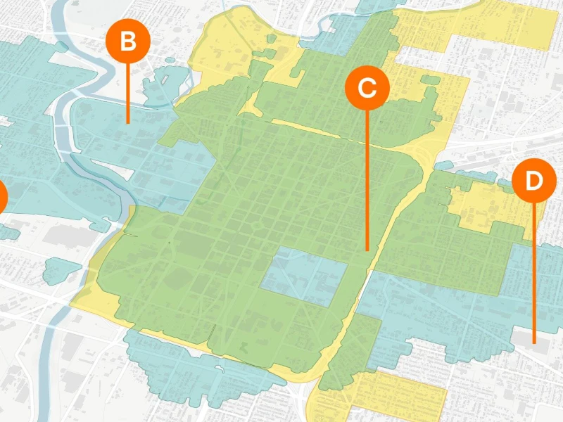
GIS Solution: GIS transforms raw, hard-to-digest data into visually intuitive formats live maps, dashboards, and heatmaps. These tools allow businesses to spot trends, track KPIs by region, and identify high- or low-performing areas. Unlike spreadsheets, maps offer context. Colour-coded zones make connecting insights with geography easier, enhancing strategic planning.
Example: A regional sales manager at a beverage company used GIS to see sales heatmaps across cities. Underperforming areas stood out in red, prompting immediate campaign adjustments. Within a month, underperforming zones showed a 15% sales lift.
Why it matters: When leadership sees maps instead of tables, decisions happen faster and align better with real-world insights.
2. Cut Delivery Times & Fuel Costs
Problem: “Our drivers waste time in traffic and miss delivery windows.”
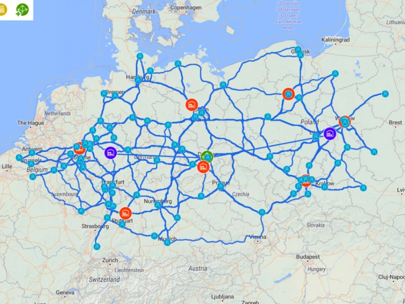
GIS Solution: GIS helps plan the fastest, most efficient delivery routes based on real-time conditions like traffic, road construction, weather, and even peak congestion hours. Businesses reduce idle time, save fuel, and increase delivery density per route.
Example: A florist used GIS routing tools to deliver all morning orders before noon. Delivery times dropped by 30%, and customer satisfaction improved without hiring more drivers.
Extra impact: With route optimisation, fewer trucks can do more work, resulting in lower carbon emissions and less wear and tear.
3. Pick the Perfect Spot for Your Next Location

Problem: “I opened a new branch, but no one’s coming.”
GIS Solution: GIS analyses multiple variables at once: income levels, traffic flow, population density, nearby businesses, and real estate trends. It doesn’t just suggest locations; it ranks them by suitability.
Example: A coffee chain used GIS to avoid areas with four rival cafés nearby. Instead, they selected a spot with heavy transit traffic and no direct competitors. The store hit monthly targets in 12 days.
Takeaway: Picking a location without GIS is like launching a rocket without coordinates.
4. Market Smarter, Not Harder
Problem: “We send ads everywhere, but most people don’t respond.”
GIS Solution: GIS layers customer data with geography, revealing who your customers are, where they spend time, and what messaging works best in each zone. This means no more wasting money on irrelevant areas.
Example: A gym chain saw a 2X ad conversion rate by targeting high-engagement postal codes. Ads in low-engagement zones were paused, reducing cost by 40%.
Additional benefit: Businesses can test localised messages and visuals, improving creative performance based on regional preferences.
5. Fix Customer Issues Faster
Problem: “Service requests pile up, and our team wastes time finding where to go.”
GIS Solution: GIS plots service issues in real time, identifies clusters, and suggests optimised routes. Field teams receive clear map-based instructions rather than vague addresses.
Example: An ISP’s average downtime per complaint dropped by 22% after adopting GIS-based dispatch.
Hidden upside: By showing issue heatmaps, businesses can proactively assign resources to recurring problem areas, preventing churn before it happens.
6. Know Where Your Assets Are All the Time
Problem: “We keep losing track of our equipment or vehicles.”
GIS Solution: Every asset, truck, crane, or sensor can be tagged and visualised on a live map. This enhances planning, reduces theft, and simplifies audits.
Example: A construction company used GIS to locate idle equipment worth over $50,000. Reallocating those machines improved site productivity and cut rental costs.
Bonus: Historical movement data helps with insurance, compliance, and future planning.
7. Understand Your Market Like Never Before
Problem: “Why do some products sell better in certain areas?”
GIS Solution: GIS integrates sales, customer demographics, seasonal trends, and even weather data to uncover why certain products succeed where others fail.
Example: A fashion retailer shifted inventory from formalwear to streetwear in areas with younger populations. Monthly sales rose by 18%.
Realisation: What sells in London won’t sell the same in Manchester. GIS makes that visible.
8. Make Your Supply Chain Work Like Clockwork

Problem: “Shipments are delayed, and inventory piles up in some warehouses.”
GIS Solution: Visualising your supply chain lets you pinpoint lags and inefficiencies. With automated alerts, logistics teams can reroute in seconds.
Example: When a warehouse was overwhelmed, a chain used GIS to divert shipments to nearby hubs with available space, preventing stock-outs.
Outcome: Reduced emergency shipping costs, balanced stock levels, and better forecasting.
9. Prepare for Risks You Didn’t See Coming
Problem: “We weren’t ready for last year’s flood or power outage.”
GIS Solution: GIS integrates environmental risk data like elevation, fault lines, and climate trends. Businesses can score sites for risk before investing or setting up operations.
Example: A logistics company used GIS to reroute warehouse placement after discovering flood-prone zones. It saved millions in damage repair during the next monsoon.
Use case: Insurance premiums may be reduced when businesses show evidence of proactive risk planning.
10. Plan for Growth Without Guesswork
Problem: “We’re expanding, but we’re not sure where or how.”
GIS Solution: GIS tools combine performance trends, customer data, infrastructure availability, and demand forecasts. This creates a strategic blueprint for expansion.
Example: A fast-food franchise achieved 22% higher year-one revenue in GIS-picked locations. They now use GIS exclusively for location scouting.
Long-term impact: Reduces expansion risk, avoids cannibalisation, and maximises capital ROI.
How Different Industries Use GIS

In addition to retail, logistics, real estate, utilities, and healthcare, GIS also powers:
Education: School districts use GIS to decide where to build new schools or shift zoning to balance class sizes.
Banking & Finance: GIS is used to assess ATM placement, understand credit risk by area, and monitor financial behaviour trends geographically.
Telecom: Telecom companies use GIS for network planning, outage prediction, and 5G tower placement.
Getting Started with GIS for Your Business
Even small businesses can unlock major benefits from GIS. Start simple:
Common Mistakes to Avoid:
- Relying on old data
- Ignoring training and user adoption
- Skipping integration with existing CRM or ERP systems
Success Tips:
- Start with a pilot project (like mapping customer addresses)
- Review data quality regularly
- Involve both leadership and frontline teams in interpreting GIS insights
From coffee shops to construction sites, GIS is becoming a strategic edge, not a luxury. Businesses that visualise their challenges and assets outperform those who rely on guesswork. The beauty of GIS is its versatility: it’s as useful for marketers as it is for logistics managers.
Think of GIS as your business’s sixth sense, adding location awareness to every decision.
Map Your Success with GIS Navigator
Ready to map your success? Don’t let outdated methods slow your growth. GIS Navigator offers tailored Geographic Information System solutions that help you visualise data, optimise operations, and make faster, smarter decisions.
Whether you’re a retailer, logistics manager, or real estate investor, our tools turn complex data into clear, actionable insights. Start with a heatmap, scale up to enterprise-wide location intelligence no technical background needed. Your competitors are already gaining an edge with GIS. Why wait?
Book a free consultation with GIS Navigator today and discover how location-based insights can transform your business strategy. See what you’ve been missing.


