
Leveraging GIS in Surveying: Benefits and Applications
In today’s fast-paced world, the importance of accurate data collection and analysis cannot be overstated. Have you ever wondered how cutting-edge technology can transform traditional
In today’s fast-paced world, the importance of accurate data collection and analysis cannot be overstated. Have you ever wondered how cutting-edge technology can transform traditional

What tools help real estate professionals make informed decisions in a market that’s rapidly evolving? How do they navigate through complex spatial data to achieve
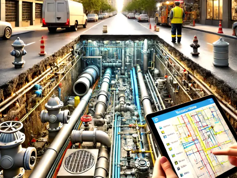
What is GIS Mapping for Water Utility Networks? Geographic Information Systems (GIS) mapping is extremely crucial when it comes to managing and maintaining water utility

United States Geological Survey (USGS) defines Geographical Information System (GIS) as “A Geographic Information System (GIS) is a computer system that analyses and displays geographically
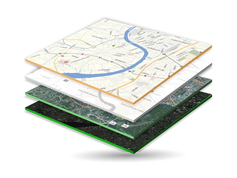
Definition and Overview Geographic Information System (GIS) is a powerful tool that lets professionals capture, store, analyse and manage spatial data. In addition, this GIS

We live in an interconnected world, which makes it easier to travel, trade, and share cultures, technology, and more. But to make everything run efficiently
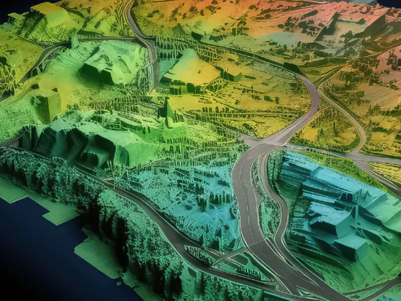
First things first; let’s try to understand what a terrain is. A terrain represents the physical features of an area of land. It includes elevation,

Geographic Information Systems (GIS) is a technology that enables the capture, storage, analysis and visualization of spatial and geographic data. It integrates several data types

For any system to work effectively, accurate data representation is crucial and the same is the case with Geographic Information Systems (GIS). In GIS, the

We live in a data-driven world where almost everything is measured and analysed as per certain needs and requirements. Geospatial information or data also helps