
What to Expect When You Hire a GIS Specialist
Hiring a GIS (Geographic Information System) expert may be an uncertain undertaking, particularly when you are not making the mapping and spatial information your day-to-day
Hiring a GIS (Geographic Information System) expert may be an uncertain undertaking, particularly when you are not making the mapping and spatial information your day-to-day

Geographic Information Systems (GIS) have become indispensable across modern industry. From urban planning and environmental impact assessments to utility network management and emergency response, organisations across the

Boundary lines decide what you control, what you can build, and who carries the risk at the edge. They affect ownership, access, utilities, planning status,
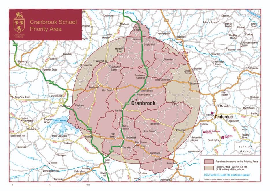
Catchment area maps translate a loose idea of reach into a defensible, testable model. Instead of guessing who is within range, you use the network
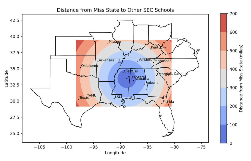
Buffer analysis answers a common planning question: what lies within a set distance of a feature, and does that change the decision? It is used
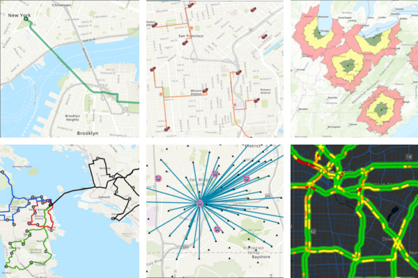
Network analysis in GIS models how movement happens along connected infrastructure. It replaces guesswork with evidence on travel time, coverage and access, so teams can
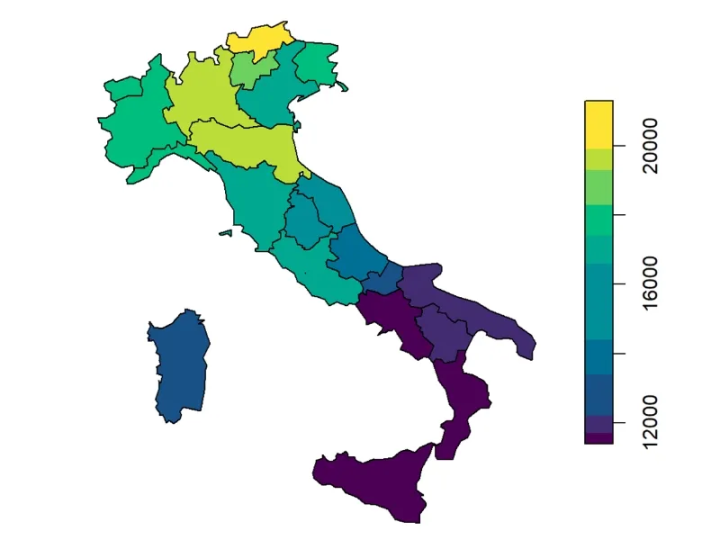
A choropleth map shades areas such as LSOAs, MSOAs, wards or postcode sectors by a value like demand, uptake, deprivation, sales density or outage rate

1. Why Land Classification Shapes Every Rural Decision The reality of agriculture and rural planning is deceptively complex. Two fields can lie side by side,

Many businesses still choose sites based on gut feeling, a quick drive around the area, or whatever a broker recommends. Some rely on basic spreadsheets
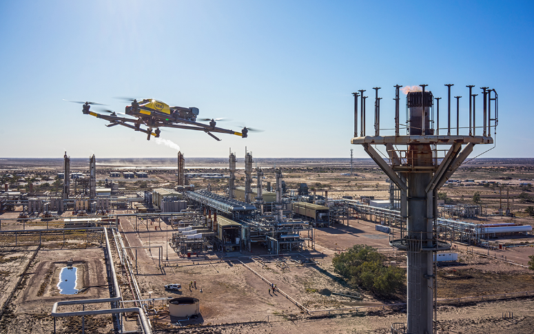
Every oil and gas project begins with one constant, location. Whether exploring new basins, designing pipelines, or restoring decommissioned sites, every decision depends on place.