SnowFox Discoveries needed a digital transformation of their historic U.S. scanned contour maps, aiming for high resolution raster based output. We started with accurately georeferencing each map, preserving spatial integrity.
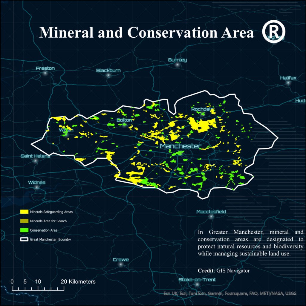
AMS Planning needed to identify 50 optimal housing sites in Manchester County, keeping more than 30 essential factors like conservation areas, greenbelts, and regulatory compliance under consideration.
GIS Navigator assisted RAF Lakenheath to address utility network challenges, specifically in electricity, water, sewer and gas, by enhancing infrastructure management through Geographic Information System tools.
Lorem ipsum dolor sit amet, consectetur adipiscing elit. Ut elit tellus, luctus nec ullamcorper mattis, pulvinar dapibus leo.
Read More