GIS Digitization for Accessible Urban Navigation
Before
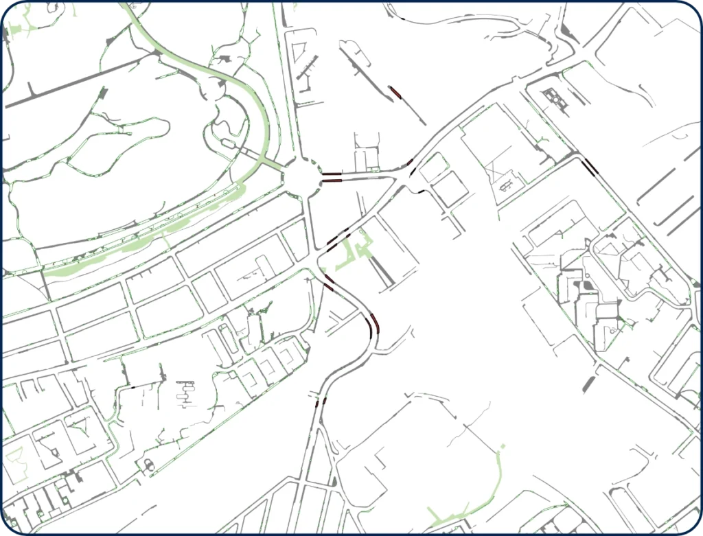
After
Overview
In a rapidly evolving urban landscape, accurate geospatial data is not merely a technical asset, it is the foundation upon which inclusive cities are built. This case study documents a high-precision GIS digitization engagement undertaken for a confidential client operating in the urban mobility and accessibility sector.
The project area spans a complex, high-density district in London, United Kingdom, encompassing intricate rail infrastructure, dense residential streets, and mixed-use commercial zones. The primary objective was to produce a clean, attribution-rich vector dataset derived from high-resolution aerial imagery, data precise enough to power real-world navigation solutions for visually impaired pedestrians.
The Challenge
Urban environments present some of the most demanding digitization challenges in the geospatial industry. Streets are irregular, pavements are narrow, crossings ambiguous, and overhead structures create visual complexity that demands expert interpretation rather than automated extraction.
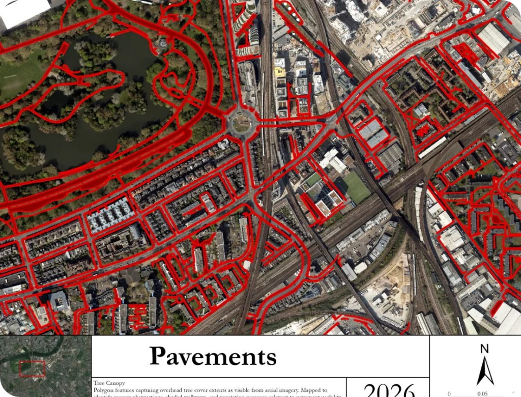
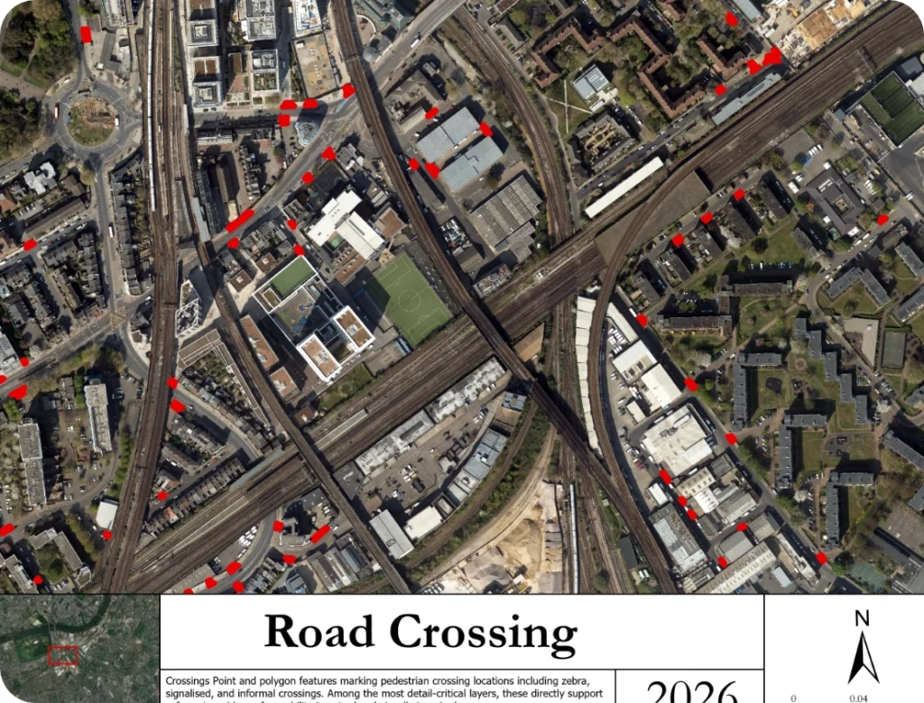
The client required a shapefile dataset covering five critical feature classes, Open Spaces, Tree Canopy, Pavements, Underbridges, and Crossinge, each with geometric accuracy sufficient for turn-by-turn pedestrian guidance. Standard automated feature extraction tools failed to meet the required precision, particularly around rail junction zones and underbridge transitions, where pedestrian infrastructure is most ambiguous and most critical.
The stakes were high. Errors in this dataset would not simply be cartographic imperfections, they could directly compromise the safety and independence of visually impaired users relying on the navigation system downstream.
Our Approach
Source Imagery Interpretation
Working from centimetre-resolution aerial imagery of the study area, our team conducted a systematic, tile-by-tile manual digitization workflow. Each feature class was captured in dedicated editing sessions to maintain focus and consistency across layer types.
Feature-Class Precision Protocol
Each layer demanded a distinct interpretation methodology:
- Pavements were traced to their physical edge, accounting for kerb lines, buildouts, and shared surfaces, not simply road margins
- Crossings were individually identified and classified by type, capturing geometry at the crossing surface level rather than approximated centreline points
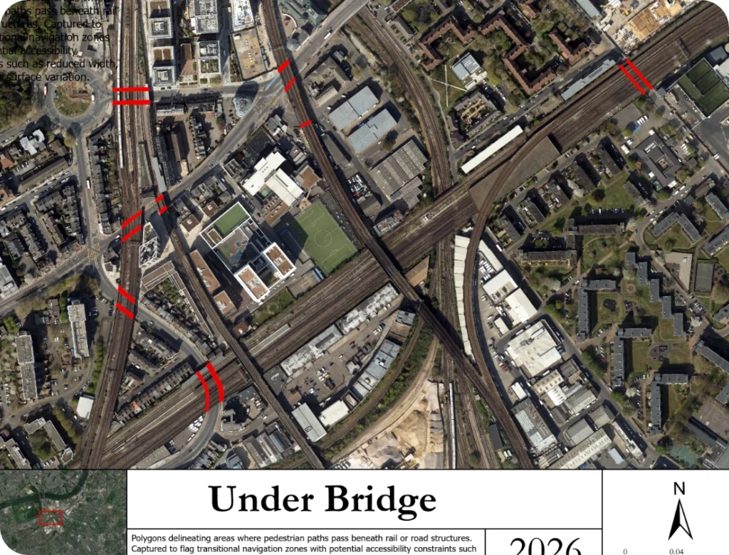
- Underbridges were delineated as full polygonal extents, flagging constrained pedestrian zones for downstream accessibility scoring
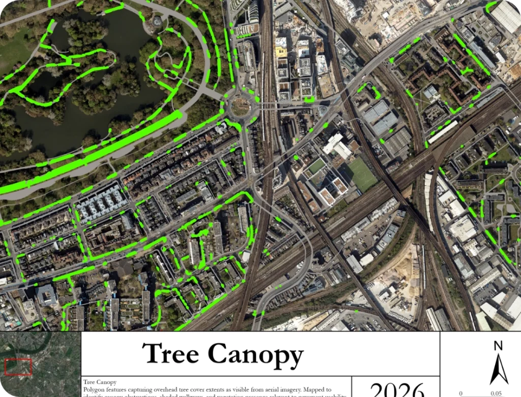
- ree Canopy was mapped at crown extent, providing spatial context for both shading and navigational landmark identification
Open Spaces were captured as usable pedestrian area polygons, excluding inaccessible green infrastructure
Quality Assurance
Every digitized feature underwent a two-stage review: geometric topology checking for gaps, overlaps, and dangling nodes, followed by a visual cross-check against the source imagery at 1:500 scale, the level at which pavement-width accuracy becomes visible and verifiable.
Deliverables
- Five production-ready shapefiles in British National Grid (EPSG: 27700)
- Full topological integrity across all layers
- Attribute schema aligned to client navigation platform requirements
- Supporting cartographic outputs for stakeholder reporting
Results
The final dataset delivered sub-metre geometric accuracy across all five feature classes, covering a study area encompassing one of London’s most infrastructurally complex districts. Crossing locations were captured with positional accuracy sufficient for GPS-assisted pedestrian guidance, and pavement geometries reflected true walkable widths rather than generalised road-edge offsets.
The client received a dataset ready for direct integration into their accessibility navigation platform, requiring zero post-processing correction.
Why Choose Us
Human-Led Precision Over Automated Extraction: We do not rely on automated digitization where accuracy matters. Every feature in this dataset was manually interpreted and traced by experienced GIS analysts, a standard we hold because the end users of this data depend on it.
Domain-Aware Digitization: Our team understands that pedestrian infrastructure data is not the same as road network data. We apply accessibility-aware interpretation protocols, capturing what matters for people on foot, not just what is visible from above.
Aerial & Satellite Imagery Expertise: We work confidently across imagery resolutions and sources, including high-resolution aerial, multispectral satellite, and hybrid composites, adapting our workflow to the source, not the other way around.
Topology-Clean Deliverables: First Time Our QA process ensures that every dataset we deliver is topologically valid on receipt. No gap-filling, no post-delivery corrections, just clean, connected, ready-to-use vector data.
Confidentiality as Standard: We operate under strict data confidentiality agreements. Client data, source imagery, and project scope remain fully protected throughout and after engagement.
Conclusion
This engagement demonstrates that precision digitization, when executed with domain knowledge, rigorous QA, and genuine understanding of end-use, delivers far more than a shapefile. It delivers confidence: for the client integrating the data, and ultimately for the person on the street whose independence depends on it.
Interested in Discussing a Digitization Engagement?
to explore how we can support your next project.