Case Study

Identifying High-Potential Wind Farm Locations Using
GIS & Data-Driven Analysis

The Client Challenge

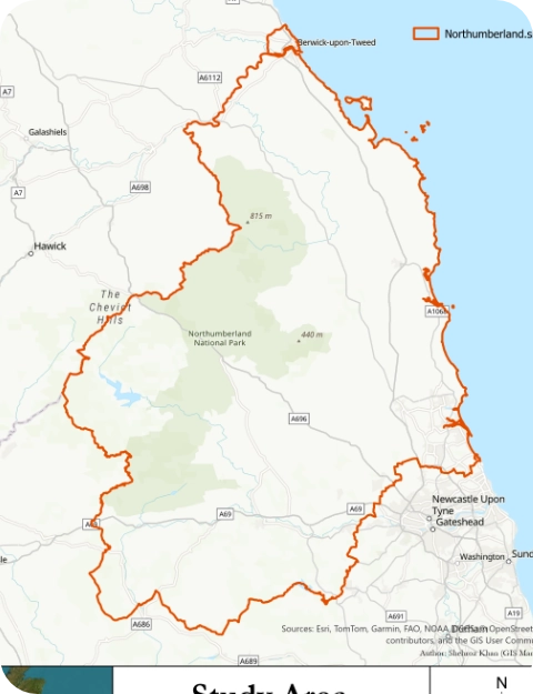
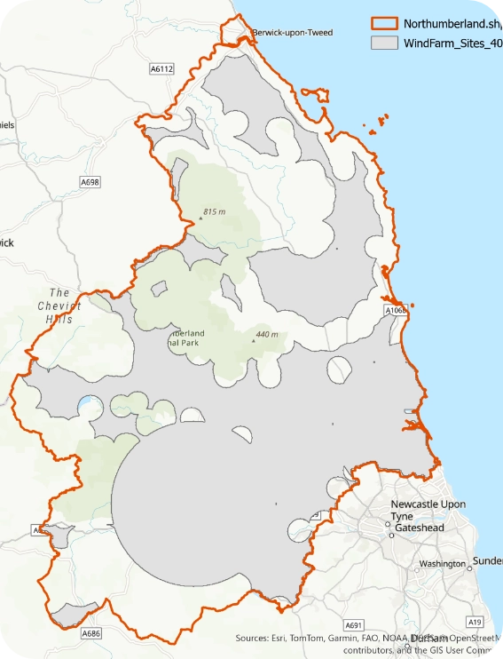
A renewable energy stakeholder required a reliable and scalable method to identify suitable locations for onshore wind farm development in Northumberland, UK. The challenge was not just to find areas with strong wind resources, but to ensure that selected sites were environmentally compliant, logistically feasible, and economically viable
Traditional site selection approaches often rely on manual assessments or isolated criteria, leading to inefficiencies and increased project risk. The client needed a smarter, data-driven solution that could streamline decision-making and highlight only the most viable opportunities

The Solutions

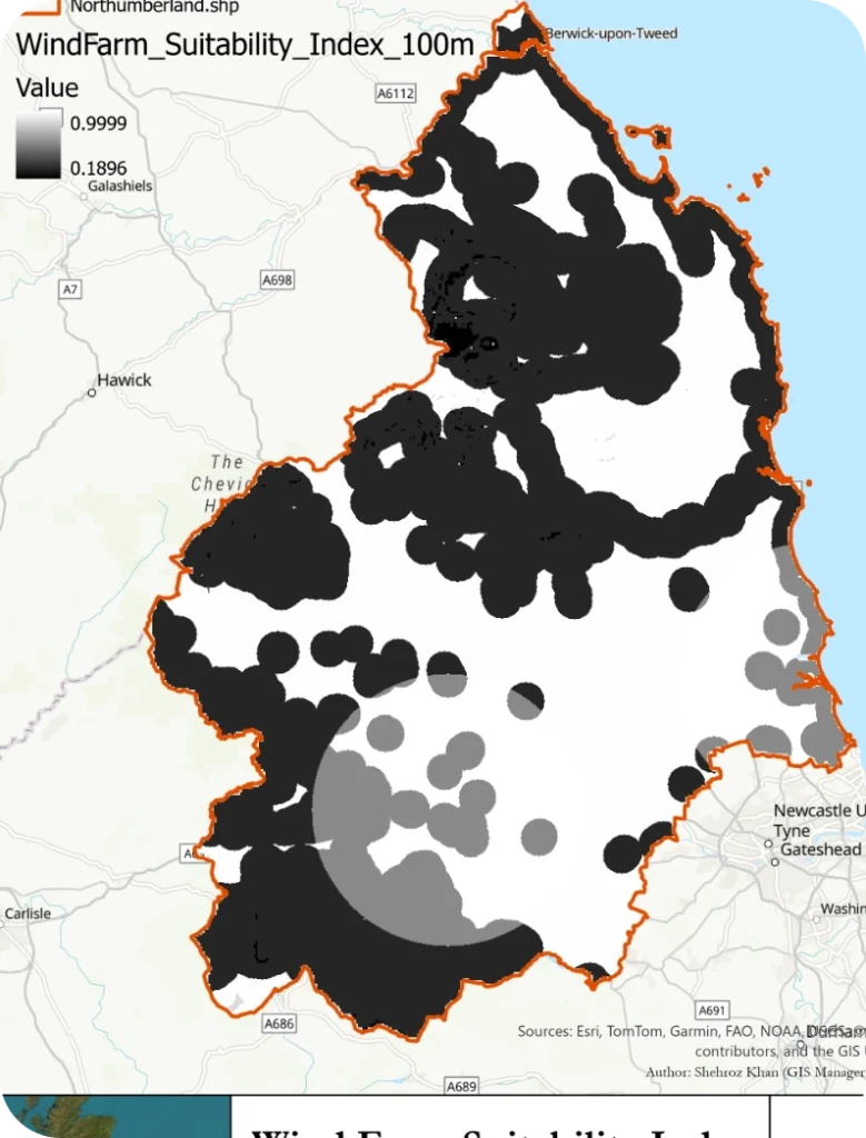
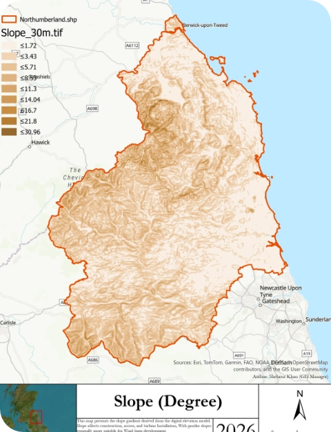
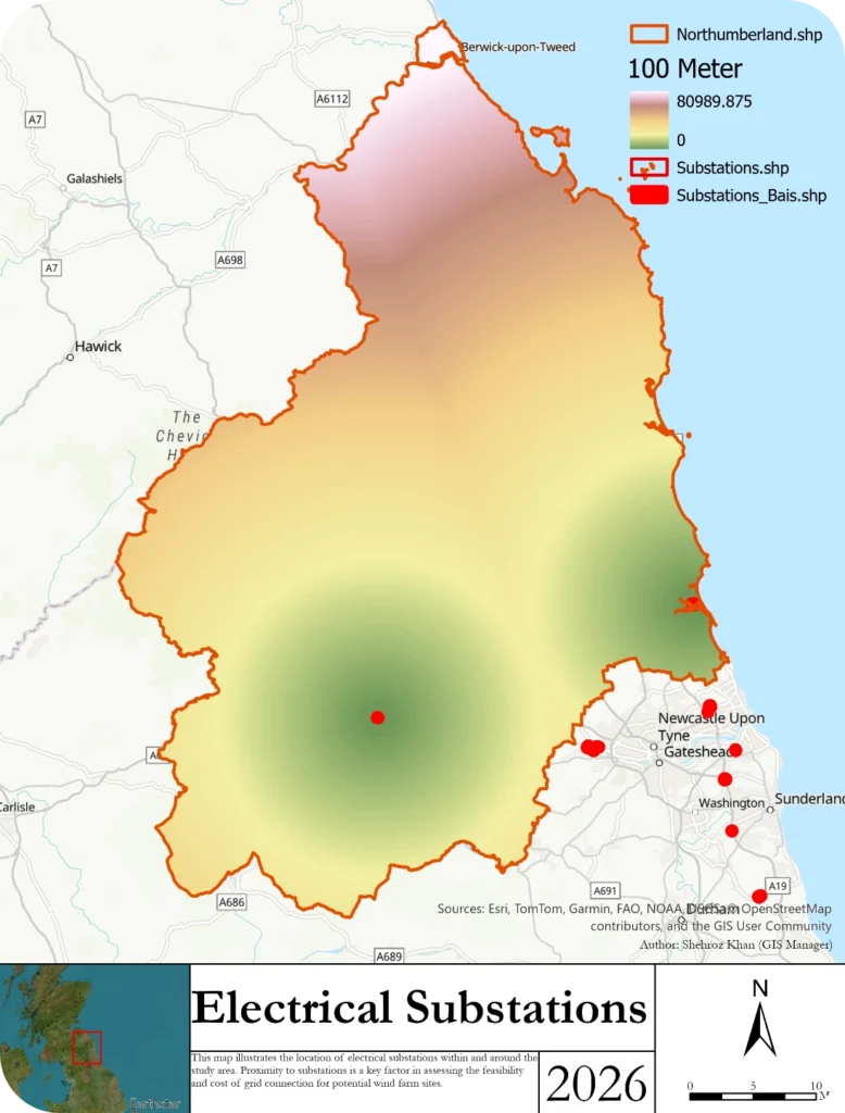
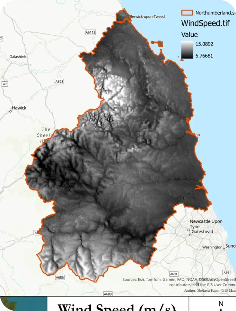
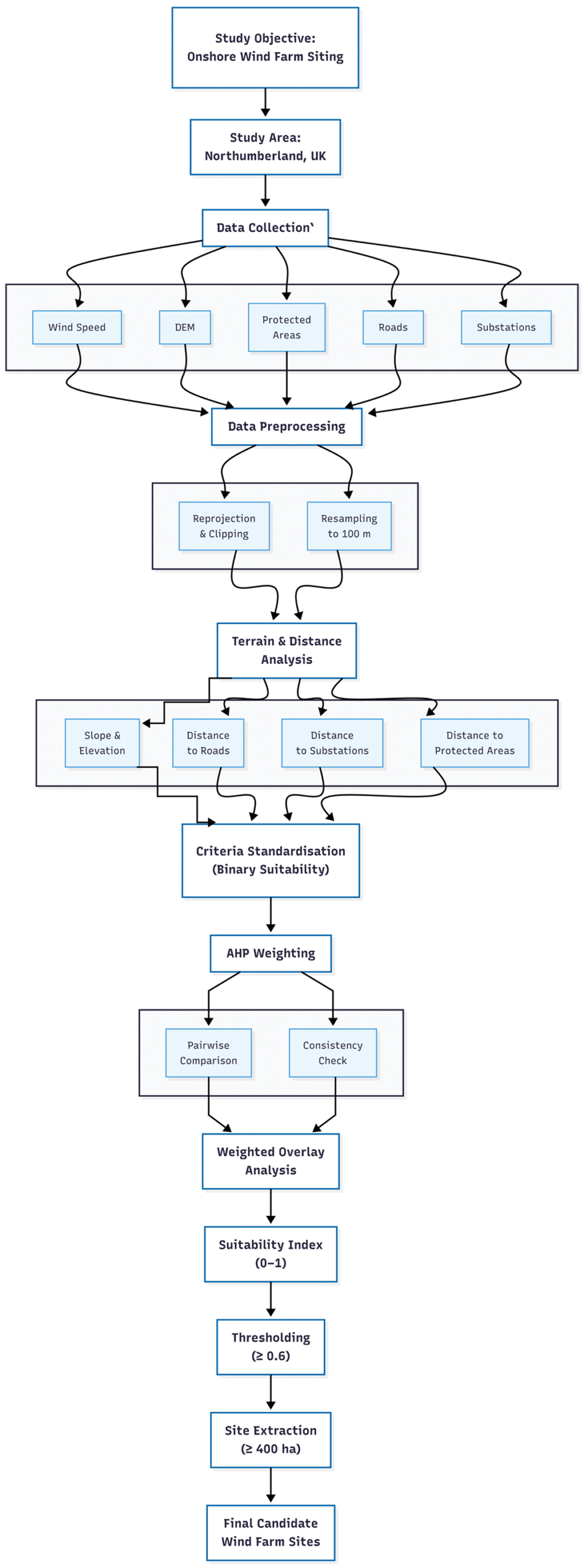
We developed a GIS-based Multi-Criteria Decision Analysis (MCDA) model, enhanced with the Analytic Hierarchy Process (AHP), to deliver a comprehensive land suitability assessment.

The solution integrated multiple critical factors into a single, easy-to-interpret model:

  • Wind speed (energy potential)
  • Environmental constraints (protected areas)
  • Proximity to substations (grid connectivity)
  • Access to road networks (logistics)
  • Terrain conditions (slope and elevation)
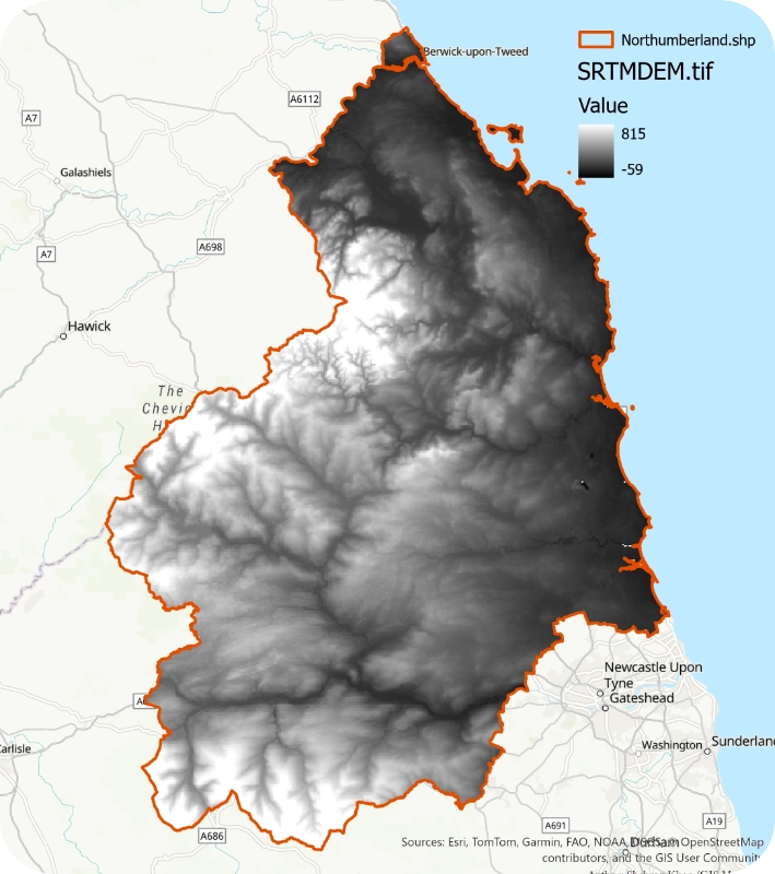
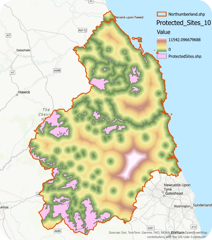
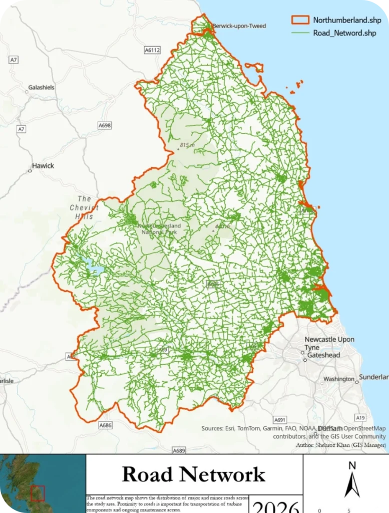
All datasets were standardised and processed within a GIS environment, ensuring consistency and accuracy. Using AHP, each factor was assigned a weight based on its real-world importance, allowing the model to reflect practical planning priorities rather than theoretical assumptions.
The result was a continuous suitability map, ranking every location from low to high potential.

The Outcome

The final analysis delivered clear, actionable insights:
  • Identified high-potential zones with optimal wind resources and minimal constraints
  • Filtered results to highlight only large, development-ready land parcels (>400 hectares)
  • Reduced the search area to a shortlist of strategically viable sites
  • Provided a transparent and defensible framework for decision-making

The model revealed that wind speed and environmental restrictions were the most critical drivers, while infrastructure access played a key role in determining feasibility.

Why This Matters?

For renewable energy developers and investors, early-stage site selection can make or break a project. Poor location choices lead to delays, regulatory issues, and increased costs.

This project demonstrates how advanced GIS analytics can:

  • Reduce risk by eliminating unsuitable locations early
  • Save time through automated, data-driven screening
  • Improve ROI by focusing only on high-potential sites
Support planning approvals with transparent, evidence-based analysis

The Value We Deliver

This case study is a clear example of how we turn complex spatial data into practical business insights.
Whether you’re planning a wind farm, solar project, or infrastructure development, our approach helps you:

  • Make faster, smarter decisions
  • Minimise uncertainty
  • Unlock high-value opportunities

Looking Ahead

The methodology used in this project is fully scalable and can be adapted to other regions or renewable energy types. Future enhancements can include socio-economic analysis, grid capacity modelling, and real-time data integration.

Ready to Identify Your Next High-Value Site?

If you’re working on renewable energy, infrastructure planning, or land suitability analysis, we can help you uncover the best opportunities using advanced GIS and data analytics.
to turn your data into decisions.