GIS Consultancy Services
From mapping to management, our GIS consultancy ensures every project moves forward with clarity, precision, and measurable value.
Organisations often spend heavily on GIS platforms but struggle when it comes to making those tools work in practice. Data sits in silos, teams work with different standards, and the technology doesn’t always match day-to-day project needs. Instead of supporting decisions, the system becomes another layer of complexity.
The result is predictable: projects slow down, budgets stretch, and opportunities are missed. A report may look impressive, but if it doesn’t answer the right question at the right time, the value is lost in sectors where accuracy and compliance matter; these gaps can damage both performance and reputation.
This is where GIS Navigator steps in. Our consultants cut through the noise, helping you move from disconnected data to clear, usable insights. We shape strategies around your goals, not just the software. The outcome is straightforward: decisions made faster, risks reduced, and projects that run with confidence from start to finish.
What We Offer:
1. Strategic GIS Planning
Every strong GIS project begins with a clear sense of direction. Our first step is simple: listen. We look at how your team currently works, the gaps you face, and the outcomes you want to achieve. Once we understand that, we shape a practical plan, choosing the right tools, setting achievable milestones, and making sure the approach fits your organisation. In urban planning, for instance, this might mean aligning council departments, architects, and contractors on one shared spatial system so approvals move faster and projects don’t stall halfway through.
2. Data Management & Integration
Data is only useful when it is accurate, consistent, and easy to access. Many organisations still juggle spreadsheets, CAD files, and survey data across different platforms. We bring all of this into one centralised system, removing duplication and uncertainty. The benefit is simple: your team spends less time searching for the right dataset and more time applying it to real problems, whether that’s managing utilities, monitoring assets, or planning new infrastructure.
3. Custom Mapping & Visualisation
Clear communication is the backbone of good decision-making. We create tailored maps that translate complex spatial data into visuals anyone can understand, such as board members, investors, or field staff. A transport project, for instance, might require heat maps to highlight congestion points, while an environmental study may call for layered habitat maps to support sustainability reporting. Each output is designed to make your decisions faster and more defensible.
4. GIS & BIM Integration
Construction and infrastructure projects demand coordination between digital design and real-world geography. By linking GIS with Building Information Modelling, we provide a single, connected view that blends location data with structural details. This helps planners avoid costly clashes like a utility line cutting through a proposed foundation before they happen. The result is smoother project delivery, fewer redesigns, and stronger collaboration between design and engineering teams.
5. Training & Capacity Building
Technology only delivers value when people know how to use it. Our consultancy includes practical, hands-on training for your staff, tailored to their roles and responsibilities. We focus on giving teams the confidence to manage data, run analysis, and produce outputs independently. Whether it’s a planning office learning to update zoning maps or an engineering team building workflows in GIS, our goal is the same: lasting capability, not reliance.
Whether you’re planning a city, managing infrastructure, or protecting natural resources, our consultants help you turn location data into measurable results. With GIS Navigator, strategy meets execution.
Industries We Serve
Our GIS consultancy isn’t tied to one sector. GIS is versatile, and so is our approach. Different industries face different pressures, but all share the same need: location-based decisions that work in practice.
1. Urban Planning & Development
Cities don’t fail overnight; they fail slowly, when roads get clogged, when housing spreads without transport links, when green space disappears because no one checked the maps properly. We work with planning teams to put everything on the table: zoning boundaries, traffic flow, available plots, and utility corridors. When that picture is clear, decisions are easier and approvals move faster. It’s not theory; it’s practical planning that avoids expensive errors later.
2. Environmental Management
Whether it’s tracking flood risk, monitoring forest cover, or reporting on emissions, environmental work depends on accurate data over time. Our consultants build mapping systems that let teams measure change and respond early. That means regulators get reliable evidence, and projects stay on track with sustainability goals.
3. Infrastructure & Utilities
Pipes burst. Power lines fail. Roads wear out. These things cost money when they aren’t appropriately managed. With GIS, operators know exactly where assets are, what condition they’re in, and when action is needed. We design systems that cut downtime, keep services reliable, and extend the life of critical infrastructure.
4. Agriculture & Land Management
Farmers and land managers can’t afford guesswork. Soil variation, water use, and crop performance all affect margins. We use GIS to bring these factors together on one map, giving decision-makers a practical guide to what works best on their land. The result is better yields, less waste, and smarter use of resources.
Our Approach

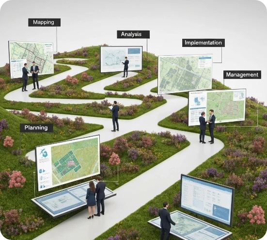
Detailed Consultancy
After discussing the client’s needs and identifying the challenges they are facing, we develop a strategic plan to help them complete the project successfully.

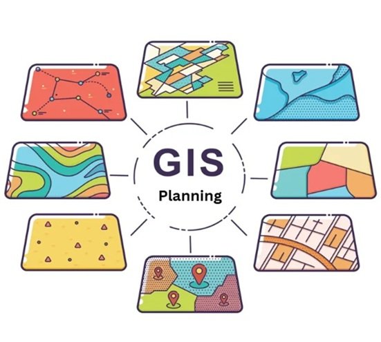
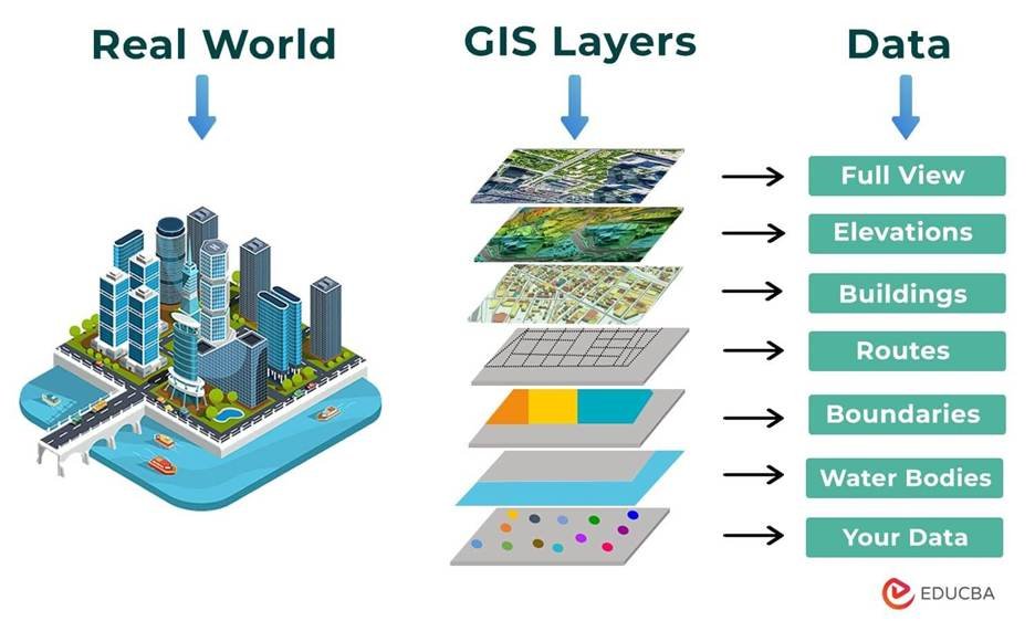
Customised Spatial Planning
Our team of experts creates customised spatial plans that focus on maximising the impact of your data and providing meaningful insights.

Guidance & Support
We deliver custom solutions to efficiently execute our strategy while also offering ongoing support throughout the project’s lifecycle.
Recognised by the Best
Our consultancy is built on trust, precision, and proven results. GIS Navigator has worked with global organisations across multiple sectors, delivering projects that stand the test of time.
Contact Us
Your Trusted Partner for Advanced GIS Solutions.
Our experts are ready to guide you in finding the perfect GIS solutions for your needs. Let’s discuss your project today!