Farm mapping is no longer just about drawing lines on a map. It’s the use of digital tools, geospatial data, and smart mapping techniques to give farmers a living, breathing picture of their land. Across the UK, it has become the modern face of agricultural monitoring, showing not just where crops sit, but how healthy they are and what resources are being stretched.
Why does it matter? Well, farming’s not just sowing seeds and cutting wheat anymore. It’s making sure shops don’t run out, ticking boxes on new green rules, and somehow dealing with skies that can’t be trusted from one season to the next. Walking a field and judging by sight alone still has its value, but it won’t cut it anymore. What farmers need now are tools that give them straight answers data they can lean on when demand climbs, the rain doesn’t come, or another set of rules lands on their desk.
Post-Brexit, the pressure has only grown. DEFRA’s Environmental Land Management (ELM) schemes reward sustainability and stewardship, meaning farmers must prove how well they care for their land. Farm mapping has become the go-to method to stay compliant, competitive, and ready for whatever changes come next.
Need Farm Mapping Services in the UK?
Get accurate maps for compliance, planning, and precision farming.
📞 Call Now | 📩 Email Us | 💼 Get a Quote Now
The Evolution of Farm Mapping
For centuries, you could get by with a rough map and a sharp eye. That kind of knowledge still counts, but it doesn’t keep up with the speed of things now. Today, it’s satellites, drones, and computer maps doing the heavy lifting pulling together soil, crop, and water data in a way that would’ve taken weeks by foot, but only takes a few hours on screen.
Modern agriculture has shifted dramatically. Drones, satellites, and GIS systems now track crops, soils, and water resources with precision. What once took weeks of observation can now be done in hours with layered geospatial data.
In the UK, this shift is amplified by the rise of agri-tech companies offering digital platforms, sensors, and remote monitoring solutions. Globally, similar trends are reshaping how farms are managed, with precision agriculture now considered the backbone of modern food production.
Core Components of Farm Mapping
Geospatial Data Integration
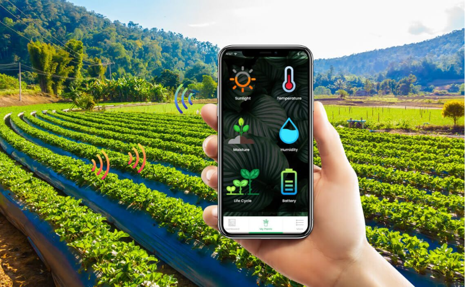
Modern farms generate data from multiple sources, including satellite feeds, drone surveys, ground-based sensors, and even tractor-mounted equipment. On their own, these datasets are fragmented and hard to use. When combined through a GIS platform, they form a single picture of the farm. This makes it easier to compare crop performance across fields, track seasonal change, and decide where resources should be directed.
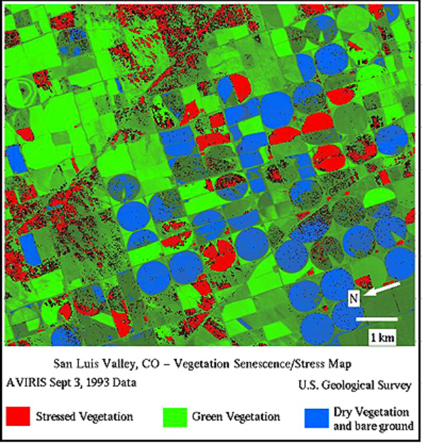
Crop Health Monitoring
Most farmers still walk their fields, keeping an eye out for weak patches. Trouble is, if you can see the problem, it’s usually already taken hold. That’s where tools like NDVI come in they flag changes the eye would miss. With that heads-up, a farmer can put on water, fertiliser, or spray in the right spot, instead of wasting it everywhere.
Soil and Water Resource Mapping
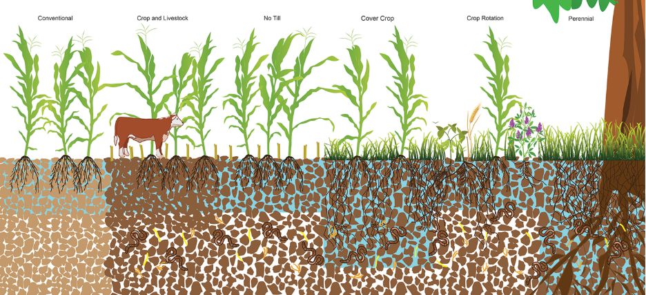
Soil is the foundation of farm productivity, yet it varies dramatically across even small areas. Digital soil maps show where conditions change, while water mapping highlights how irrigation flows through the land. Together, they guide the precise application of water and fertiliser. Instead of treating an entire field the same way, inputs are directed to the zones that need them most, reducing waste and improving output.
Livestock and Pasture Management
In livestock farming, overgrazing can strip pastures and lower long-term productivity. Mapping tools give a clear view of where herds are grazing, how vegetation is recovering, and when a pasture should be rested. By rotating animals based on accurate maps rather than guesswork, farmers maintain healthy land and improve animal welfare.
Farm Boundaries and Parcel Mapping
Accurate boundaries are essential in today’s regulatory environment. In the UK, compliance with DEFRA’s Environmental Land Management (ELM) schemes requires precise parcel mapping. It ensures farmers claim subsidies for the correct areas and meet land stewardship commitments. Beyond compliance, precise mapping also prevents disputes with neighbours and makes long-term planning more reliable.
Technologies Powering Farm Mapping
- Remote Sensing & Satellite Imagery – Systems like Sentinel, Landsat, and PlanetScope provide ongoing coverage for monitoring crops, water bodies, and land-use change.
- Drone Monitoring – High-resolution images help detect crop disease, pest infestations, and nutrient deficiencies at an early stage.
- GIS Platforms – Software such as ArcGIS and QGIS allows farmers to visualise, analyse, and manage geospatial data in one place.
- AI & Machine Learning – Predictive models identify yield potential, disease risks, and anomalies in crop growth.
- Blockchain & Digital Records – Ensures full traceability in the food supply chain, supporting compliance and consumer trust.
Applications of Farm Mapping in the UK
Precision Agriculture
Inputs like fertiliser, pesticides, and water are some of the biggest costs on any farm. Farm mapping allows them to be applied with accuracy, not guesswork. For instance, a grower in Cambridgeshire can use NDVI maps from drones to identify weak patches in a wheat field and apply extra fertiliser only there. The rest of the field gets precisely what it needs, saving money while maintaining yield.
Sustainability
The UK government’s Environmental Land Management (ELM) schemes encourage farmers to cut emissions, protect soil, and manage biodiversity. Farm mapping makes this practical. Carbon footprints can be mapped field by field, while soil monitoring highlights where cover crops are most effective. This gives farmers measurable evidence that their land management aligns with sustainability targets.
Policy Compliance
Subsidy applications and environmental schemes depend on precise boundaries. A parcel map generated through GIS removes disputes about land area and ensures farmers claim what they are entitled to. For example, accurate mapping of field edges can demonstrate compliance with buffer strip rules under DEFRA’s subsidy guidelines, avoiding costly penalties.
Risk Management
Weather extremes are becoming more frequent. Farm mapping helps prepare for them. Flood risk zones can be overlaid on field maps, warning landowners where drainage needs improvement. In drought-prone areas, irrigation demand can be modelled before crops suffer. These early insights mean farmers act before small problems escalate into major losses.
Agri-finance and Insurance
Banks and insurers are increasingly asking for evidence before lending or paying out claims. Farm mapping provides that proof. A farmer applying for a loan to expand operations can show several seasons of mapped crop performance to strengthen their case. Likewise, insurers can validate claims for hail or flood damage using satellite and drone imagery, speeding up payouts and building trust.
Looking for Precision Farm Mapping?
Our GIS experts deliver crop, soil, and boundary maps tailored for UK farms.
📞 Call Us | 📩 Email Us | 💼 Get a Quote Now
Benefits of Farm Mapping
- Higher yields through precision input use.
- Lower costs by reducing waste and inefficiency.
- Improved environmental outcomes, including better carbon management.
- Near real-time insights for better farm decisions.
- Stronger farm-to-market traceability, building consumer confidence.
Challenges in Farm Mapping
Despite the benefits, adoption is not without obstacles:
- Data Gaps – Cloud cover can block satellite imagery, and rural areas often face weak internet connectivity.
- Adoption Costs – Small farms may struggle with the price of drones, sensors, or premium GIS software.
- Digital Skills – Not all farmers are comfortable using advanced technology, slowing adoption.
- Data Ownership – Questions about who controls and profits from agricultural data remain unresolved.
- System Compatibility – Different software and data formats often fail to work seamlessly together.
Conclusion
Farm mapping is no longer optional; it is central to the future of UK agriculture. As food demand grows and climate risks intensify, farmers need tools that combine local knowledge with precise, data-driven insight.
The challenge is striking the right balance: embracing technology without leaving smaller farms behind. If that balance is achieved, farm mapping will not just improve efficiency, it will deliver climate-smart, sustainable agriculture that supports food security and long-term resilience.
Ready to Map the Future of Your Farm?
Partner with GIS Navigator to gain actionable insights, meet sustainability goals, and make data-driven farming decisions with confidence.
📞 Call Us | 📩 Email Us | 💼 Get a Quote Now


