Today’s health challenges ranging from pandemics to inequitable service access must be met with precise and data-driven responses. Geographic Information Systems (GIS) provide the spatial clarity needed to make informed decisions in the health industry. GIS allows professionals to pinpoint disease hotspots, identify areas without adequate health services, and deploy resources where they will have the greatest impact.
This blog unpacks the powerful role of GIS in the medical field, explores cutting-edge developments, and showcases how GIS Navigator supports healthcare teams in implementing spatial intelligence to improve patient outcomes and public health equity.
GIS in Healthcare
GIS (Geographic Information Systems) is a software framework that integrates location data such as patient addresses, clinic locations and environmental hazards with powerful analytical tools.. By layering demographic information, disease incidence, resource locations, and travel paths, GIS enables health professionals to visualize and interpret complex health patterns on a map.
In healthcare, GIS helps answer questions like:
- Which communities are underserved by medical facilities?
- Where are disease outbreaks most likely to occur?
- How do social determinants correlate with poor health outcomes?
Medical geography a field rooted in the methods used by Dr. John Snow during the 1854 cholera outbreak is the scientific backbone that supports these analyses.
Why GIS is Critical in Today’s Health Industry
1. Delivering Health Equity Through Accessibility Analysis
GIS calculates realistic travel times to healthcare facilities by car, transit, or walking revealing territories where medical access is poor. For example, GIS toolkit helped South Africa expand its chronic medication pickup points from 1,278 to 2,866 by 2024 drastically reducing patient travel burden .
2. Mapping Disease Outbreaks and Epidemics
GIS enables live tracking of diseases like COVID‑19, dengue, and malaria by mapping case locations and identifying clusters. Analysts use tools like SaTScan for cluster detection, allowing early interventions.
3. Embedding Social Determinants of Health (SDoH)
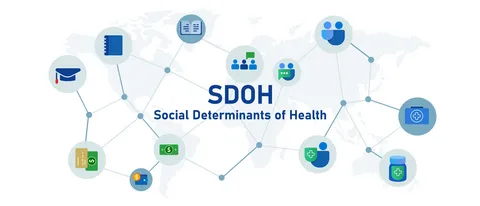
Modern GIS incorporates socioeconomic data such as income, education, and environmental factors with health outcomes. Mapping these layers exposes inequality, helping public health bodies target high‑need regions.
4. Meeting Regulatory Requirements with Network Adequacy
Agencies like CMS in the U.S. require proofs that patients are within defined distances or times of specialists. GIS is the only reliable tool for these compliance calculations.
5. Supporting Emergency Response and Capacity Planning
During disasters whether infectious outbreaks or natural events GIS tracks facility status, access routes, and medicine distribution in real time to support rapid response.
Key Trends Driving GIS in Healthcare
GeoAI & Predictive Analytics
The integration of AI with GIS (GeoAI) allows automated detection of disease clusters and predictive modeling of health risks. These tools can, for instance, predict lead contamination in water systems or anticipate dengue outbreaks.
Real-Time Visualization and Mobile GIS
Public health dashboards now display near-real-time data on outbreaks and service access. Mobile GIS apps help field workers locate patients and facilities, even in remote areas.
Environmental Health Surveillance
GIS is now critical in tracking environmental hazards like polluted air or contaminated water and their impact on public health.
Participatory GIS
By engaging communities in mapping local issues like environmental risk zones or neglected neighbourhood clinics GIS enables bottom-up planning in vulnerable communities .
Proven Use Cases
- South African Medication Program: GIS doubled medication access points, reducing geographic barriers.
- Esri’s Maternal Health Mapping: GIS identified regions with high maternal mortality, aiding targeted interventions.
- COVID‑19 Response: Dashboards and cluster analysis informed lockdowns and resource placement worldwide.
- SaTScan Cluster Detection: Widely used in epidemiology to identify disease clusters for rapid response.
- Environmental Hazard Mapping: GIS tracks polluted zones, informing targeted policy and cleanup efforts.
How GIS Navigator Empowers Healthcare Organizations
Integrated Data Solutions
We blend patient records, clinic locations, environmental indicators, and social data into unified GIS frameworks.
Tailored Spatial Analysis
Whether performing drive-time studies, outbreak detection, facility placement, or emergency simulations, our tools are built to your needs.
Interactive Maps and Reporting
We deliver accessible dashboards and maps that engage board members, clinicians, and communities no heavy GIS training required.
Implementation Support
We guide clients from planning through training, integration, and live dashboard deployment.
Overcoming Common GIS Challenges
- Data Sensitivity: We prioritize aggregated and anonymized data with offsetting to protect privacy.
- Data Quality: We implement robust validation workflows to ensure point accuracy and integrity.
- Adoption Resistance: Our user-friendly interfaces and training ensure smooth uptake across clinical teams.
- System Integration: We align GIS with EHRs, mobile health systems, and planning software for seamless integration.
The Broader Impact: Health Geography & GIS
GIS stands at the intersection of geography and health. It shapes our understanding of disease propagation in relation to environment, infrastructure, and social systems. This field known as medical geography transforms raw data into maps that guide everything from disease intervention to equality in healthcare distribution.
Across health-related Sustainable Development Goals, GIS plays a role in water sanitation, controlling tropical diseases, safe births, and sustainable health planning .
Conclusion
GIS plays a critical role in shaping modern healthcare delivery. It identifies regions where access to medical services is limited, helping ensure more equitable healthcare coverage. With its ability to support strategic planning, GIS informs decisions about clinic placement, community outreach, and telehealth deployment ensuring resources reach the right areas. During disease outbreaks or natural disasters, GIS enables rapid, targeted responses by highlighting affected zones and guiding logistics.
By layering social and environmental data, GIS also promotes data-driven equity, allowing healthcare providers to address disparities more effectively. Additionally, it helps organisations meet regulatory requirements by generating precise spatial reports and access maps needed for compliance.
GIS in healthcare is no longer optional it’s essential for any organization aiming for fairness, efficiency, and clarity in health strategy. GIS Navigator combines technical expertise and healthcare insight to design spatial solutions that deliver measurable impact.
Contact GIS Navigator today to explore a demo and discover how spatial intelligence can transform your health planning and patient care


