Geographic Information Systems (GIS) have become essential tools when it comes to fisheries, providing an innovative approach towards aquatic ecosystem management and improving fishery productivity as well as promotion of sustainability.
GIS has revolutionized fisheries by enabling researchers, conservationists and policy makers to visualise, analyse and store spatial data with precision. The diverse applications that it provides consist of stock assessments, conservation planning and proactive solutions to problems faced by fisheries worldwide.
The blog further discusses the comprehensive applications of GIS in fisheries and underlines the significant influence of GIS on the fisheries sector.
Enhance your fisheries management with our expert GIS solutions.
Explore our Spatial Data Analysis Services.
📞 Schedule a Call | 📩 Email Us | 💼 Get a Quote Now
Understanding the Basics of GIS in Fisheries
GIS is an effective computer-based tool that helps integrate a wide range of data sets such as field surveys, remote sensing, and satellite imagery to generate spatially mapped insights. This allows the users to visualise relationships, patterns, and dynamics within the aquatic system with ease.
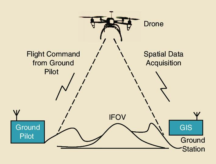
To continue by overlaying multiple data layers such as temperature, bathymetry, habitat types and fishing effort GIS helps in providing a cohesive perspective on fisheries. The integration of GIS with technologies such as the Global Positioning System (GPS), radio telemetry and acoustic sensors has further advanced its functionality. Researchers are now able to effectively not only fish movements but also assess habitat changes and outline spawning groups.
Such advancements have cemented GIS as an essential tool for scientific research and practical management of fisheries. Ensuring persistent and informed decision making and instillation of sustainable practices.
Key Applications of GIS in Fisheries
1. Habitat Mapping and Conservation
The sustainable management of fisheries requires fundamental knowledge of fish habitats which GIS supports through mapping across physical, chemical and biological characteristics of aquatic domains. Spatial map technologies deliver important spatial information about habitats essential for fish development including spawning grounds and nursery areas and feeding zones.
GIS specialists in the Great Lakes region of North America developed maps to show where important organisms including phytoplankton, macrophytes, and benthic species exist because they support fish populations. Combining bathymetry and water temperature data with these maps allows researchers to identify specific locations that need conservation or restoration action.
GIS techniques have transformed the way proactive conservation planning operates. Modern conservation tools employ habitat supply analysis to forecast biodiverse productive areas while helping guide resource distribution for efficient project execution. GIS-based gap analysis tools have proven vital in locating vulnerable biodiversity hotspots so conservation plans can be designed with greater precision.
2. Fisheries Management
GIS delivers powerful spatial tools to address fisheries management challenges by enabling sustainable resource utilization. GIS analysis of fish stocks distributions and fishing patterns allows authorities to design management plans which unite ecological conservation with economic targets.
GIS technology finds its main use in designing marine protected areas (MPAs) and no-take zones. The tools detect essential fish reproduction sites and growth regions thus assisting in reducing fishing overexploitation risks. GIS systems in lakes enable the observation of fish populations which produces vital information for sustainable harvest limitations.
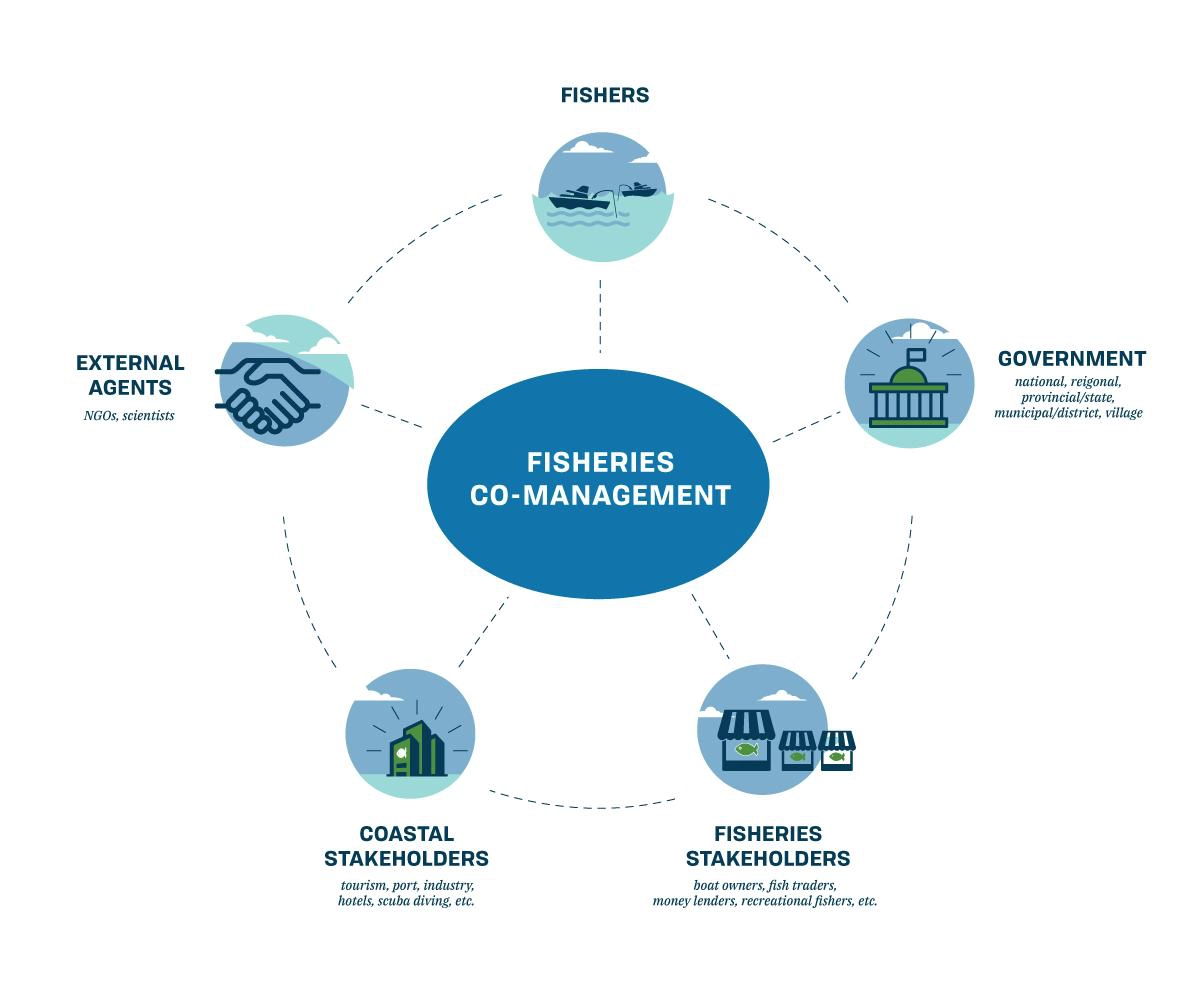
The spatial mapping capabilities of GIS prove essential for resolving disputes between different fisheries user groups. GIS technology enables the creation of spatial maps which identify the locations of commercial fishers and recreational and subsistence fishing sectors when these activities occur within the same area. Through collected data policymakers develop management plans which reduce conflicts while securing fair resource distributions and supporting sustainable practices.
3. Monitoring and Predicting Fish Movements
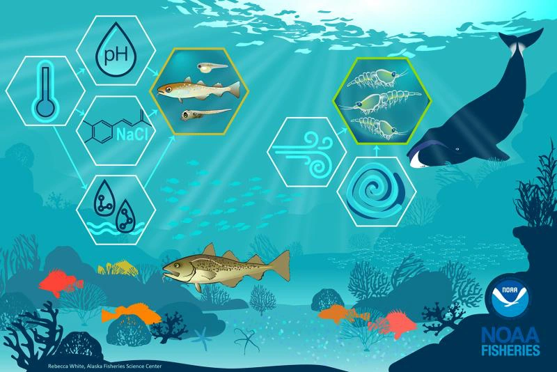
Fish relocate throughout their environment according to three main environmental factors including temperature along with oxygen levels and food availability. Research tracking movements of fish through GIS in conjunction with GPS and radiotelemetry provides precise detection of what drives these movements.
Researchers at Lake Superior used GIS techniques to monitor how lake herring movements changed when temperatures shifted. The spatial data analysis showed fish moved toward certain thermal refuges as seasonal changes occurred demonstrating the fundamental importance of these habitats for their survival.
Such information helps create successful management approaches that defend vital habitats as well as protect fish communities against climate-related changes.
4. Ecosystem Modelling and Productivity Assessments
Research models complex ecological relationships through GIS because it creates connections between habitat attributes and fish population dynamics. Spatially explicit models utilize bathymetry and substrate composition and vegetation and water quality data to make precise predictions about fish populations and productivity distribution.
Using bioenergetic models that integrate with GIS experts have predicted salmonid species growth rates in Lakes Michigan and Ontario. Spatial data on prey abundance and water temperature and habitat suitability feed into models that assess fish growth energy availability.
Science-based fishery targets depend on these tools together with habitat quality assessments and environmental change evaluations to enable adaptive fisheries management.
5. Climate Change and Fisheries
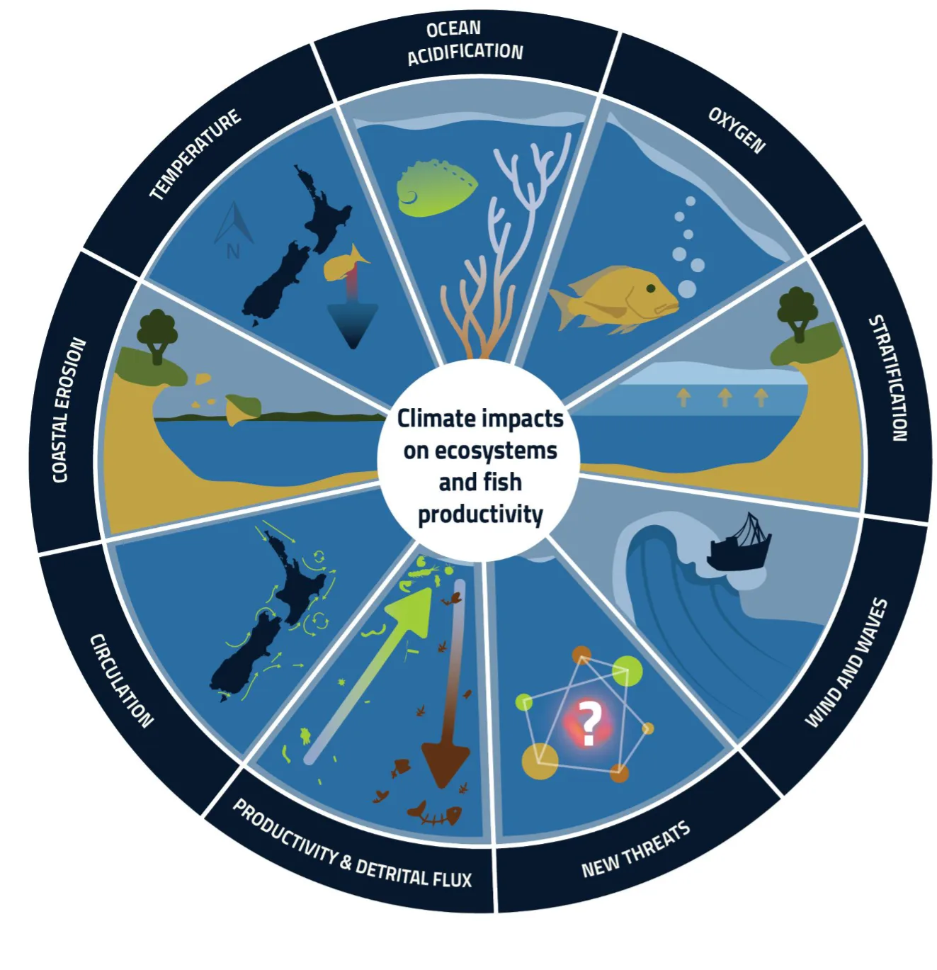
Fisheries encounter major difficulties because of climate change which causes water temperature changes together with sea level rises and habitat modifications. The utilization of GIS provides essential quantification capabilities through predictive modelling and habitat analysis for future fisheries assessments.
Scientists used GIS to study how changing thermal structures affect yellow perch habitat in Long Point Bay Lake Erie. Spatial changes and temporal shifts in thermal habitat suitability emerged from the analysis which demonstrates why adaptive management approaches are essential. The use of GIS-based models proves essential in predicting how sea-level rise affects coastal fisheries because they identify vulnerable habitats and direct proactive conservation strategies.
GIS applications generate critical information which allows for better development of fisheries management strategies that are resilient to climate change.
6. Aquaculture Site Selection
Aquaculture development as a profitable industry depends more and more on Geographic Information Systems (GIS) to make decisions about site selection and continuous management. GIS integrates water temperature data with measurements of salinity and depth and human-built infrastructure positions to help researchers pick fish farm sites that reduce environmental harm.
The suitability of sites for salmon farming in Norway was evaluated by a GIS-based assessment of coastal areas. The research combined water quality information with current speed measurements alongside disease outbreak risk assessments to protect the sustainability and operational efficiency of aquaculture systems.
The system of geographic information supports both environmental impact evaluation and site selection for aquaculture ventures. Through GIS users can monitor nutrient pollution together with habitat alterations and additional ecological changes which leads to vital insights for sustainable practices as well as adverse impact reduction.
Make the most of your fisheries data with accurate mapping and digitization.
Learn more about our Georeferencing & Digitization Services.
📞 Schedule a Call | 📩 Email Us | 💼 Get a Quote Now
Case Studies Demonstrating GIS Applications in Fisheries
Mapping Fish Productivity in the Great Lakes
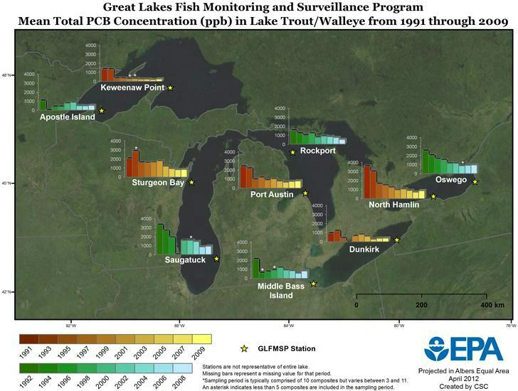
Researchers have made use of GIS to evaluate primary productivity in Lake Erie and Lake Ontario by Forster mapping phytoplankton photosynthesis across the ecosystems then using surveys that involve spatial work to develop models that correlate primary production with fish productivity. Providing valuable ecosystem insights to further form fishery management strategies.
The studies discussed outline the ability of GIS to integrate data across spatial and temperature scales, allowing a comprehensive understanding of the ecosystem dynamics. By bridging primary productivity with fishery outputs, GIS once again promotes informed decision making and sustainability.
Habitat-Based Population Modelling in Lake Ontario
A GIS model was developed to predict the population dynamics of the northern pike in Lake Ontario. This model integrated data that was based on bathymetry, substrate type and vegetation cover to overall assess habitat sustainability. Through the overlaying of these spatial layer’s researchers identified areas with high biomass potential and were able to evaluate effectiveness of habitat restoration efforts.
The study also outlines GIS’s essential role in linking habitat availability to fish population outcomes, providing valuable insights for targeted conservation and management strategies aimed at improving fish population and ecosystem health.
Managing Fisheries in Long Point Bay

In Long Point Bay, GIS was used to develop thermal habitat suitability indices for yellow perch. Through the analyzation of a three dimensional matrix of temperature data, researchers are able to visualise how habitat suitability has evolved overtime.
This analysis helps in understanding and forming adaptive management strategies that help ensure long term sustainability of fish stocks regardless of the changing environmental conditions. This approach underscores the importance of GIS in responding and monitoring ecological shifts in real time.
Challenges and Future Directions
Through the implementation of Geographic Information Systems (GIS) fisheries science has experienced a revolution that enables better management and conservation of aquatic ecosystems. The capabilities of habitat mapping and fisheries management together with ecosystem modelling alongside climate change adaptation through Geographic Information Systems have brought about a fundamental shift in fisheries research and management. The implementation of GIS faces significant barriers when used in underwater settings because traditional data acquisition methods prove difficult to execute.
The research investigates GIS strengths in fisheries science while analysing barriers that exist alongside prospective solutions for better fisheries management sustainability.
Challenges in Applying GIS to Fisheries
Data Acquisition Difficulties
The implementation of GIS in fisheries faces its biggest obstacle because of data collection difficulties in underwater environments. Underwater environments prove harder to monitor and assess than surface-based ecosystems. High-resolution spatial data for effective GIS applications depends on costly technologies that include remote sensing and underwater acoustic surveys and sonar imaging. Expensive technological tools deliver important information but their high costs limit accessibility for stakeholders so they may prevent extensive use in fisheries science and management applications.
Complexity in Data Integration
Integrating data from multiple sources is another major challenge in fisheries management. Fisheries often rely on diverse datasets, such as satellite imagery, acoustic survey data, and biological sampling, each with its own collection protocols, formats, and spatial resolutions. This diversity can make standardization and integration a complex task. Without consistent protocols, discrepancies in the data can arise, leading to inaccurate analyses and potentially flawed decision-making. Effective integration is crucial for ensuring reliable results and the success of GIS applications in fisheries management.
Demand for Computational Expertise
The precision required in GIS spatial modelling demands advanced computational expertise because minor errors in the interpolation or extrapolation of data or spatial analysis can produce deceptive analytic outcomes. Incorrect data could jeopardize fisheries management structure resulting in poor choices or detrimental outcomes. The success of spatial modelling through GIS depends on experts who manage complex spatial datasets and apply appropriate methodologies while delivering accurate interpretations of results. The expansive usage of GIS technology requires continuous training and specialized knowledge expansion in fisheries science and management.
Future Prospects: Advancements in GIS Technology
Expanding the Role of GIS in Fisheries Management
Future growth of GIS adoption in fisheries management will mirror the rising need for sustaining practices. The pressures from climate change alongside overfishing and habitat degradation on aquatic ecosystems require GIS technology to serve as a fundamental instrument for addressing these challenges. This powerful tool integrates spatial data while creating ecosystem models to guide decisions which establishes its essential role in fisheries management sustainability.
Promoting Sustainability through Collaboration
Realizing the full potential of GIS for sustainable fisheries management depends on effective cooperative initiatives between governments research institutions and private sector entities. The collaboration between governments and research institutions along with private sector members creates opportunities to address costs and data standardization barriers with pooled resources and expertise and funding. Sharing resources through collaborative work leads to innovative development of new GIS tools and methods that serve fisheries-specific requirements. The coordinated efforts between stakeholders will produce better outcomes which enables fisheries management to adapt to fresh problems and maintain sustainability over the long term.
Supporting Climate Change Adaptation
Climate change adaptation depends heavily on GIS technology which enables habitat vulnerability mapping and environmental monitoring as well as future scenario predictions. GIS-based models help detect at-risk locations due to sea level rise and ocean acidification as well as temperature fluctuations while offering essential information for proactive conservation. GIS creates visualizations of future impacts to direct the development of strategic adaptation plans which protect ecosystems and fisheries from climate change effects.
Ready to transform your fisheries operations?
Contact GIS Navigator today to learn how our tailored GIS solutions can drive sustainability and efficiency.
📞 Schedule a Call | 📩 Email Us | 💼 Get a Quote Now
GIS: A Catalyst for a Sustainable Future in Fisheries
GIS operates as a transformative power in fisheries science because it provides strong tools which enable habitat mapping and ecosystem modelling and climate change adaptation approaches. The framework creates stable conditions for the development of sustainable fisheries management that remains resilient to change. Ongoing advancements in GIS technology together with improvements in data integration provide remarkable opportunities to address challenging fisheries problems worldwide.
Research shows that improvements in GIS applications will follow from ongoing developments in machine learning (ML) and artificial intelligence (AI) alongside real-time monitoring systems. Future technological developments together with collaborative work between stakeholders will enable effective decision-making processes that benefit fisheries resources and their dependent communities.
By embracing the evolving capabilities of GIS the fisheries sector will both resolve current difficulties and safeguard sustainability across multiple generations.


