Enhance disaster preparedness through precise risk mapping and analysis.
Disaster management is crucial for minimising the impact of natural disasters, yet it faces significant challenges. Increased frequency and severity of events, such as floods, require accurate and timely data for effective response. Many regions lack comprehensive risk assessments, leading to insufficient emergency preparedness. Additionally, inadequate resources can hinder recovery efforts after disasters. Understanding vulnerabilities and implementing effective mapping solutions are vital for improving resilience. GIS technology offers essential tools for addressing these challenges, ensuring communities can better prepare for, respond to, and recover from disasters.
How GIS Navigator Helps
Accurate flood risk mapping highlighting hazardous area
Comprehensive vulnerability assessments
Timely damage assessments post-disaster
Enhanced emergency informed strategies
How GIS Navigator Helps
Accurate flood risk mapping highlighting hazardous area
Comprehensive vulnerability assessments
Timely damage assessments post-disaster
Enhanced emergency informed strategies
Looking for Professional Approach and Quality Services?
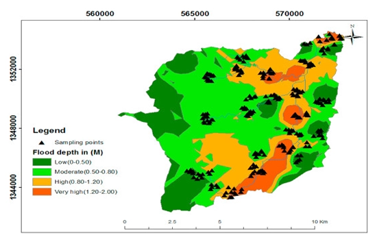
Flood risk modelling involves analysing topography, land use, and historical data to identify areas vulnerable to flooding. By visualising potential flood zones, communities can proactively develop mitigation strategies, enhancing safety and preparedness.
Our flood risk models enable planners to make informed decisions about resource allocation and emergency response, ultimately reducing the impact of floods on people and infrastructure. With GIS, flood risk modelling empowers local authorities to implement effective disaster prevention and resilience measures.
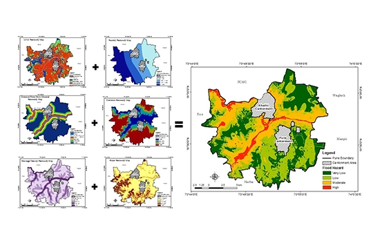
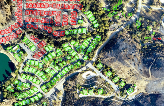
Disaster Risk & Vulnerability Mapping
GIS Navigator specialises in disaster risk and vulnerability mapping, a vital tool for understanding community risks. Our approach integrates various data layers, including socio-economic factors and environmental conditions, to highlight areas most susceptible to disasters.
This detailed mapping informs emergency planners, enabling them to allocate resources effectively and prioritise high-risk areas.
By identifying vulnerabilities, we help communities strengthen their preparedness and response strategies.
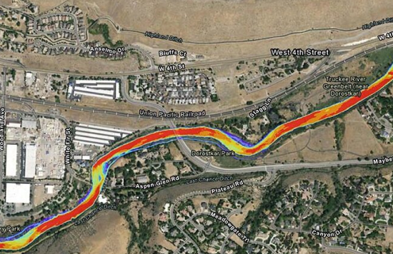
Water Flow & Flood Simulation
Water flow and flood simulation are essential for predicting potential flood scenarios. Using GIS technology, we model how water moves through landscapes during extreme weather events. This simulation allows emergency managers to assess potential impacts on communities, infrastructure, and natural resources. By visualising flood dynamics, decision-makers can develop targeted response plans and identify critical areas for intervention. Our simulations enhance understanding of flood behaviour, supporting better preparedness and risk reduction efforts. With accurate flood simulations, communities can improve their resilience to future flood events.
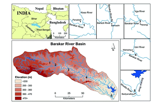
River Morphology Monitoring
River morphology monitoring through GIS is vital for understanding changing river dynamics. By analysing data on river shape, flow patterns, and sediment transport, we help authorities anticipate potential flooding and ecological impacts. This service enables proactive management of river systems, ensuring that flood risk mitigation strategies remain effective. Continuous monitoring allows for timely interventions, improving community preparedness. By providing essential data, our river morphology services contribute to sustainable water management and disaster resilience efforts, protecting both lives and livelihoods.
Change Detection
Change detection using GIS involves monitoring environmental and landscape changes over time. This service is critical for disaster response as it identifies shifts that may indicate emerging risks, such as increased flooding potential or habitat loss. By analysing satellite imagery and spatial data, we provide actionable insights that guide emergency planners in assessing vulnerability and risk. Our change detection services enhance situational awareness, enabling timely responses to evolving conditions. By accurately detecting changes, communities can adapt their disaster management strategies effectively.
Damage Assessment (Post-Disaster Mapping)
Post-disaster mapping is crucial for assessing damage and informing recovery efforts. Our GIS services provide:
Detailed maps that visualise the extent of destruction caused by disasters.
Enabling rapid evaluation of impacts on infrastructure.
Essential services.
Analysing data collected after an event, we help local authorities prioritise response actions and allocate resources effectively. Accurate damage assessments are essential for rebuilding efforts and improving community resilience.
Contact Us
Your Trusted Partner for Advanced GIS Solutions.
Our experts are ready to guide you in finding the perfect GIS solutions for your needs. Let’s discuss your project today!