Most decisions made by governments have one thing in common: they’re tied to location. Whether it’s repairing a street, placing a new health clinic, planning housing, or responding to a flood, the question always comes back to “where?”
For years, that question was answered with static maps, paper records, and guesses. However, as responsibilities grew and cities became increasingly complex, those methods proved inadequate. That’s where Geographic Information Systems (GIS) stepped in.
Rather than relying on outdated plans or word-of-mouth reports, GIS gives local and national governments the tools to understand their area with precision. Roads, buildings, trees, flood zones, and bus stops are all visible on a single screen. Add population data or public feedback, and those layers of information become decision-making tools.
This isn’t just about modernisation. It’s about making services more effective, reducing waste, and responding to people’s needs faster than before.
A Quiet Revolution in Local Government
For someone outside the system, local government might seem slow or bureaucratic. But inside, there’s constant pressure to do more with less. Budgets are tight. Staff turnover is high. Demands from residents keep growing.
What GIS does is bring some order to the chaos. It shows teams how their responsibilities overlap, where services are duplicated. Where gaps exist.
Imagine this:
A housing officer wants to identify land for affordable homes. A transport team is planning a new bus route. A school expansion is under discussion nearby. Each group has its own data, but unless those pieces come together, the full picture is missed.
GIS makes that connection. It shows the area where all three concerns meet and helps the teams work together rather than in isolation.
Responding to Public Health Needs
During the COVID-19 pandemic, many councils learned a hard truth: you can’t plan a public health response without knowing where people are, how they move, and what services they can reach.
With GIS, public health teams could map outbreaks by postcode, see where testing was needed most, and deliver leaflets to the right addresses. This wasn’t just about controlling a virus. It was about making sure resources reached the right people at the right time.
But the use of GIS in health didn’t stop there.
Today, councils use it to find gaps in access to GPs, pharmacies, or social care. They can see which areas have long ambulance response times, or where poor air quality overlaps with high asthma rates. For services that once relied on national averages, this level of detail is a game-changer.
And it’s not just for large cities. Rural districts can use the same tools to monitor how far residents travel for basic care or which areas have the highest demand for mobile services.
Infrastructure, Maintenance, and Getting Ahead of Complaints
Most people only notice public infrastructure when something goes wrong. A broken light, a flooded path, or a pothole left for months. These issues damage trust not just in the service but in the council as a whole.
Many of these problems come down to one thing: not knowing what’s happening, where.
GIS helps flip that around.
Instead of waiting for reports, maintenance teams can see which roads haven’t been inspected in a while, which lights are near schools and deserve priority, or which drains overflow after certain levels of rainfall. Work becomes proactive, not reactive.
And it goes beyond small repairs. Councils can use GIS to plan major upgrades based on actual data traffic flow, pedestrian usage, condition reports and make sure they’re spending money where it counts.
Explore More: Infrastructure & Utilities Mapping with GIS
Planning With the Community in Mind
Planning is one of the most visible (and often controversial) parts of local government. New developments can bring jobs and homes or congestion and complaints. The difference often comes down to whether decisions are based on complete, current information.
GIS helps here, too. Not only does it show planning officers the physical layout of land and buildings, but it adds crucial layers: transport access, flood risk, environmental designations, and more.
A proposed housing development might look fine on paper. But add in GIS layers and you might find it blocks wildlife corridors, strains local school capacity, or increases runoff in an area already prone to flooding.
With that level of insight, planners can ask better questions. Should the development be adjusted? Can green space or drainage improvements offset the impact? Would shifting it 200 metres improve access to bus routes?
These aren’t just technical questions. They’re political ones. And when decisions can be backed by clear maps and data, they’re easier to explain to residents.
Keeping People Safe When It Matters Most
Emergencies never happen at convenient times. Floods, fires, road accidents, or power cuts demand fast decisions, often from teams spread across different departments. In those moments, the ability to see what’s going on and where becomes critical.
GIS gives emergency planners and responders that visibility.
Let’s say heavy rain is forecast overnight. A council can use GIS to pull up flood risk zones, overlay drainage capacity, and check which care homes or schools are located in vulnerable areas. That information helps teams decide where to send sandbags, who might need evacuation support, and how to set up diversion routes before the problem hits.
It’s not just about floods. During a major traffic accident, for example, GIS can help emergency services find the fastest route, check if nearby roads are blocked, and understand what buildings or facilities might be affected.
For longer-term safety work, GIS helps identify trends spots with recurring accidents, or places where speeding is more common. That data leads to better enforcement and smarter investments in signage, crossings, or traffic calming.
Making Public Engagement Real
People don’t want to read 40-page planning reports or policy statements. But they do care about what’s happening on their street. When residents can see clear, map-based updates what’s being built, repaired, or discussed they’re more likely to engage, and less likely to complain after decisions are made.
That’s one of the most powerful but underused benefits of GIS in government: communication.
Councils can create public-facing maps that show:
- Roadworks and closures
- Proposed housing or zoning changes
- Upcoming events or consultations
- Locations of services like polling stations, libraries, or clinics
Instead of vague notices on lamp posts or dense PDFs buried in a website, residents get clear visual answers to everyday questions. And when those maps are interactive, people can filter by topic or postcode and get the exact information they care about.
It’s not about controlling the message. It’s about making decisions easier to understand and, in many cases, easier to accept.
Environment and Climate: Planning for the Long Term
The environment doesn’t respect council boundaries or budget cycles. Issues like flooding, heat islands, and air quality change over time and often across jurisdictions. To respond effectively, governments need tools that track those changes and help them plan with the future in mind.
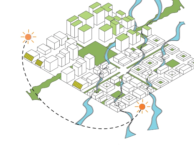
GIS is made for this.
Local authorities can use it to:
- Monitor changes in green space, wetlands, or coastal erosion
- Track tree cover, land use, and building density
- Compare flood risks under different climate scenarios
- Identify areas where interventions (like planting or resurfacing) will make the biggest impact
When these maps are updated regularly, they become a living record of environmental health. That helps councils back up their climate plans with evidence and adapt those plans as conditions evolve.
It also makes it easier to apply for funding. Many environmental grants now require detailed spatial data to show need, impact, and delivery strategy. With GIS already in use, teams don’t have to start from scratch every time they submit a proposal.
Explore More: Environmental Monitoring & Agriculture with GIS Solutions
Working Across Boundaries
Some of the biggest challenges governments face don’t fit neatly into one department or even one council’s patch. Housing pressures in one borough might spill over into another. Road traffic in a city might affect rural areas miles away. River pollution doesn’t stop at a district line.
To address those kinds of issues, governments need shared systems. GIS helps create them.
When teams from different departments or different councils work from the same mapping tools and data standards, collaboration becomes possible. A regional transport strategy can align with housing growth plans. Environmental projects can be coordinated across catchment areas. Emergency response plans can link fire services with police, ambulance, and utility providers.
None of this requires huge centralisation. It simply means building systems that speak the same language, and maps are a language everyone understands.
From Local to National: Scaling What Works
While much of the action happens at the local level, national governments also rely on GIS. National infrastructure agencies use it to plan rail, roads, and energy networks. Health departments use it to track vaccination rates or target community health programmes. Environmental agencies use it to oversee conservation and flood defences.

What’s changing now is the growing focus on consistency. Instead of each council using its own disconnected tools, there’s a push for shared platforms, open standards, and better data governance.
That doesn’t mean one-size-fits-all. It means building systems where local detail can feed into national plans and national priorities can support local action.
When done right, this approach improves accountability, supports investment, and allows success to scale.
The Bottom Line: GIS Makes Government Work Better
No technology solves every problem. But GIS solves a particular kind of problem that governments face every day: seeing how people, services, infrastructure, and the environment interact in space and over time.
It turns what used to be guesswork into something grounded. A housing officer can plan with confidence. An emergency team can respond without delay. A resident can check what’s happening on their street and feel like someone’s listening.
For most public sector teams, GIS doesn’t just make work easier. It makes outcomes fairer. It helps resources reach the people who need them. And it allows decisions to be made and explained with honesty.
In short, it brings the public back into public service.
How GIS Navigator Helps Public Sector Teams
At GIS Navigator, we work with councils, agencies, and public bodies across the UK. We know what it’s like to manage competing priorities with limited time and resources. That’s why we’ve built our services to fit around your goals, not the other way around.
We help local government teams:
- Set up GIS platforms that are easy to manage and update
- Map their assets, infrastructure, and service coverage clearly
- Analyse spatial data to support better decisions
- Improve engagement by making maps public-friendly
Whether you’re just starting to explore GIS or ready to upgrade what you already use, we’ll meet you where you are and help you get where you want to be.
Ready to make your decisions clearer and your services stronger?