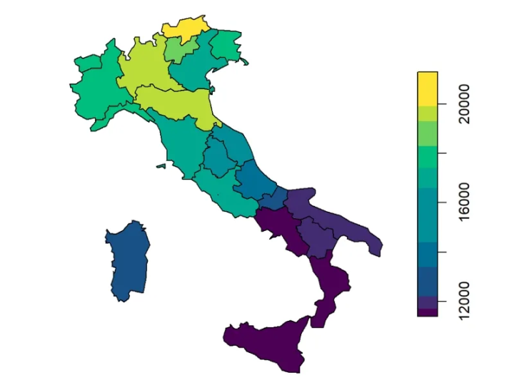
Importance of Elevation Models in Mapping
Elevation data plays a vital role in several tasks related to mapping and geospatial analysis. The data provides the vertical dimension crucial for understanding a particular area’s topography. The elevation data facilitates the process of creating accurate 3D models of the terrain that are vital for various applications such as infrastructure planning, environmental monitoring, and risk assessment during floods. This data also helps optimize routes done by identifying the most efficient paths in transportation. The elevation data is also useful in precision farming as it helps determine water flows. Professionals find elevation data useful for their tasks as it not only enhances accuracy but also aids in conducting geospatial analyses.
Improve your mapping accuracy with GIS solutions.
Explore our GIS Services.
📞 Schedule a Call | 📩 Email Us | 💼 Get a Quote Now
Overview of the different types of elevation models (DEM vs DSM vs DTM)
There are three different types of elevation models:
Digital Elevation Model (DEM): This refers to the digital representation of ground surface topography or terrain. A DEM shows the elevation of the Earth’s surface at specific points in a defined area.
Digital Surface Model (DSM): This model refers to the representation of the Earth’s surface including all the objects on it. A DSM records the elevation of the highest reflective surfaces.
Digital Terrain Model (DTM): This refers to the representation of the Earth’s bare surface without including any objects on it. A DTM captures a ground-level view of a terrain without surface features.
Where to find these data and their applications?
Allow us to first mention the sources of DEM, DSM and DTM. And then we will briefly share the various applications of these data!
Sources: The sources of such data can be satellite imagery, LiDAR, aerial photogrammetry as well as public geospatial databases.
Applications: DEM facilitates the processes of terrain analysis, environmental monitoring and other geospatial data analyses. DSMs serve as foundational data for urban planning and development and solar energy assessment. And DTMs aid in flood modelling, environmental management and more.
II. Definitions and Key Differences
Digital Elevation Model (DEM):
As we have mentioned earlier, a DEM is the representation of the Earth’s surface; devoid of natural and human-made features. The characteristics of these models are that they contain bare earth elevations only, without buildings, vegetation, etc. The common uses of DEMs are hydrological modelling, terrain analysis, etc.
Get high-quality elevation data for better decision-making. Learn More About Our Terrain Analysis Services.
Digital Surface Model (DSM)
DSMs represent the Earth’s surface, including all objects on it, such as buildings and trees. The primary characteristic of a DSM is that it captures the elevations of the “first surface” encountered by sensors. The common uses of digital surface models are urban planning, telecommunications and line-of-sight analysis.
Digital Terrain Model (DTM)
A DTM can be defined as the refined version of DEM, often manually corrected to represent only the ground surface. DTMs happen to provide more accurate ground surface representation, especially in complex terrains. The common uses of DTMs can be engineering projects, land surveying and flood modelling.
The key differences between the three types of models have also been discussed above but allow us to share those again in this part of the article.
| DEM | DSM | DTM |
| This is a general term used for any elevation data. | This covers all surface features, natural and man-made (vegetation, buildings). | This represents only the bare ground. |
| Data: Includes elevation points of the ground without any objects on it | Data: Includes elevation points of the ground, as well as objects like buildings, trees, and other structures | Data: Similar to a DEM, but with added information about terrain features. |
| Uses: Terrain analysis, flood modelling, land-use planning, and geological studies. | Uses: City modelling, urban planning, telecommunications, and visualization applications. | Uses: Terrain analysis, hydrology |
When comparing elevation models, it’s important to clarify DEM vs DTM vs DSM. While all three represent elevation, the DEM offers a general elevation surface, the DSM includes surface features like trees and buildings, and the DTM provides a more refined view of just the bare terrain. Understanding DSM vs DEM helps when working with urban environments, while evaluating DTM vs DEM is essential for terrain-based analysis where objects must be excluded. The difference between DTM and DEM often lies in accuracy and refinement, especially in rugged or vegetated areas.
III. Data Sources for DEM vs DTM and DSM
In this part of the article, we will share the data sources for DEM, DSM and DTM in detail. And you know what’s the best thing about this part? We will mention both free and paid data sources. So, keep reading the article to learn more about those data sources.
Free Data Sources
1. Shuttle Radar Topography Mission (SRTM)
The Shuttle Radar Topography Mission (SRTM) was launched by NASA in 2000. The SRTM was designed to develop a high resolution DEM of the surface of the Earth. The data collected through SRTM offers global coverage with two resolutions: 30 meters (1 arc-second) and 90 meters (3 arc-seconds). Both resolutions offer different details for example the 30m resolution data is more detailed while the 90m resolution data offers broader coverage.
The data can be found on the website: SRTM DEM.
2. ASTER Global DEM
The Advanced Spaceborne Thermal Emission and Reflection Radiometer (ASTER) was launched in 1999. The Aster Global DEM offers worldwide elevation data to professionals with a resolution of 30 meters. It is safe to say that ASTER GDEM provides the most comprehensive datasets, capturing over 99 percent of the Earth. It captures data in the form of stereo-pairs that are mounted on Terra Satellite.
The required data can be accessed on the website: ASTER GDEM.
3. EU-DEM
This is a digital elevation model that captures the elevation datasets of multiple European countries with a resolution of 25 meters. EU-DEM is a hybrid product which was developed by the European Environment Agency (EEA) and European Space Agency (ESA) Copernicus. The model is created by combining the data from SRTM and ASTER Global DEM. It also offers additional corrections to enhance data accuracy.
The data can be found on the website: Copernicus Open Access Hub.
Paid Data Sources
Let’s now have a look at the paid/subscription-based data sources!
1. LiDAR Data
LiDAR data is captured utilizing a remote sensing technology. This technology measures distances by using laser light. The data collected by using LiDAR is highly accurate and is in three-dimensional point clouds of the surface of the Earth and the objects on it.
To access LiDAR data, you must know that there are various commercial data providers such as HERE Technologies and Intermap Technologies.
2. National Elevation Dataset (NED)
This dataset is a comprehensive elevation data that covers the United States. The data is accurate and focuses on consistency across the U.S. The NED provides data in two resolutions: ⅓ arc-sec, 1 arc-sec and 2 arc-sec.
Those who wish to access NE datasets can do so by visiting: USGS NED.
3. Airbus WorldDEM
This high resolution Digital Elevation model was created by Airbus that offers highly precise data. The data coverage is global, and the resolution is 12 meters. It also offers commercial licensing. Airbus WorldDEM also provides a uniform elevation while also maintaining high quality.
The data can be easily accessed on Airbus Global DEM.
Cost Vs. Benefit Analysis
Evaluating the trade-offs between free and paid data sources based on project scope.
Allow us to share how you can perform the cost vs. benefit analysis before picking a model for your projects.
| High-Resolution Data | Medium Resolution Data | Low-Resolution Data |
| Data with a resolution of 5 meters is considered high resolution | Data with a resolution of 10 or 30 meters is considered medium resolution | Data with a resolution greater than 60 meters is generally classified as low resolution |
| Accurate and detailed data | Usable data quality | Limited data detail |
| Improved decision making | Potential data compromises | Not suitable for detailed tasks |
| Higher costs, longer processing time | Cost-effective, reduced processing requirements | Lower costs, faster processing time |
IV. Applications of DEM, DSM, and DTM
In this part of the article, we will share the various applications of DEM, DSM and DTM one by one.
Digital Elevation Model (DEM) Applications:
Digital Elevation Models (DEMs) are used in different types of applications that help in making informed decisions. For example;
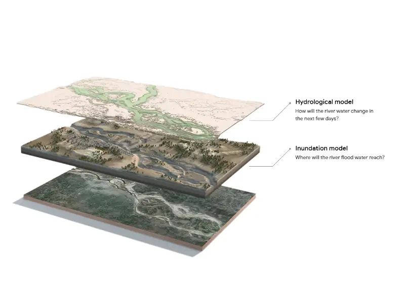
Hydrological Modeling: It refers to the analysis of water flow, flood risk management and effective drainage planning. DEM is crucial for understanding the complex interactions between water, land, and human activities. Various hydrological processes are simulated, such as rainfall, runoff, infiltration, and evaporation, to produce models that can help predict potential flood events, assess the impact of climate change, and develop sustainable water resource management strategies.
Landform Classification: Landform classification is the process of categorizing landform types based on their characteristics such as shape, origin, etc.
Geomorphology Studies: DEMs also facilitate Geomorphology studies in several ways by allowing for conducting terrain analysis, erosion and sedimentation studies and more. Additionally, DEMs enable the calculation of slope gradients, aspect, and curvature, which are crucial for understanding erosion and sedimentation processes.
Digital Surface Model (DSM) Applications:
Digital Surface Models also serve a vital role in various applications. Such as:
Urban Planning: DSMs facilitate the process of urban planning and development and also allow for making sustainable decisions. DSMs do so by providing detailed information about the existing land surface, including buildings, infrastructure, and vegetation. This detailed data helps different stakeholders, including planners to identify suitable locations for new development, assess the impact of proposed projects on the environment, and optimize transportation networks.
Line-of-Sight Analysis: DSMs are crucial for line-of-sight analysis as well. Such models provide highly detailed elevation data, covering both natural and man-made features present on Earth’s surface.
Solar Energy Potential Assessment: DSMs help in carrying out solar energy potential assessment through site selection, shade analysis, solar access calculation, etc. How? Well, by analyzing the 3D representation of the terrain and surrounding structures, DSMs enable precise site selection for solar power installations.
Digital Terrain Model (DTM) Applications:
Engineering and Construction Projects: Professionals can easily conduct the process of site selection which is crucial for engineering and construction projects. Such models are also useful for the excavation process.
Road and Rail Planning: For these kinds of planning, DTMs facilitate the professionals to effectively work on aligning routes while also ensuring that the development does not impact the environment.
Leverage GIS for precise elevation and terrain mapping.
See how we assist in geospatial data processing.
📞 Schedule a Call | 📩 Email Us | 💼 Get a Quote Now
V. How to Choose the Right Model for Your Project
Assessing Project Requirements
One cannot randomly pick a model for their project and start working with it. In fact, this process needs a lot of research and assessing the project requirements before a model is selected to get things done. Let’s explore how you can choose just the right model for your next project!
Explanation of when to use DEM, DSM, or DTM based on specific project needs.
You would like to choose DEM if you need to get access to general elevation data. As such data helps in broader applications such as topography, etc. you won’t face any challenges using DEMs for your projects. On the other hand, a DSM can help you when you require detailed information on the Earth’s surface. In other words, if you are working on urban planning and development, telecommunications infrastructure design, etc., then DSM should be your ultimate choice. Lastly, DTMs are best for gaining access to an accurate representation of the bare ground but without the objects present on the Earth’s surface.
The choice between DTM vs DEM depends on whether you need raw elevation data or a refined model suitable for high-precision tasks. Similarly, the DSM vs DEM comparison becomes relevant when your focus includes buildings or vegetation, DSMs are ideal for urban layouts, while DEMs are more suitable for natural ground surfaces. Understanding the difference between DTM and DEM is critical when your project involves slope stability, landform studies, or floodplain analysis.
Resolution and Accuracy Considerations
The key considerations when picking the right model are detail and accuracy. Higher resolution data is perfect for those applications that require precise measurements and fine-grained analysis; examples of these are urban planning, infrastructure development and landslide risk assessment.
However, lower resolution data suits projects which focus on broader-scale patterns or those that require less detailed information; examples are regional climate modelling or watershed analysis. In conclusion, by understanding your project’s specific needs, you can select the appropriate model and data resolution to ensure accurate and efficient results.
Discussion on the importance of choosing the right resolution for precise mapping tasks.
It is pertinent here to mention that resolution and accuracy of the data are critical factors which influence the quality and utility of the results. Higher-resolution data, with smaller pixel sizes, can capture finer details, providing more accurate terrain representation. However, the trick is that higher-resolution data is more computationally intensive and may have limitations in terms of coverage area. For large-scale projects where absolute accuracy is less critical, lower-resolution data (e.g., 30-meter or coarser) is used to balance computational efficiency and spatial coverage. The choice of data resolution depends on the specific project requirements and the desired level of detail.
Make Right Choices With GIS Navigator
Do you require more information on DEM, DSM and DTM? Then wait no more and get in touch with our team of professionals today. We won’t only optimize your project outcomes but will also help you make the right kind of choices!
Whether you’re evaluating DEM vs DTM vs DSM for flood modelling, urban design, or infrastructure development, choosing the correct elevation model is the first step toward accurate geospatial analysis.