BIM & GIS Integration
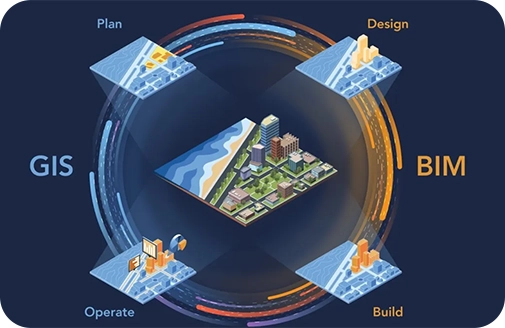
Utilise geospatial data and BIM for site analysis, urban planning & development and effective asset management.
Problem
Infrastructure projects need accurate data to run smoothly. Without it, teams face delays, miscommunication, and rising costs. When workflows are poor and data is unreliable, key tasks are missed, and projects can fall apart.
Bringing GIS and BIM together helps teams stay aligned, avoid mistakes, and manage assets more effectively. Without this connection, projects often face confusion, budget overruns, and in some cases, complete shutdowns.
These setbacks don’t just slow progress; they hurt your reputation and bottom line.
Work with a team that helps you stay on track. Let’s remove the roadblocks and give your projects the support they need to succeed.

What We Offer:
1. Geospatial Data Integration with BIM
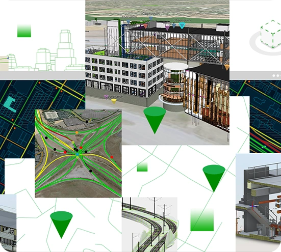
At GIS Navigator, our experts specialise in integrating geospatial data with client’s Building Information Modelling (BIM) models, enabling them to visualise their projects in the context of the real world. This seamless integration offers improved spatial awareness, essential for informed decision-making. Together, we will work on projects that are fully aligned with community’s needs and requirements while also safeguarding the environment.
2. Site Analysis & Selection
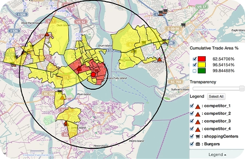
At GIS Navigator, we are always ready to help you perform detailed and accurate site analysis by enabling you to combine Geographic Information System (GIS) and BIM data. This acts as a guide to understanding the terrain, related environmental challenges and how to develop infrastructures. Our site analysis and selection solutions will help you pick the best sites while also mitigating risks.

3. 3D City Models for Urban Planning
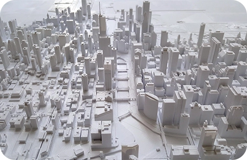
Get ready to develop fully immersive 3D city models as this facilitates the process of sustainable urban planning and development. Our carefully created models let you visualise your projects realistically while allowing you to thoroughly understand the impacts of the new developments. Through 3D city models designed for urban planning, we empower our clients to create efficient and sustainable environments.
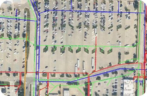
4. Utility Mapping (Sewer, Power)
Experience precision of the highest order while mapping utilities such as sewer lines and power networks. Our utility mapping services will enable the seamless integration of BIM; offering detailed reports on infrastructure and related assets. This ensures efficient planning and maintenance of the developed infrastructures while optimising resource allocation for proactive and long-term infrastructure management. To be precise, through accurate data, we help our clients improve their decision-making abilities.

5. Visualisation of BIM Data in GIS
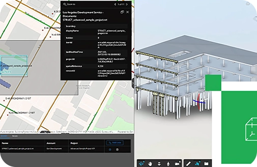
Wish to visualise BIM data with GIS environments to gather improved spatial awareness before initiating a new project? Our teams of expert will help you transform complex raw data into visuals that are highly accurate and accessible. This enables efficient planning and asset management; ensuring seamless collaboration among all stakeholders. This practice also helps ensure that all your projects are aligned with your goals.

6. Infrastructure Asset Management
Do you also want to experience effective infrastructure asset management? This carefully designed service and our expertise enable our clients to view the location of the assets, their conditions and their lifecycle allowing stakeholders to schedule maintenance as and when required. Through accurate infrastructure asset management, our clients feel empowered to make better and more informed decisions for their projects.

Bridge the gap between design and real-world data.
Explore BIM +
GIS Integration

Industries We Serve With Our
BIM & GIS Integration Service
We empower several industries by helping them plan and develop sustainable infrastructures. Explore how we can enable you to experience a seamless BIM-GIS Integration.
Infrastructure & Utilities
At GIS Navigator, we support careful planning and maintenance of critical infrastructure development through seamless BIM-GIS Integration. From efficient utility mapping to careful asset management, our services are designed to provide reliable data to you which is essential for creating smarter utility networks.
Real Estate & Property Management
Experience enhanced property management and improved visualisation and geospatial analysis with us. Through the seamless integration of BIM with GIS, we enable effective asset management while also ensuring optimal site selection. GIS Navigator also specialises in streamlining property development by delivering invaluable spatial data.
Urban Planning & Development
Build sustainable cities by utilising precise 3D models. We empower urban planners and developers through modern technology and advanced tools that help them in visualising projects in real time. This also facilitates that process of optimising land use to develop eco-friendly infrastructures.
Embark on the journey of seamless BIM-GIS integration!
Our Approach

Detailed Initial Consultation
We thoroughly discuss your project needs & goals and deliver tailored solutions to meet them successfully.

Data Integration & Implementation
Our team of experts creates customised spatial plans that focus on maximising the impact of your data and providing meaningful insights.

Guidance & Support
Enjoy hands-on knowledge and ongoing support to make the most of our bespoke solutions to get your desired results.
Recognised by the Best
We deliver smart, reliable GIS solutions on time, helping our clients meet deadlines, avoid costly penalties, and achieve success

Contact Us
Your Trusted Partner for Advanced GIS Solutions.
Our experts are ready to guide you in finding the perfect GIS solutions for your needs. Let’s discuss your project today!
