Georeferencing & Digitization Services
Using outdated maps or missing proper georeferencing and digitisation makes it hard to trust the data you’re working with. This creates serious issues when planning new projects or managing resources.
Without accurate and up-to-date data, projects can face delays, exceed budgets, or fail to meet expectations. Teams may struggle with poor planning, wasted time, and missed deadlines, leading to financial losses and a damaged reputation.
When trust in the data is lost, confidence in the project suffers too. Over time, this can hold businesses back and stop them from taking on new opportunities.
Stay ahead with accurate, digitised data you can trust. Let us GIS Navigator help you fix gaps, reduce delays, and confidently move your projects forward.

What We Offer:
1. Georeferencing
Our georeferencing services are designed to guide our valued clients on how to align historical and scanned maps to real-world coordinates. This enables a seamless GIS integration, ensuring that your obtained data is highly accurate and precise. We assist and guide our clients to work on data-driven insights for strategic analysis and planning, facilitating them to ensure successful project developments.


2. Digitization of Maps (Roads, Rivers, Boundaries)
At GIS Navigator, we will help you convert your raster images into editable vector data. By accurately digitizing the geographical features such as roads, rivers and boundaries, we facilitate the processes of managing and analysing them in your Geographic Information System. We empower you to streamline your workflows and improve your decision-making by delivering data that is accurate and reliable.

3. Historical & Cultural Preservation
We enable our clients to strategically preserve the culture while also planning for future developments. By digitizing the historical maps, we make sure that historical and cultural data are not only easy to access but also beneficial for research, cultural preservation and sustainable urban development. This practice enables us to empower our partners and communities alike while also safeguarding historically significant infrastructures.


4. Cadastral Map Creation
Do you also want to accurately map and manage property boundaries for real estate, land administration and more? Look no further as our cadastral mapping services offer precise data that is essential for accurate property assessments, land use planning, zoning and more. This also facilitates the process of better land management and minimise the chances of disputes between different stakeholders.

5. Geospatial Data Integration
With our seamless geospatial data integration, we will help you merge vast datasets into developing cohesive GIS frameworks. This approach will enable you clients to ensure compatibility while maximising invaluable insights that can be extracted from your obtained spatial information. Through the integration of diverse data sources, we enable businesses to make the most of modern tools and cutting-edge technologies.

Bring Paper Maps And Scanned Drawings into Today’s Workflow.


Industries We Serve With Our
Georeferencing & Digitization Services
Our georeferencing and digitization services enable our partners to perform desired actions. This enables them to get their hands on data that’s not only accurate but also enables working on sustainable projects.
1. Mining & Natural Resources
By partnering with GIS Navigator for georeferencing and digitization, you will get to optimise resource exploration and environmental monitoring. We deliver highly accurate geospatial data which help you perform several actions such as mapping mineral deposits and monitoring land changes.
2. Infrastructure & Utilities
We specialise in strategic infrastructure planning and management. Through our georeferencing and digitization, we will guide you on how to efficiently map utility networks and plan expansions after considering the needs & demands. This enables sustainable development while minimising all sorts of operational risks.
3. Real Estate & Property Management
Our teams at GIS Navigator help enhance property management and urban planning by offering accurate and detailed cadastral maps and georeferenced data to our partners. We also guide and support efficient zoning, thorough land use analysis and careful property assessments.
4. Urban Planning & Development
We specialise in planning smarter cities that prove to be highly sustainable for businesses and communities. Our bespoke geospatial solutions are designed to offer accurate desired data which facilitates the process of strategic urban development and understanding their environmental impacts.
Claim a free georeferencing consultation today!
Our Approach

Project Assessment & Consultation
Once we have carefully assessed your projects and understood your requirements, we offer detailed one-to-one consultations to help you meet your business goals.

High-quality Data Processing
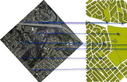
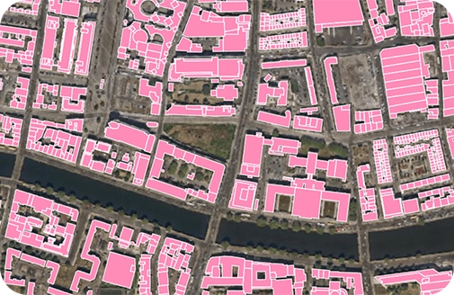
Our specialised teams will work on integrating your data through careful georeferencing and digitization.

Data Delivery & Continued Support
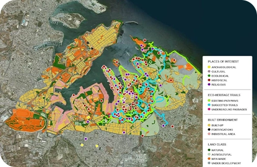
Get ready to utilise up-to-date accurate data and make the most of our continued support to ensure successful project completion.
Recognised by the Best
We deliver smart, reliable GIS solutions on time, helping our clients meet deadlines, avoid costly penalties, and achieve success

Contact Us
Your Trusted Partner for Advanced GIS Solutions.
Our experts are ready to guide you in finding the perfect GIS solutions for your needs. Let’s discuss your project today!