FLOOD MAPPING
Safeguard Communities & Assets with Advanced Flood Mapping Solutions
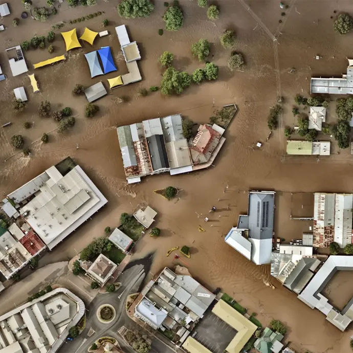
At GIS Navigator, we utilize high-resolution LiDAR and advanced hydraulic modeling to improve disaster preparedness for enhanced protection of communities and assets. We deploy cutting-edge technology and latest techniques to provide you with detailed risk assessments through flood risk mappings, empowering you to understand and mitigate potential flood impacts. So, if you want to equip yourself with tools to anticipate flood events and respond to same with proactive strategies to minimize losses, get in touch with us today!
Our Services

2D Computational Flood Modeling
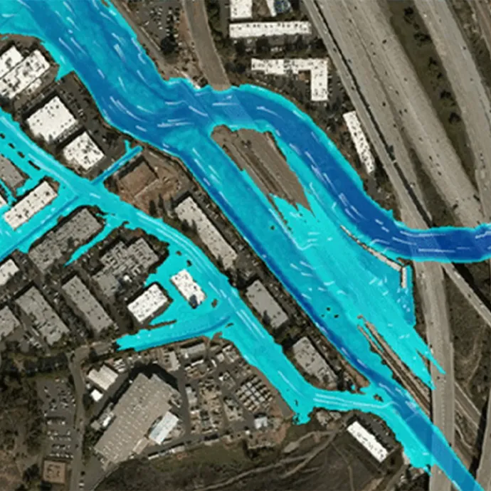
At GIS Navigator, our 2D computational flood modeling services allow you to develop an in-depth understanding of flood dynamics across a wide range of terrains and conditions. Being an advanced modeling technique, it provides you with detailed visualization of extents and depths of floods; these insights are extremely helpful when assessing potential impacts accurately. 2D computational flood mapping services are termed ideal for urban planning and risk management as it supports strategic decision-making by helping you identify vulnerable areas effectively.

Flood Response Plans
Our flood mapping services also entail flood response plans. Therefore, if you want to protect your communities and businesses from devastating impacts of floods, we have got you covered with tailored flood response plans. Our plans include emergency procedures, resource allocation, and communication strategies to help you fully prepare for and act swiftly during a flood event. Our flood response plans include detailed risk assessment and modeling data to craft to design actionable response strategies. Therefore, we have got your back whether you need flood mapping UK services or anywhere else.
Advantages of Flood Hazard Mapping

Improved Safety and Preparedness
Flood hazard mapping services help government agencies, communities, and businesses identify flood-prone areas in advance. Thus, stakeholders and decision makers can develop more effective evacuation routes, optimize resources, and expedite safety measures.

Enhanced Decision Making
Flood mapping services provide detailed and valuable insights to planners and developers which later prove valuable in infrastructure development, investment strategies, and other policy-making processes. It all results in sustainable and resilient developments.

Risk Management for Insurance
Flood mapping helps insurance companies to assess risks associated with floods more accurately. These insights prove valuable when setting rates while helping companies to reduce losses related to flood claims. Likewise, companies use flood mapping to tailor insurance products to cater to specific needs of different areas.

Resource Allocation
Government bodies use flood mapping to prioritize resources for areas with bracing for severe impacts, thus optimizing and allocating resources in more efficient manner. These insights also help authorities to allocate resources for flood defenses and mitigation efforts.
Who Needs
Flood
Assessment?
Government and
Municipal Authorities
These bodies need flood assessment or mapping services to craft effective flood management strategies, enforce building and other infrastructure regulations in areas more vulnerable to floods, and plan for emergency response and evacuations.
Real Estate Developers
and Investors
These firms need flood zone mapping and assessment services to make informed decisions vis-à-vis property developments and investments in certain areas. Furthermore, they need it to ensure developments are designed to withstand flood events of various scales.
Insurance Companies
Insurance companies need these services to assess risk exposure and reduce losses emanating from flood damage claims. Likewise, flood mapping services help insurance companies set coverage plans meticulously and more carefully.
Urban Planners and
Architects
These individuals need flood assessments to design and build sustainable and resilient urban environments by taking into account various factors such as flood risk mitigation into their planning and building design processes.
Environmental and
Conservation Groups
These groups need assessments to understand the impact of flooding on natural habitats. Likewise, they use flood assessment reports to ensure that sustainable management practices are followed that reduce the risk and severity of floods.
Homeowners and Community
Groups
These groups need flood assessments to prepare for flood events and protect their properties and communities from the same. Flood mapping and assessment services also help homeowners and community groups to reduce financial losses.
Why CHOOSE uS?

Detailed Reports
With GIS Navigator, flood mapping reports you get will be accurate and detailed. These reports will entail in-depth analysis and visualizations of flood extents, potential impacts, and vulnerabilities. Through our reports, you will get clarity and actionable insights that will prove effective in decision making.
Reliability
Our reports are reliable and the number of projects we have completed speaks volume about the same. Here at GIS Navigator, we take pride in using latest technologies and methodologies to guarantee accuracy and dependability in all projects we take.
Time-Saving
When it comes to flood events, time is crucial. We understand this and therefore, we have streamlined our processes through the best use of GIS technologies. When you work with us, you save time and spend your efforts on more essential tasks: flood mitigation and preparation.
Our streamlined processes and expert use of GIS technologies significantly reduce the time required for comprehensive flood risk assessments and mapping. By choosing us, you save valuable time that can be better spent on mitigation and preparation activities.
Risk Management Recommendations
When you hire us, you get risk management recommendations from the experts. By choosing us, you get tailored and free advice on mitigation strategies, infrastructure improvements, emergency preparedness and other important matters.

FAQs
Popular Questions Asked
How much does flood mapping cost?
What equipment do you use for flood mapping?
At GIS Navigator, we use high-resolution LiDAR and advanced hydraulic modeling techniques modeling to improve disaster preparedness for enhanced protection of communities and assets.
Do you offer risk management recommendations?
Yes, you get tailored and free advice on mitigation strategies, infrastructure improvements, emergency preparedness and other important matters
Previous Post
← USA ZoningNext Post
Utility Mapping →